“
“
“
“
Those are very funny – especially the music 
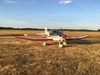
Are you zooming that camera manually as you approach the “target”?
Incidentally I wonder if one can get busted for this. On my Mt Blanc video I made sure the GPS altitude showed summit + 550ft because under SERA one cannot go below 500ft AGL. The UK has a concession on this if there are no people or buildings etc, but there were people on the summit! Although that was not evident until right up close, so I wonder where the law would stand. The UK CAA would be unlikely to go after a pilot on behalf of another country if the crime was not a crime in the UK.
As far as I know the 500ft agl overhead MtBlanc is measured by pilot MK1 eye, it seems far more accurate than altimeter AMSL reading with regional QNH error or non-wass GPS height with ionosphere and WGS84 error
However, the size of registration marks as measured by someone with 20/20 eyesight is an accurate measure of height, the other legit way to find out is to land on top, set QFE and fly above 500ft agl, but last time I tried kollsman window would not put QFE at Courcheval, no wonder why QFE is successful in UK
Careful having fun while broadcasting ADSB data, I think an old lady in the US recently got what she deserved on her reckless flying under a bridge, still getting busted because of an algorithm running against your ADSB feed rather than someone doing “human reporting” is pretty scary IMO, but anyway you can get CAIT’ed by LTMA, irrespective if you flew or not that day…
It is quite hard to judge the height of a mountain from far away, say 10nm. At say 1000ft above the summit, it appears to tower well above you. Only as you approach do you see that actually it is below. My videos show this. One obviously has to be fairly careful with “visual flying” unless it is an F16 / loads of climb rate, or the summit is well isolated so you can go to one side if you got it wrong.
Yes I agree you can’t use the eyes to navigate in the mountains when low but over the highest peak you are pretty much on top of all of them, now on top of all, how to judge 500ft agl above the heigh peak, seems having few skier on top of it does help to get some relative measure 
No Peter, the zooming is all done post editing.
Talking about this kind of stuff, guess one needs to be cautious. Tickling the mountains can have one flying real low and close to the terrain, so not only a physical danger, but getting reported has happened quite a few times around here… one good reason I don’t publish my best vids, such as the Churfirsten Slalom and some other interesting venues…
FYI, following noise complaints, R30 areas have been extended and are now forbidden to all traffic except electric planes, from june to august.
Jujupilote wrote:
from june to august
Who flies Alps in Dec/Jan
“Who flies Alps in Dec/Jan?”
Surely that’s when they are at their most magnificent photographically speaking.
Ibra wrote:
Who flies Alps in Dec/Jan
Everyone who can. Best time of the year to do it, good performance due to cold weather, breathtaking sights and very few turbulence usually.