Every time I have complained to FF about routing, the answer has been “doesn’t work for VFR, don’t use it.”
I understand that it’s a hard software problem, and perhaps SD does this better. I think this is something for software to take care of for us, and adjust the route based on user configurable parameters. Something like “keep me out of any class D and C airspace” or “give me the best route/altitude that will most likely get ATC to let me through any class C airspace.”
Routing code is unique and it runs at the server side. If it doesn’t work in browser, it won’t work in the application either. I reported routing bugs to FF ten times without any results.
Every time I have complained to FF about routing, the answer has been “doesn’t work for VFR, don’t use it.”
I think they misunderstood you totally.
Of course one cannot “autoroute” VFR (in any practical way), and obviously you know that. Z and Y flights (and VFR-IFR-VFR is filed as Z, normally) are used for
In most cases the VFR section is a single DCT. This is OK because (in general) nobody is validating that portion. Eurocontrol certainly isn’t.
Actually Jepp Flitestar did offer VFR (OCAS) routing but it never worked; it was impressive to watch snaking its way around the CAS but on almost any practical route in Europe it either locked up, or produced a route with 100 waypoints and had no practical way to transfer these to a satnav device, never mind the VNAV steps required.
perhaps SD does this better.
Nothing does it. SD shows CAS, in 2D and 3D, and you have to fly around it “manually”. Any autorouting solution, in the VFR sphere (i.e. where you do not have radar controllers responsible for you, like you do have in “Eurocontrol IFR”) is never going to work because e.g. there is no current database of TRAs etc. One could get enroute notams and e.g. SD does this but that process is unreliable and is basically broken once you get away from the primary market (the UK) and if the notam is malformed in some way.
Hi Peter,
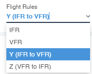
you can select the flight rules in the details or in the route constraints.
Here’s the route I got in FFWeb:
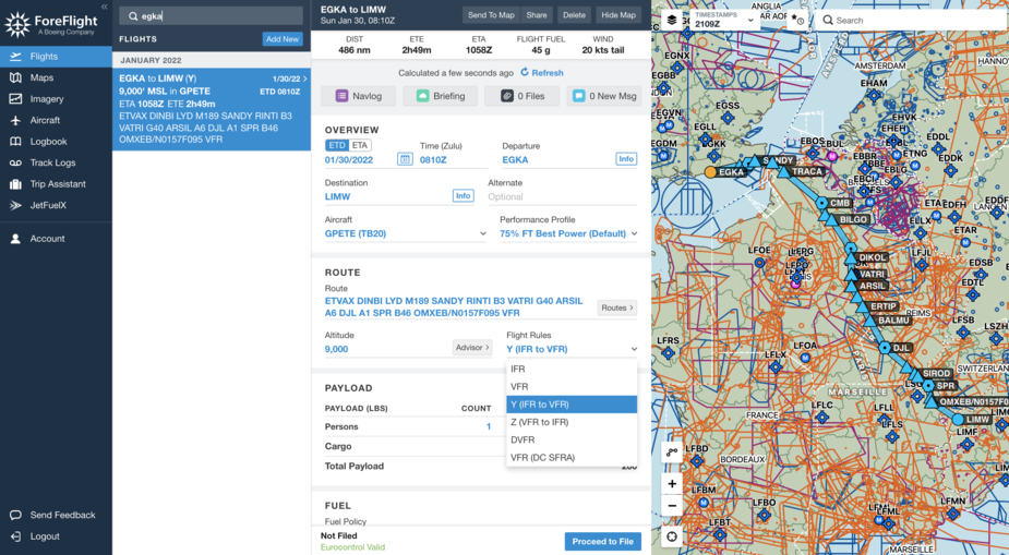
You can create IFR / VFR / Z / Y Routes what part do you miss?
I see only
How did you configure the altitude? I can’t get any route using any setting I see in your screenshot above.
How do you do VFR – IFR – VFR?
Hi Peter,
You have a European coverage, I have the US added. That explains the DC (SFRA) and DVFR entries. For Europe, you have everything you need.
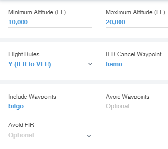
The Route Constraints provide you with minimum and maximum altitude plus IFR Cancel and Pickup Waypoint in case of Z/Y flight plans
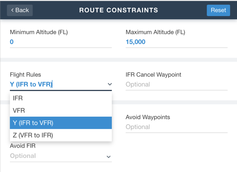
We’ve done this before, years ago. On one screen you see something like this
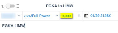
and it is unclear what the 9000 number is used for.
Then I click on Route Advisor and get this

So I change the two numbers (yet again) to this
I still get no route. 10000-17000, still nothing. It’s broken.
Maybe there is a black art? So I log out and log back in. That fixes it. Now I get something. Y does not work but I does:
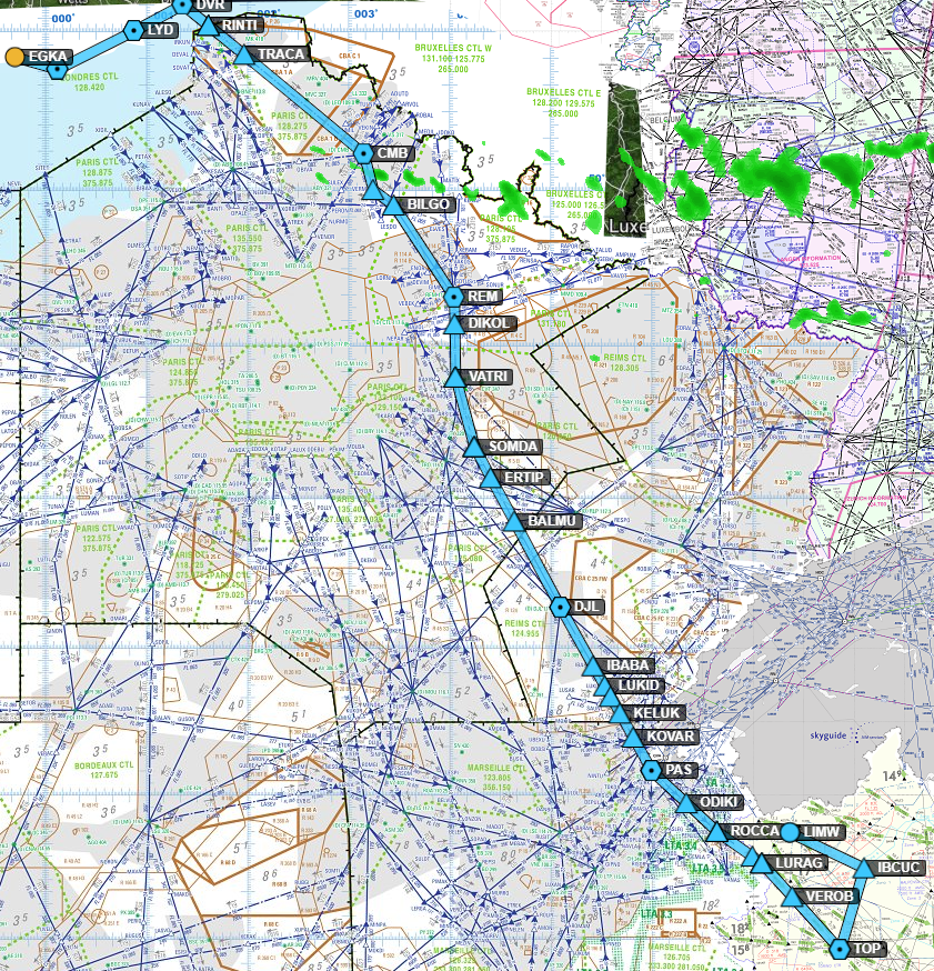
but this is not a sensible way to fly to LIMW.
ForeFlight is updated every month. Please use always the most current release for ForeFlight Mobile and ForeFlight Web.
I would start with as few restrictions as possible. I’ve used a maximum of 15.000ft. Is there a reason you limit the minimum altitude to 10.000?
The 9.000 ft shows the altitude of the first leg.
The IFPS only addresses the IFR parts of any flight so of you are VFR, YFPL or ZFPL you have to make sure that the service you use addresses those parts.
A good description of how it works can be found in the UK AIP enr 1.10 IIRC.
That’s right. When filing the plan using ForeFlight Mobile (or ForeFlight Web), the AFTN addresses can be checked in the ICAO flight plan form.
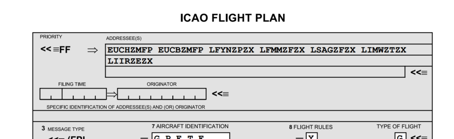
To get the ICAO form tap on Proceed to File and share (Web) or Sendo To (ForeFlight Mobile)
ForeFlight ensures, that also in case of a VFR, Z, or Y plan, all required addresses will receive that plan.