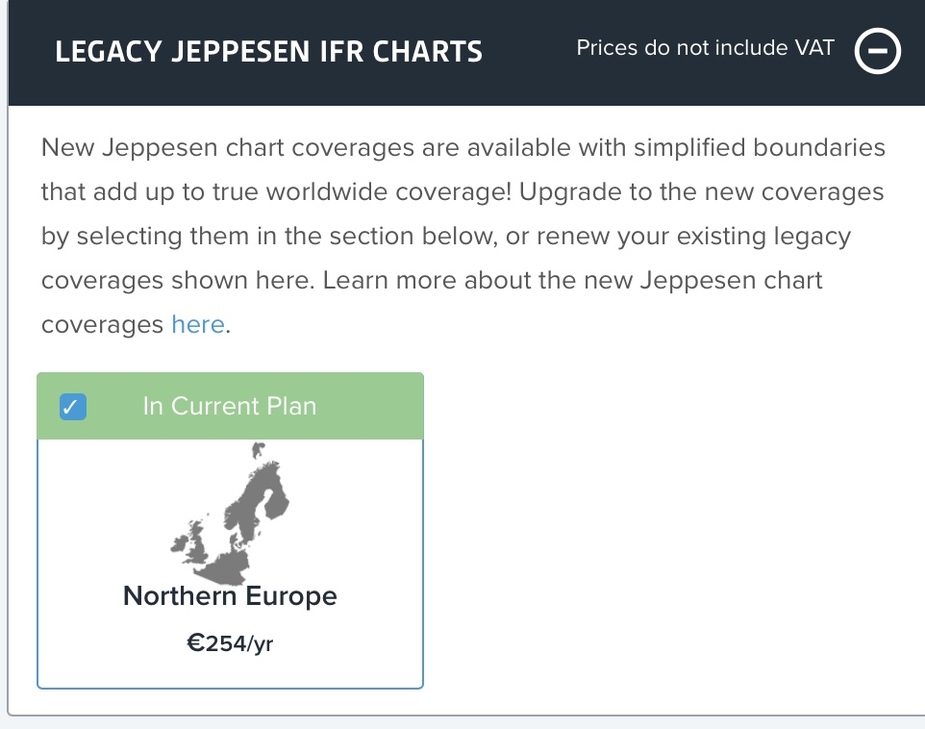
In my attempt to compare prices with GP, I noticed that FF no longer offers IFR charts for only part of Europe for new subscribers, only entire Europe, for a considerable higher fee. I seem to be able to renew my subscription though, which I am grateful for.
When did this change? Is it the same for all Jepp subscriptions regardless of app bundling?
Supersonic wrote:
Dimme wrote:You rubberband over the town and select the coordinates from the list.
Well, that certainly works with any point. I would expect to see the landmarks name in the flightplan instead of the coordinates.
That would certainly be nice but needs integration with the underlying map and the map may well not be in a format that contains that information.
The VRPs are coded waypoints in the nav data so their names can be shown in the plan window. When rubber-banding to a place in the map, the coordinates where the finger is lifted are presented at the top of a list for selection. Other options are then listed below with a distance from those coordinates. So one doesn’t need to exactly pick a coded waypoint when rubber-banding….. it can then be chosen from the list. I think that EasyVFR does this better. When rubber-banding to a coded waypoint it detects the waypoint and pops it up next to the finger on the map. If it is the one desired, then just lifting the finger selects it.
martin-esmi wrote:
When did this change? Is it the same for all Jepp subscriptions regardless of app bundling?
I don’t know the answer, but FF raised their prices in March and it may have been done at that time…. just a guess.
AFAIK Jeppesen still offers regional IFR charts within Europe if you order directly from them, and a Jeppesen subscription can still be linked to FF. However, the Jepp subscriptions are more restrictive wrt device counts, so it may turn out cheaper to get the FF Europe coverage than a regional Jepp sub for 2-3 devices.
chflyer wrote:
That would certainly be nice but needs integration with the underlying map and the map may well not be in a format that contains that information.
I must admit that this an issue that can be dealt with. I really would like to make the move to FF to have a on-stop-solution for VFR and future IFR planning. I see the strong points of it but the two things final that currently keep me from the transition are:
Airspace related NOTAMs only appear on the map two hours before they become active: i.e. when planning a flight at home a few hours before departure they are not depicted on the map – although they might be published already!
This sounds implausible. Are you sure something else is not going on?
Peter wrote:
This sounds implausible. Are you sure something else is not going on?
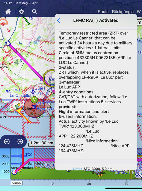
Yes I am sure. I wrote to the FF support team and this is the answer I got (name of the agent anonymized – I sent the support request on Saturday when the NOTAM was published alread, but not active yet):
Hello Christoph,
ForeFlight displays this Temporary RA NOTAM on the map. See the attached screenshot for reference.
ForeFlight displays NOTAMs that indicate airspace becoming active two hours before they become active (in yellow), which changes to red when the NOTAM becomes active. Inactive NOTAMs that will become active greater than two hours in the future are not displayed until two hours of being active.
Please open ForeFlight and confirm you can view the Temporary RA NOTAM.
Best Regards,
xxxxxx
Pilot Support Team
Here is also a sreenshot comparison between SD and FF of the same area at the same time:
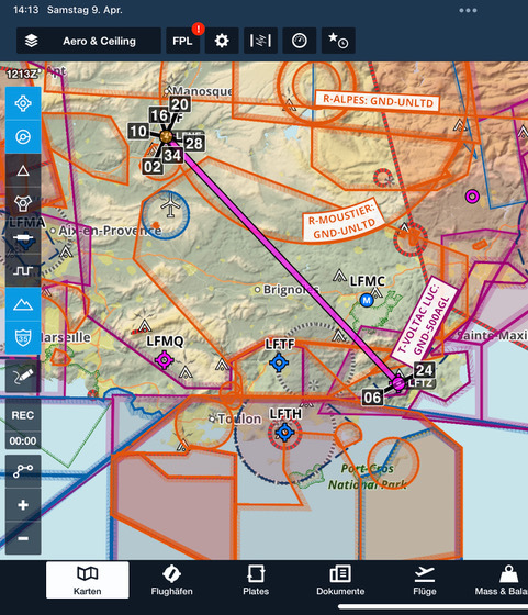
ForeFlight displays NOTAMs that indicate airspace becoming active two hours before they become active (in yellow), which changes to red when the NOTAM becomes active.
This can affect flight planning quite seriously, although they would still be visible on the actual flight (could be too late in some cases I recall).
Peter wrote:
This can affect flight planning quite seriously, although they would still be visible on the actual flight (could be too late in some cases I recall).
This is exactly my point. The issue came to my attention when planning a VFR-route through France and comparing the result with SD.
Especially in France with its convoluted airspace and all those restricted areas that are activated by NOTAM this is critical IMHO.
Certainly a surprise when using FF if one departs on a four hour flight with a NOTAM like this near the end of it.
BTW in the briefing pack those NOTAMs appear nevertheless – just not on the map. I.e. one definitely should check the textual NOTAMs in order not to be surprised.