FlySto takes all your logs at once and puts them on a map, and you can select to show tracks or A-B. Just sayin… Cheers 😎
Well… How?? 🤔
There are plenty of options looking at „Upload new log“ and also further at „Supported avionics“, but they all appear single file-based. Any hint towards a batch import to FlySto from SkyDemon is highly appreciated….
Seems like ForeFlight is reading euroga after all and listened to this thread :)
They just released this:
https://plan.foreflight.com/recap
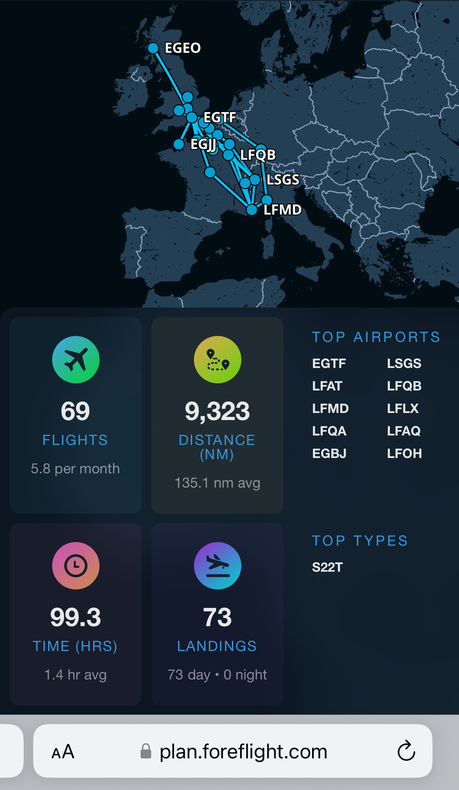
@roznet, I’m not sure this is really what we are after since it is more a map of destinations with straight lines in between, and not the actual route depiction which can be vastly different.
Snoopy wrote:
As to how SD files can be batch exported I don’t know.
Neither do I  Like I wrote somewhere above, I contacted SD on the subject a few years ago, and the reply was a condescending no, no batch export. Individual leg export as described by @etn here.
I flew a total of 247 legs in 2023, and selecting, opening, emailing, extracting individual kml files… would sure be some work
I flew a total of 247 legs in 2023, and selecting, opening, emailing, extracting individual kml files… would sure be some work
Upload the G5 file and voila you have all flights on a map in flysto
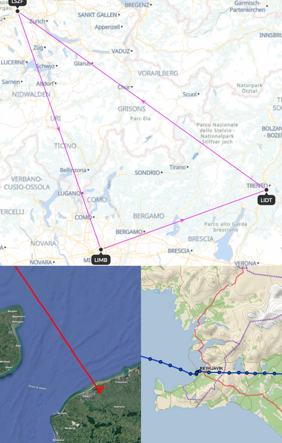
Thanks @Snoopy. Yes this is a map, as depicted in the upper image below, courtesy of flysto. Destinations linked with a straight line. But it is not a plot of my flight as mentioned in the very title of this thread, and of very little interest (to me).
The 2 inserts below are plots of a flight, with its meandering, the more so when I’m flying AP off and following an exciting coastline Only few of my flights are in a straight line, and therein lies the interest…
The first one with the red trace, has been created in GoogleEarth by extracting the kml as described above, from SkyDemon. The one on the lower right is created automatically by Garmin’s inReach, albeit a ping/minute.
PS
A SD batch export would be great since I’ve been using that program for many years now…
Dan wrote:
Neither do I Like I wrote somewhere above, I contacted SD on the subject a few years ago, and the reply was a condescending no, no batch export. Individual leg export as described by @etn here.
The PC version of SD allows me to export a leg directly to GPX or KML. On iOS you can achieve the same thing by choosing “explore in google earth” and then sharing the resulting KML file. Not sure about Android. Still a crappy one by one process but at least it lets you skip the stupid email sidestep.
Is there any difference for processing between GPX and KML in terms of information content?
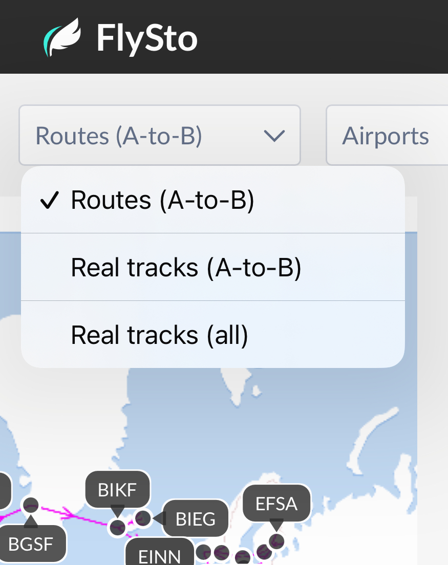
Snoopy wrote:
you can show tracks too
Absolutely, thanks for that @Snoopy! I guess one should first explore, and this before writing stupid stuff on EuroGA
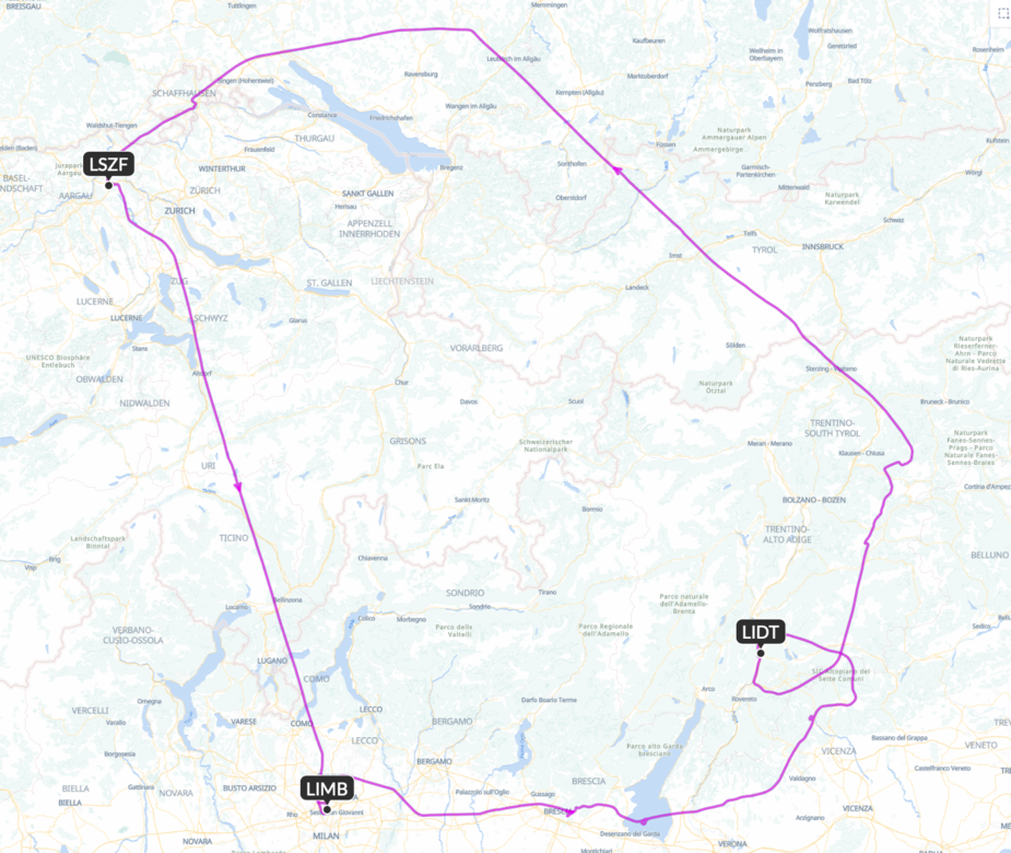
Here the same legs, plotted (and curvy  ):
):
So now we just need a batch export from SD… I have to play with the PC version of SD, but IIRC last time I looked (long time ago) I was not able to access my cloud backup logs…