arelplane does it and off course flysto.net as well.
Due to popular demand a map export option is coming soon.
you can upload all skydemon files in batch to flysto, is that still too much effort on the skydemon side?
Ah really? I haven’t seen a batch export, but will search again.
(I‘m not looking for a solution delivered on a silver plate, just something an average user can handle within an appropriate amount of time. The last time I programmed something is >20yrs ago……)
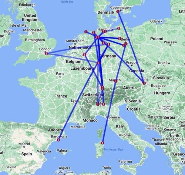
These are my 2023 flights using MyFlightBook. It’s the closest I’ve found that doesn’t involve any extra hassle/work besides keeping my logbook up to date.
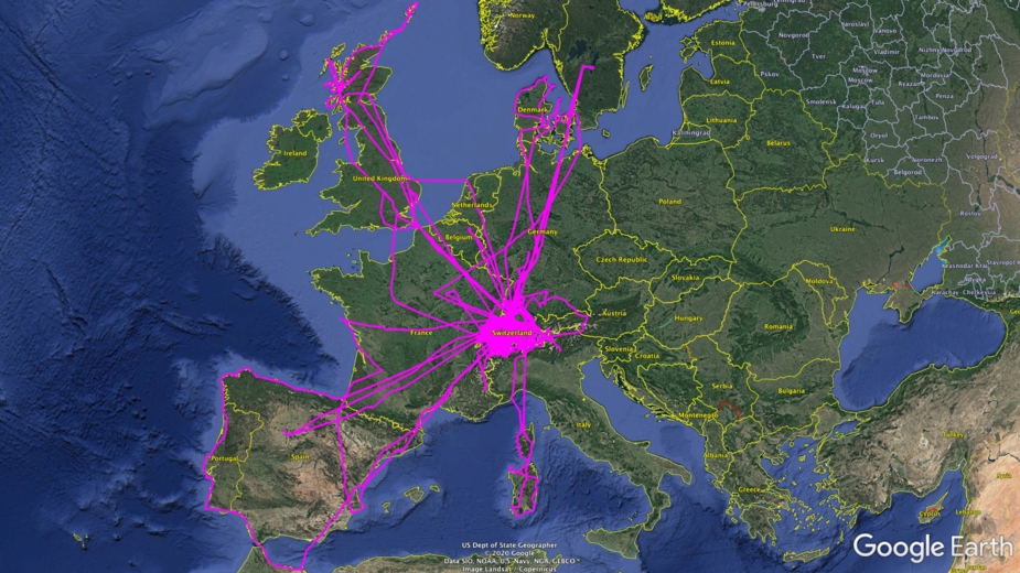
this is the map I did in 2019, the first year I had my present steed. Now exporting those individual legs out of SD by mailing them out of the iPad mini, and then feeding the KML data in Google Earth… is time consuming to say the least. The advantage here is having the real track displayed iso a straight point to point line.
A SD batch export would facilitate this kind of tedious work…
Gloze ADL shows tracks and enables export to .kml but both features are available on a single track/date basis. Maybe this could be expanded to multi-select.
Snoopy wrote:
@marcel you can upload all skydemon files in batch to flysto, is that still too much effort on the skydemon side?
Having gone that route, the problem I see is not getting the flights into Flysto, but out of Skydemon.
The only way to export a flight in GPX/KML format is to send it per email.
Issues:
- you need to do that individually; no possibility to do it in batch
- the process of sending the email is slow. From the point when I press “send”, the 30 mins flight shown below takes about 10 seconds to send, during which Skydemon is blocked for other uses
- once you receive the email, you have an extra step to save the attachment
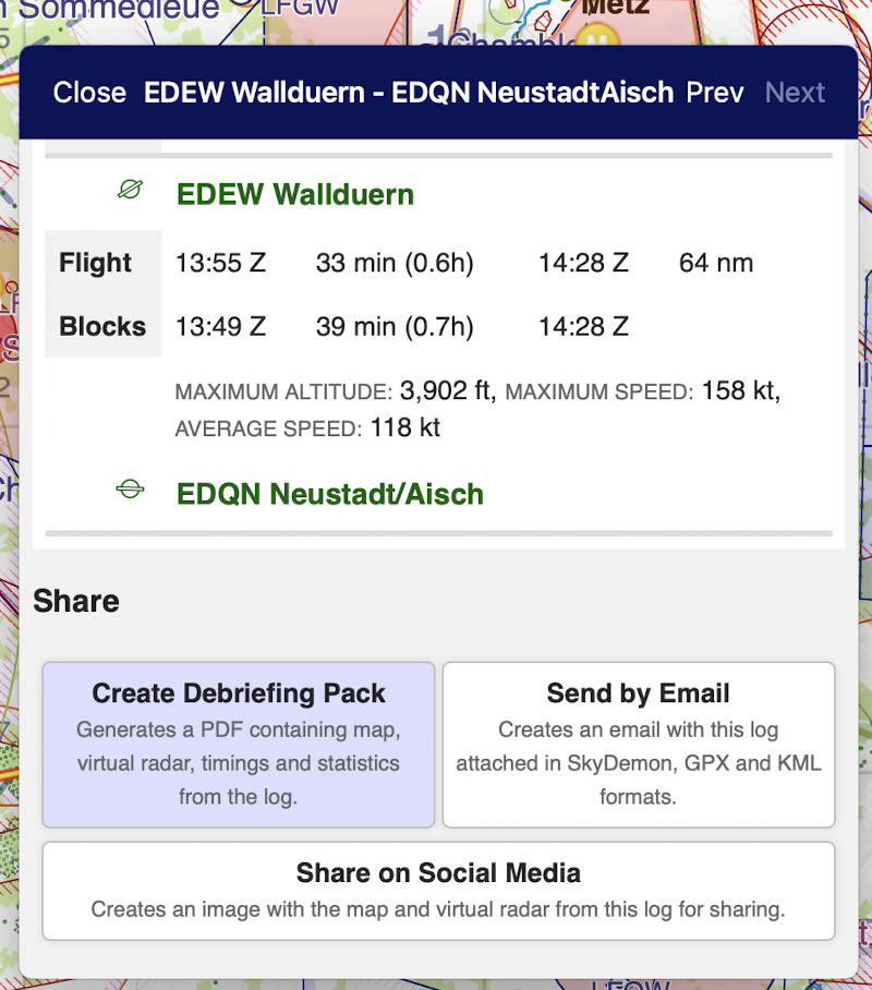
In other words, it sucks :) Or did I miss something here?
… is time consuming to say the least. The advantage here is having the real track displayed iso a straight point to point line.
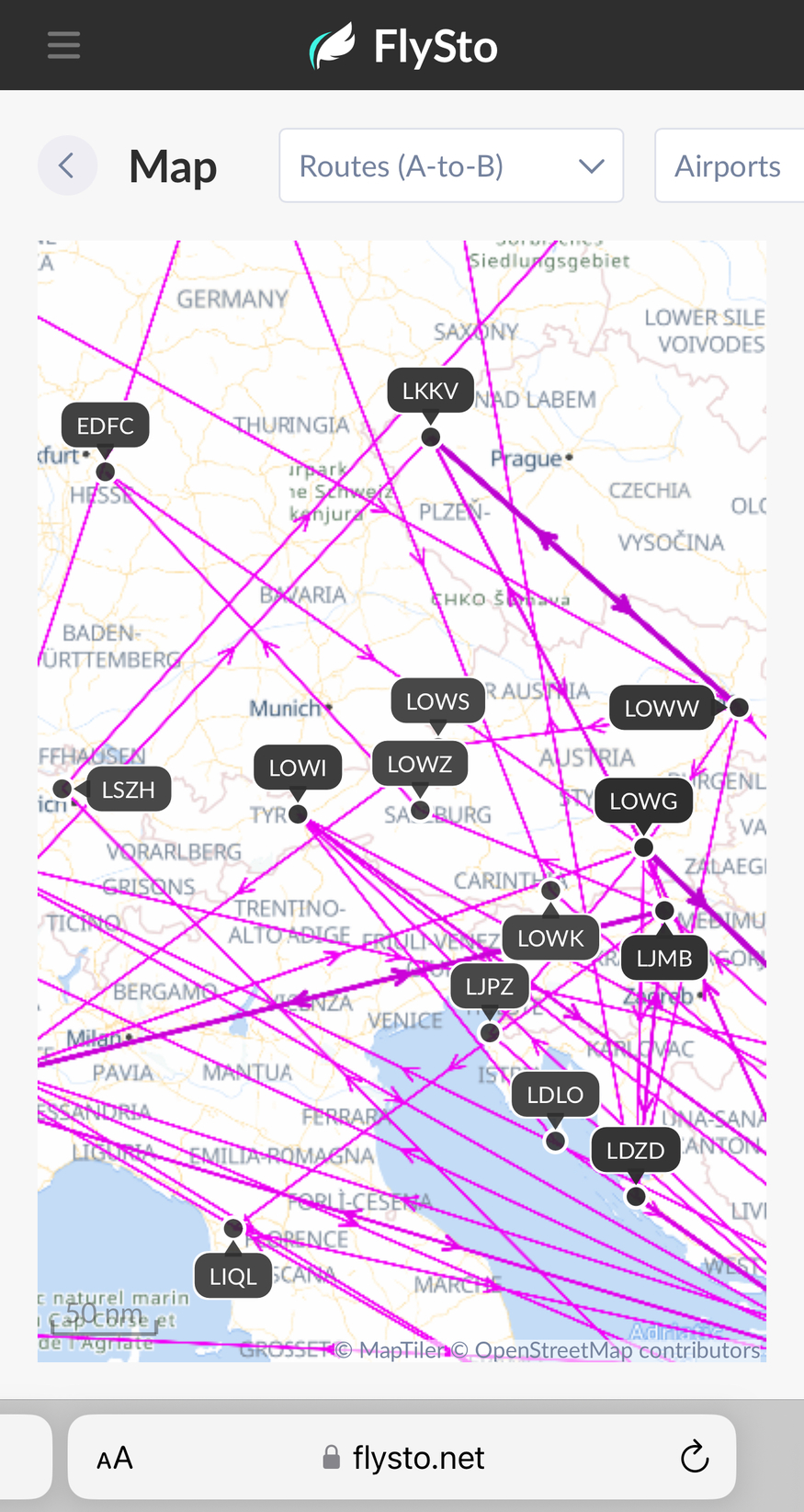
FlySto takes all your logs at once and puts them on a map, and you can select to show tracks or A-B. Just sayin… Cheers 😎
I save a copy of my GPX-log from SkyDemon after every flight. True, batch-export is not available from SkyDemon, but:
That directory acts basically as my personal flight log. I have a couple of tools that operate on gpx files. One of them is https://flight-display.venus-flytrap.de/. It uses google maps to create maps similar to the one shown by Dan.