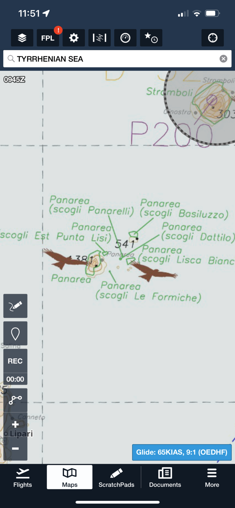
Peter, if you look at Panarea, it is one of the Lipari islands (isole = island 😉). And yes, those are shown on SD, same for the one around Stromboli…
Enjoy the short flight!
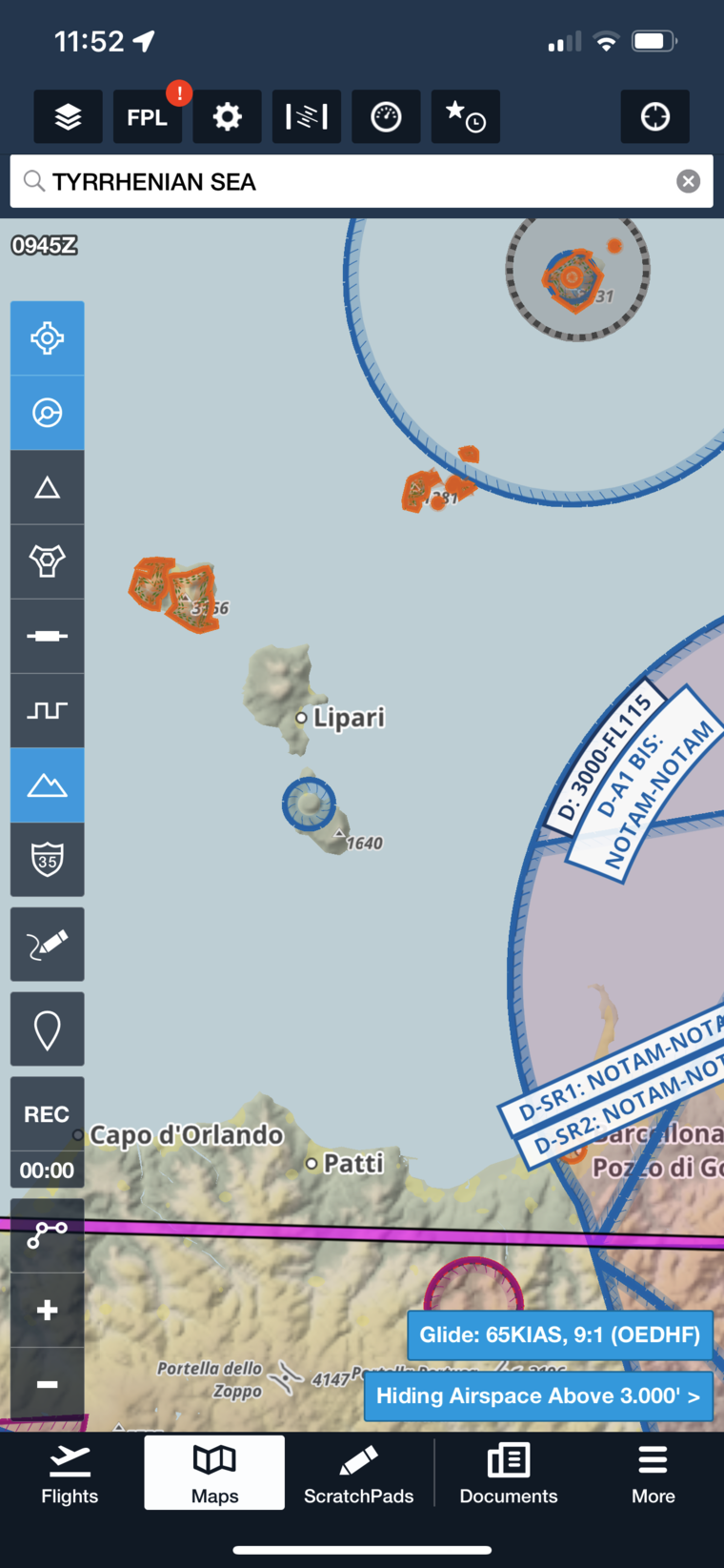
FF shows all of these tiny areas (74.1 Meters radius…) and so does the VFR layer in FF with those hand drawn ICAO style maps.
Sorry. My mistake! I read 74.1M as 74.1 Miles.
Ignore!
dublinpilot wrote:
I read 74.1M as 74.1 Miles.
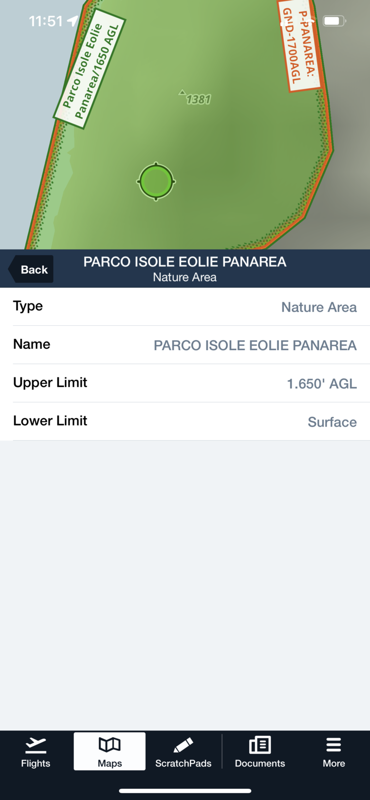
74.1 metres!? What’s the point of having a prohibited area that small and if you do, what’s the point of extending it up to 500 metres AGL? Not to mention the 0.1 metre precision in the definition of the area. Are you sure it isn’t nautical miles?
This is Italy, guys…
I asked both LICR and LICP about that route. LICR ignored the question (as expected – 3 × PPR needed for one arrival so far) but LICP replied helpfully:
About the route, that is a very scenic flight, no problem along the
route, maybe you can’t contact ATC Roma Information when you leave
Messina to Cefalu, anyway there aren’t problems.
See you soon
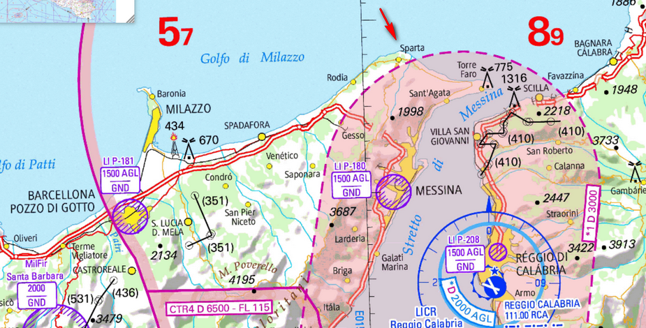
There should be no issues with LICR LICP VFR. Roma Info should be able to tell you if LIR501 is active. Roma (on 129.575 in this case) is usually very helpful. Frankly I’d take the scenic route up to the Sparta VRP then follow the coast, descending below 1,500’ to avoid the restricted area. Enjoy!
p.s You really need SkyDemon 😉
74.1 metres!? What’s the point of having a prohibited area that small and if you do, what’s the point of extending it up to 500 metres AGL?
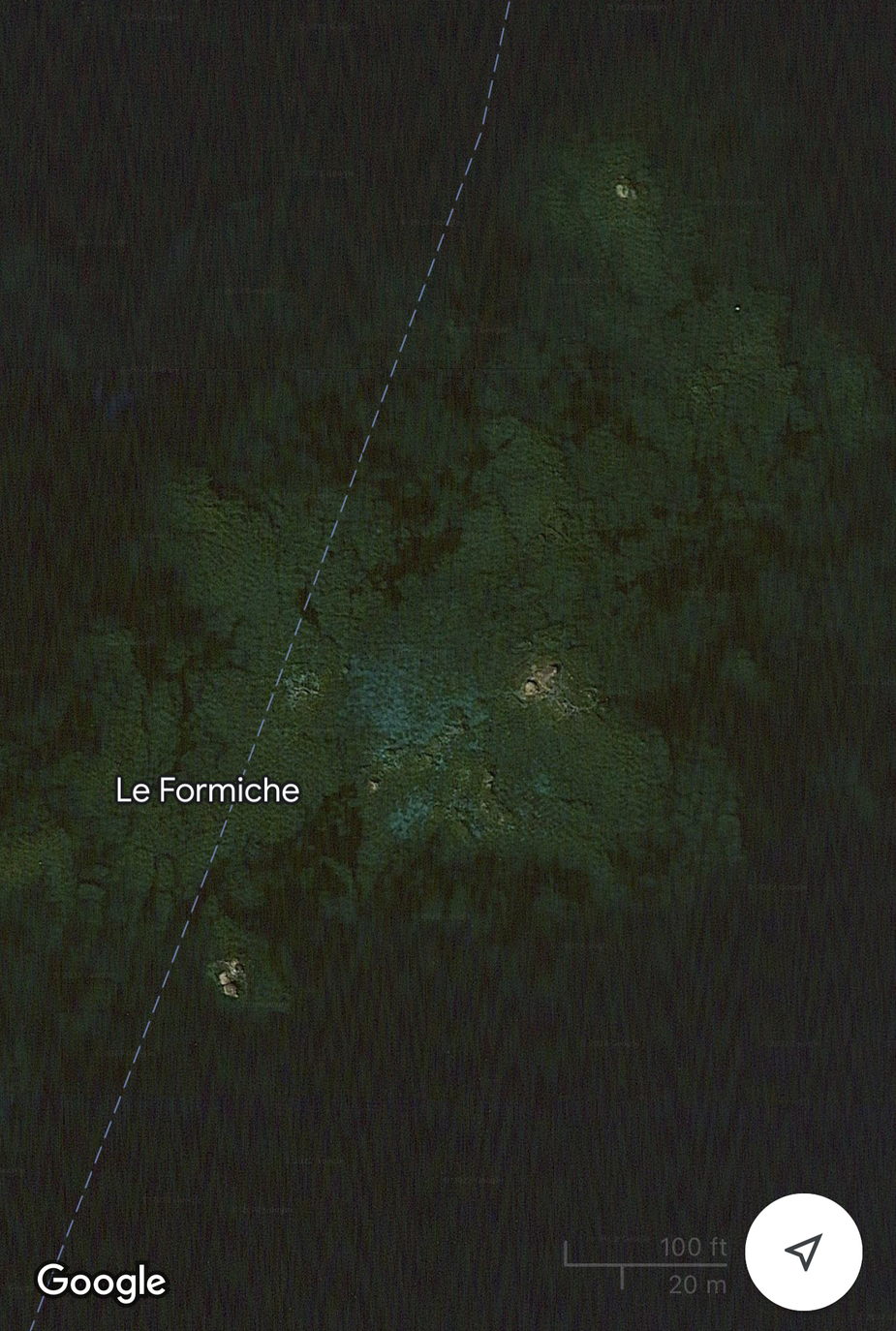
If you look at my screenshots you can see the island is hardly bigger than a few meters in length. It’s probably a bird nesting rock, hence protected in the published dimensions.
/Edit
Formiche is tiny:
There should be no issues with LICR LICP VFR. Roma Info should be able to tell you if LIR501 is active. Roma (on 129.575 in this case) is usually very helpful. Frankly I’d take the scenic route up to the Sparta VRP then follow the coast, descending below 1,500’ to avoid the restricted area. Enjoy!
p.s You really need SkyDemon
Thanks – that’s my plan.
Re SD, I have Foreflight but left the Ipad in the plane  Also I struggle to understand how it works. I would need to go on a course. I can do basic route entry but not sure how to get e.g. a terrain / CAS profile if not actually flying.
The terrain in Sicily is nontrivial so a VFR flight could be tricky if there is cloud around, especially given the destination has no IAP. Hence my plan to fly VFR along the coast. I found Sparta – right at the top of Sicily. This is on an old VFR chart
Snoopy wrote:
If you look at my screenshots you can see the island is hardly bigger than a few meters in length. It’s probably a bird nesting rock, hence protected in the published dimensions.
Sure, but what’s the point of the area in the first place? An aircraft flying 74.1 metres from the island at 500 ft will disturb the birds much more than one flying straight overhead at 1500 ft. But 74.1 NM would be unreasonable, so I guess metres is correct after all.
I would guess that this restriction is really intended for boats and that they just slapped a standard 1500 ft limit on it for aviation without thinking.
Indeed, it doesn’t make sense looking at it that way.