Flight from LFNG to LFMA (South Est France).
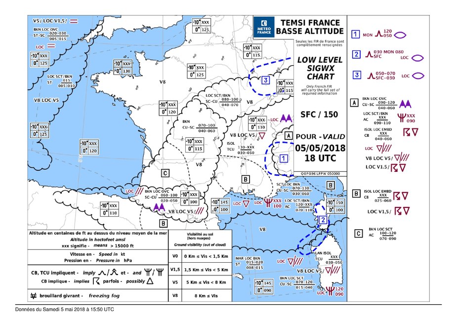
The TEMSI shows not great weather (look at “B”)
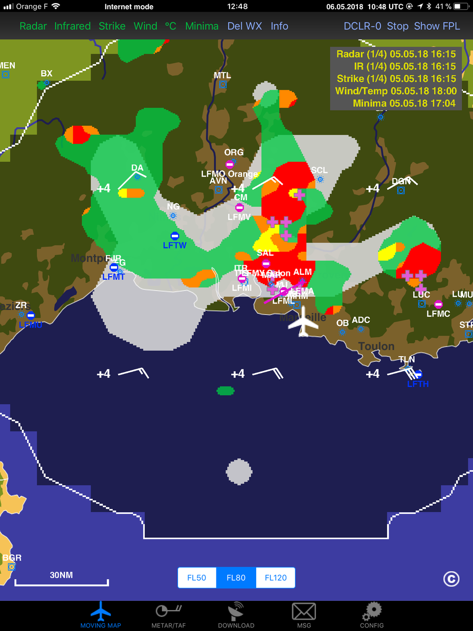
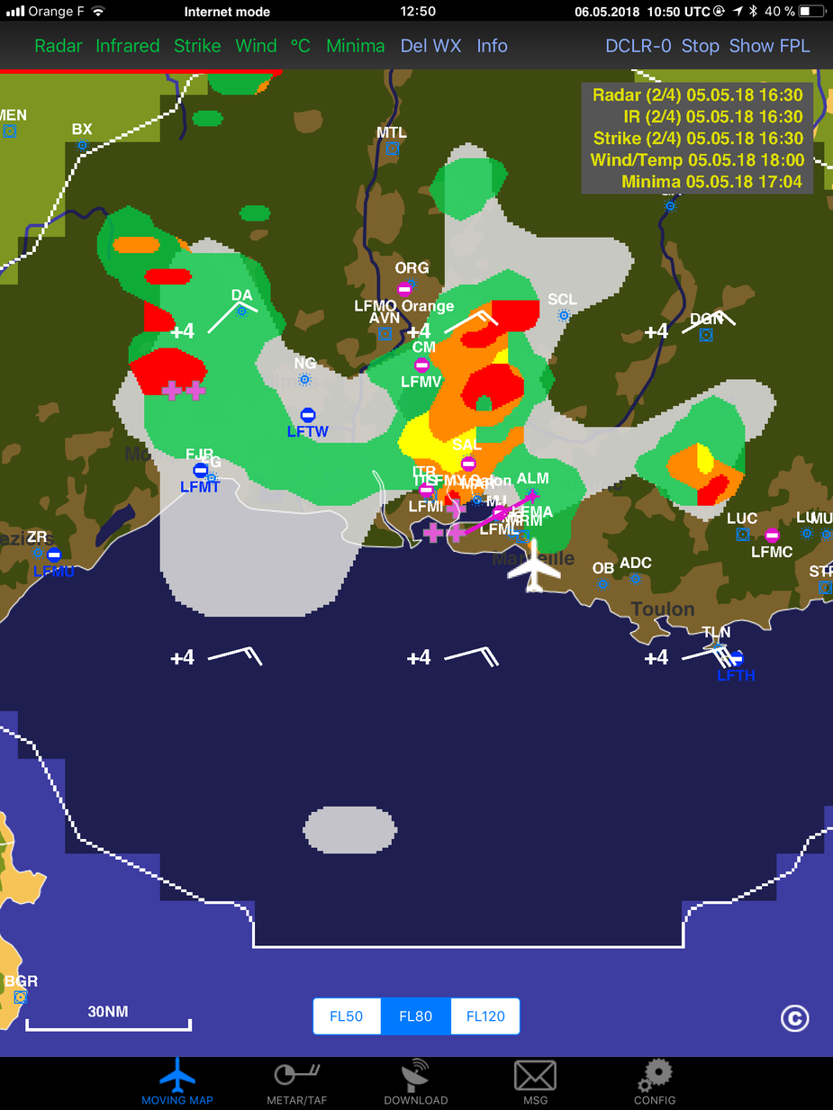
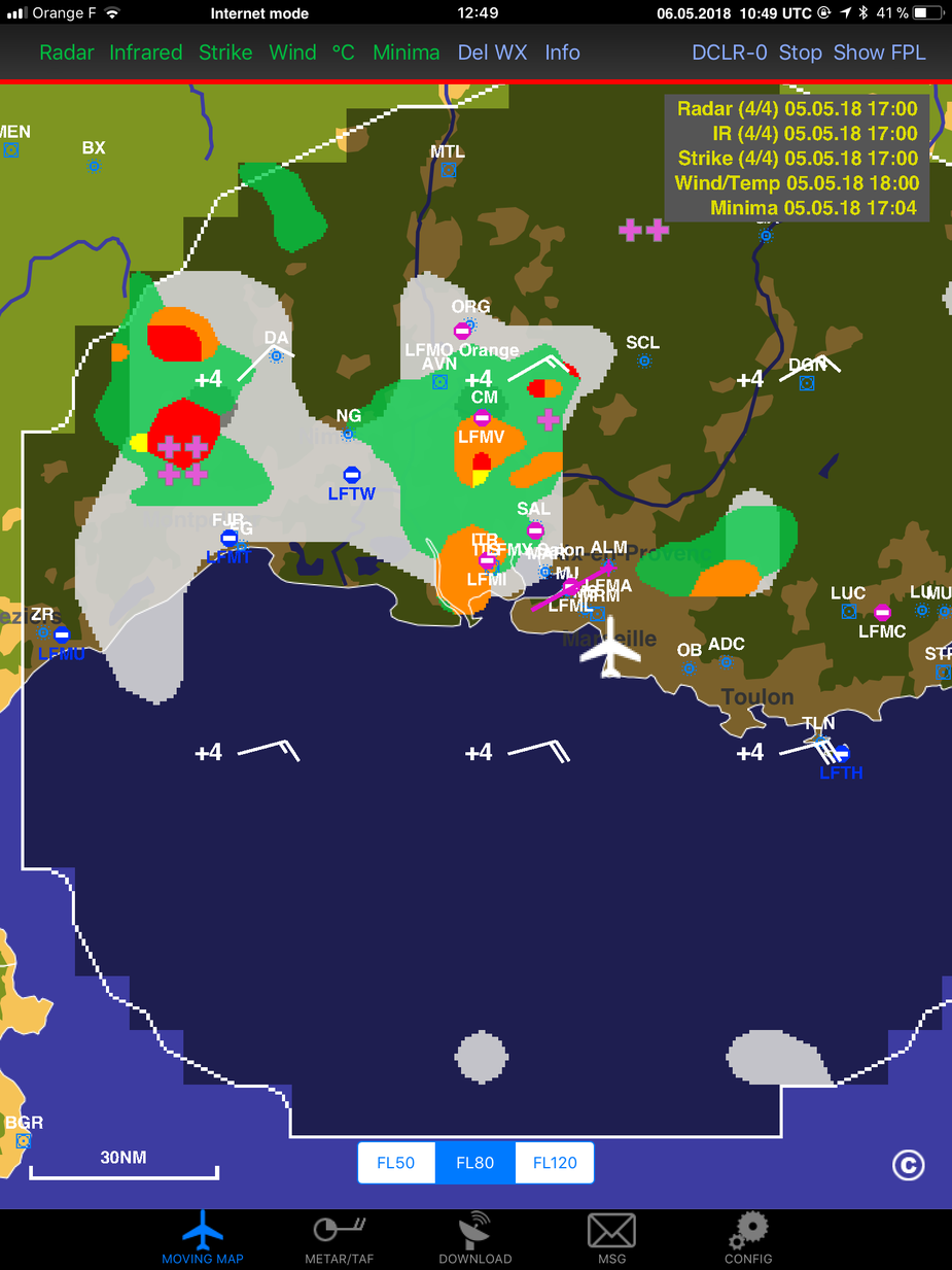
And the Golze system proves to be significant help (and relief) to find your way.
In this weather, better in VFR. Golze images come with a delay. In IMC, it’s only an indication.
I agree VFR is better.
But with only the TEMSI, I think I wouldn’t have dared, because I wouldn’t have known where were the cells, and if I could find my way.
It allows to fly between the CBS and with some margin. Not too close, not below. What was a great flight.
I was flying from LFBO. With radar data, and just as Dick Collins learned us, I used the best light GA advantage: being able to land anywhere to wait.
So I landed LFNG, waited one hour, monitoring the radar from the ground, and when the path cleared, I took off.
Thanks @Sebastian_G !
I find the ADL great just for tafs and metars. One can often get these over 4g with the autorouter telegram gateway but this can be highly unreliable.
Fog can form suddenly in CAVOK conditions…
All the metar in the region were showing TEMPO SCT CB TSRA
Without radar images, I think I would have slept in Montpellier (maybe am I wrong to fear so much those conditions ?)
Route was globally LFMT —> LFMA along the shoreline.
Interesting post. I could see value in this, for example in a VFR Catania-Rome (Urbe) flight planned for tomorrow. Good weather at the start and possible scattered T-storms from Naples on. I’m always ready to divert, but this sort of picture in advance would indeed be handy.
I’m sitting on the fence here with such technology in VFR as I can’t see the benefit of delayed info. I recall one weekend when I flew back from Ostend, was heading towards Dinslaken and saw what looked like a line of CBs stretching from Cologne up to at least Düsseldorf so I diverted further to the north with a view of getting in behind them. A pilot I was flying with had onboard weather on his iPad (picked up from Garmin Pilot App) and was saying that he could see the cells on his screen and was heading directly toward Dinslaken. I could see with my eyeball mark 1 the precipitation coming down over Dinslaken so diverted to Borkenberge, told my friend of my plans and he basically mocked me because his app was showing the cells were still further to the southwest, he was going to land there.
10 minutes after I landed in Borkenberge, he landed, got out and looked rather pale. It transpired that he had been shaken like a leaf in a tumble drier when he was caught under some pretty hefty downdraught from a CB about 10 miles away. I asked him why he flew into the bad weather. ‘Because my Garmin told me it was ok’.
The linked video is a good example of reading the sky – when he looks to his left, there is no way I would fly that direction even without any in flight weather radar. I would try to determine the course of the storm and aim to either circle / divert until it passed or try to get ahead and land in front of it. My practice is to make sure I have enough fuel and aim to fly towards the sky where it’s at it’s lightest. Even if it takes you away from where you want to go, usually you can avoid isolated areas of bad weather and find a place to land before you run out of options. For that, I don’t need any additional electronics….
Steve,
I do agree. Eyeball is the tool to use when flying in such weather. And AVGAS is the thing to have in your tanks.
Radar images were not intended to penetrate weather, and finding my path implied only the eyes.
To me, usefulness of the radar appears at three levels:
- it helped in determining the weather situation at destination. Actually there is no METAR in LFMA, and weather can be very different between LFML (shoreline) and LFMA (ca. 15nm into the land). As there was very little wind, orographic CBs have been active in the very same area for a good part of the afternoon.
- it showed that I was not entering a dead-end, with possibility to circumnavigate safely
- during the flight, if things had not turned well at destination, it would have helped in determining the evolution behind me (LFMT), allowing me to take the best decision; flying back, or diverting further east.
I’m sure more experienced pilots may not need the informations.
In my case, it helped in taking the decision to 1) land and wait when it appeared bad at destination 2) take off again when I thought there was no more danger
If you are flying 50nm (as much GA does) then you don’t need airborne wx because you can almost see the enroute and destination wx as soon as you get airborne 
Pretty obviously the radar/sferics data from the ADL is very useful on VFR flights if the flight is reasonably long.