iz-trips wrote:
If Red I understand I should under no circumstances enter. If Green should be OK. But what about Yellow ?
Heavily depends on your airplane, the weather situation (e.g. if you can exclude that it is hail and nor rain) , etc. But in general terms: While it typically should be survivable, with a light aircraft I would never do a “planned entry” into a yellow area on the radar. Radar is clearly there to avoid red an yellow.
In addition to that: Typical radar systems in light aircraft have limited capabilities to “see beyond” an area of precipitation – the more the more rain there is. Therefore if you fly through a yellow area, the risk is much higher that you end up in front of a massive purple wall that you could not see from outside.
Overall the best way to learn to read an onboard weather radar is to use it as much as possible at day VMC flights where you can actually see the convective weather in front of you and decide if you would enter or not.
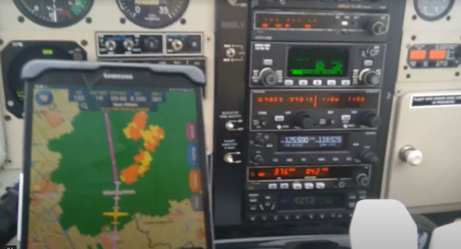
You‘ll want to learn more about tilt than this guy here… 
Which Radar? Dish size?
The colors on your radar are only useful if showing water… no point avoiding a city (strong returns, red) and ending up in a CB next to it (that didn’t paint on your radar due to inappropriate settings).
On GA planes (with small antennae) I have two strategies.
1) Disable gain calibration and ground clutter removal. Set range to around 40 miles (or below). Tilt down until ground returns cover the far end of the arc. Turn on ground clutter removal/calibrated gain.
For non pressurized/lower cruise levels:
“With the aircraft flying level, adjust the antenna tilt so ground returns are displayed at a distance that equals the aircraft’s current altitude (AGL) divided by 1,000. For example, if the aircraft is at 14,000 feet, adjust the tilt so the front edge of ground returns are displayed at 14 nautical miles. Note this antenna tilt angle setting. Now, raise the antenna tilt six degrees above this setting. The bottom of the radar beam is now angled down four degrees from parallel with the ground.” Once you establish the proper tilt for your AGL altitude (nearly always between 6 and 7 degrees nose up for the cruise altitudes I generally fly), the system is freakin’ awesome – better than a lot of commercial airliners currently flying. At the proper tilt angle, I would never consider flying through red.
2) Use one of the apps to visualize your beam width (eg 10“ dish =
The 10-inch phased array antenna has a certified beam width of 10 degrees, which means the beam is 10,000 feet in height (and width) at 10 NM and 100,000 feet in height (and width) at 100 NM.
• At 20 NM range the beam height changes by 2,000 ft. per degree of tilt change.
• At 40 NM range the beam height changes by 4,000 ft. per degree of tilt change.
• At 100 NM range the beam height changes by 10,000 ft. per degree of tilt change.
and point tilt to area of greatest reflection.
The advice to use the radar in VMC and match images to actual weather is good, do that before avoiding CB TSRA in IMC.
I would recommend to find and pay an experienced professional pilot and fly a week or two in bad weather to learn wx radar operation among other things.
In my personal experience avoiding certain colors is not the best approach neither for on board weather nor for satellite weather. The key is to understand the structure of the weather and then to avoid it accordingly. So for example if it is a convective cell I would try to avoid the center circular structure entirely, even the green parts. If it is a wide spread “downpour” type of weather flying through green areas will probably just wash the plane.
Also be aware that when getting closer the colors usually get worse. I have never seen red returns on our radar at the maximum practial detection distance (so maybe 50-60NM) but when we get closer they tend to intensify.
Also consider adding data link weather. Either from Garmin or my company whichever you like better. Both will make a huge difference to on board radar only. This video might give you an impression on what is possible with radar and what not:
The key is to understand the structure of the weather
Exactly. Avoid hooks, fingers, scallops and clearly painted „crisp“ rings of green/yellow/red.
20NM, even ob the upwind, isn’t much for a real CB!
I recommend the Golze ADL – a huge safety benefit!


This thread is worth a read. Also, another existing thread on same topic merged-in.
Compared to what you might find in the Amazon, the European CB always looks like TCU, not suggesting y’all go explore them.
Most garden variety GA weather radar suffer attenuation just because they have baby dishes. My advice treat them for strategic planning not tactical picking your way through cells.
I had the impression even if you have a big dish and you know how to fiddle with knobs, the key limit is GA slow speeds? the green arc max is at 160kts, you are just not moving at all while it’s going popcorn around on +1degC/6min
Sebastian_G wrote:
be aware that when getting closer the colors usually get worse.
I’ve actually never noticed that, and even basic GA radars try to compensate for that, so maybe your install has an issue Seb?
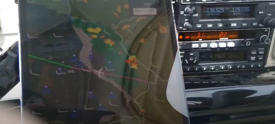
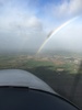
ADL is a fantastic tool and concur with the statement of Sebastian. Last friday I had IMC from Balaton lake till Regensburg. Sorry bad quality pics..;-), ouside picture when finally weather improved bordering green, grey IR.
Trying to get on top useless as it sat in all flight levels till 20000Ft. Confirmed by Skew T the day before. Rain without too much turbulence all the other days were really convective from 10:00 UTC onward. OAT was 2- 3 degrees but ice was forming @9000Ft. Used 3 gallons of TKS to get me over the mountains in IMC. The area’s right in the pic painted yellow orange, but didn’t cause turbulence accept of a bit more rain….So all in all I think you need to compile all sources and make your own picture. I try to avoid flying @ time/places when the weather is really convective with potential embedded CBs etc, with collie flowers tending to becoming huge TCUs mushrooms fast……Radar gives you a 3D picture ADL is 2D…
That weather the guy was flying through in the video Bosco posted …well…holy crap…..if you like going through the dark side? It doesn’t look like he was using a stormscope. Not being an expert but it seems he was doing a radar ground mapping of the FRA area..:-) in stead of seeing what was in front…
Windy is a good tool to predict time and place for potential convective weather…..
I would love to have (some) radar and combine it with ADL and a stormscope to have the full tactical picture..I will have to do with eyeball avoidance, stormscope and ADL for now when airborne.