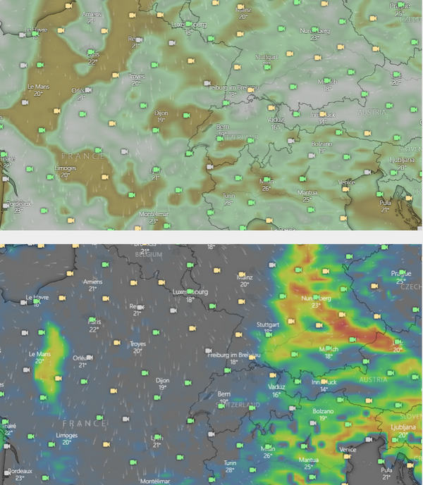
Look at NE France.
I thought the very definition of “medium cloud” would make this impossible.
But… when you click somewhere within that region, you get this
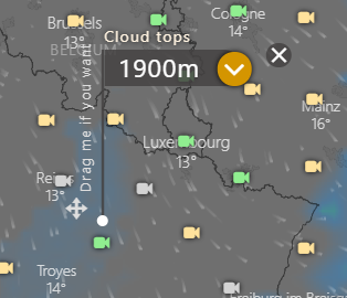
What seems to be happening is that the cloud top colour coding just happens to coincide with the background:

The edge of the blue area where you placed your marker corresponds to 1900m on the legend. A bit hard to see but it’s there.
You mean you see no blueish grey shading at Troyes? I can clearly see it, maybe try another device or different colour settings for your screen.
Bright ambient and a laptop 
What a cool feature!
But still there are major inconsistencies between cloud coverage and cloud tops of medium level clouds. Today there are areas which show 99% cover (overcast) of medium level clouds, but cloud top far below 2000m, which is low level according to their definition.
See here:
https://community.windy.com/topic/4117/clouds/3
We should keep this thread updated with Pireps here. This could turn out to be a great feature, if it was reliably indicating tops at steps of 100 meters of altitude. Hard to believe it!
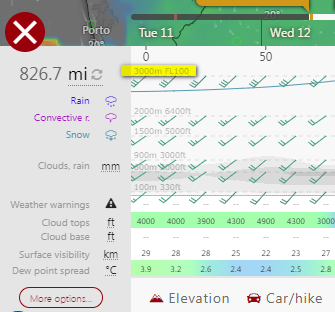
I’ve been using the Distance & Planning feature
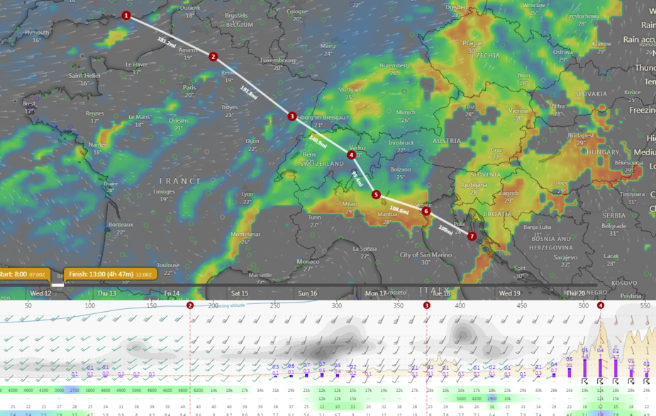
Only in “VFR” mode can one see the IMC profile along the route. But this profile goes only up to 10k feet
Is there any way to adjust this?
Basically the IMC profile does not relate to the main screen medium cloud, high cloud, cloud tops, etc.
I also found this, FWIW
(for ECMWF model)
… cloud layers are assigned as:
High-level cloud cover (HCC). – Cloud integrated from top of the atmosphere down to 450hPa.
Medium-level cloud cover (MCC). – Cloud integrated from 450hPa down to 800hPa.
Low-level cloud cover (LCC). – Cloud integrated from 800hPa* down to the surface.
BTW Distance and planning is available on iPad and iPhone apps from the latest version.
Looks like nobody knows the answer, or there isn’t one and the profile is just fixed at 10k feet height.
Looks like nobody knows the answer, or there isn’t one and the profile is just fixed at 10k feet height.
It’s fixed based on idea that VFR flights are executed at low altitudes.
Haha yeah right we all do that