For me this would be a go. I would expect IMC, wet plane and a few bumps. Would not expect any avoidance. These are not thunderstorms, tops too low. Just thicker cumulus. This is from my past experience with Ogimet, where I also had doubts. I don’t know if it is correct to give such advice. Sorry if not. Use your own judgement and adjust to abilities.
What I tend to find on the Autorouter gramet is that most stratified cloud is missing most of the time. It shows convective stuff, but you can get a pretty good idea of it by looking at the MSLP chart…
The world is full of pretty graphics…
The best thing is the IR image on the morning of the flight, with tafs and metars.
Reading the IR image is a bit of alchemy though.
It tells you (approximately) the cloud tops, which is the main thing that matters in IFR, where the objective is to fly VMC on top in the enroute portion.
All the graphics coming out of wx models so largely conjecture.
The bottom line is that we don’t have any way of forecasting where IMC will end up, even 2 days ahead. You can forecast convective conditions (largely from the also forecast temp lapse rate, and also forecast humidity, etc) and then, hey, you drop some nice pics of CBs into the gramet 
The bottom line is that we don’t have any way of forecasting where IMC will end up, even 2 days ahead. You can forecast convective conditions (largely from the also forecast temp lapse rate, and also forecast humidity, etc) and then, hey, you drop some nice pics of CBs into the gramet
I am using a simplified GFS model utilising primarily the dewpoint spread (ambient vs dewpoint temperature) at altitude combined.
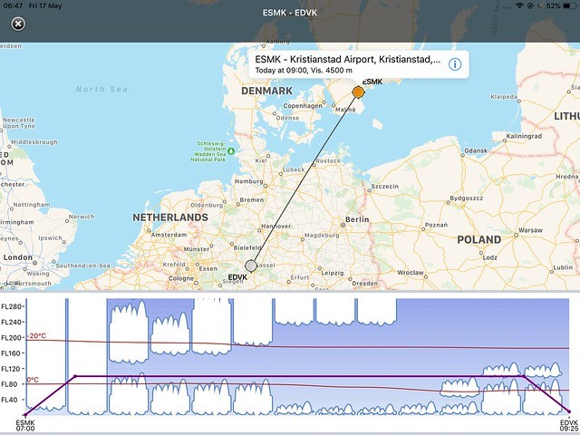
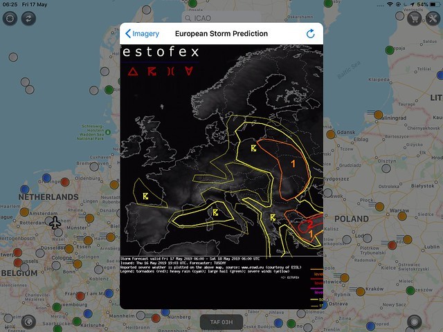
If the lifted index or CAPE is telling me something, I simply draw the clouds darker on the chart. The IR cloud top temp image, the METAR, TAF, and sometimes the Estofex – European Storm Prediction chart complete the picture I am drawing of the weather to expect. In the south of Sweden, there is a 15% probability that lightning will occur somewhere today, giving me at least a warning that convective clouds are passing through.
I can look at a simulated (GFS based) Skew-T diagram to see how the dewpoint spread at a specific point, e.g. airport to see how the dewpoint spread will move over time to give me a bit more details.
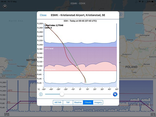
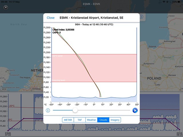
Most of the time, this is all I need to do and it takes just a few minutes of time. If the weather forecasted is bad, I will sit down and have a more detailed look at the weather such as downloading at a more complete Gramet chart, opening up Windy or looking at significant weather charts (not that often).
I would, of course, be interested to see what the actual weather would be this morning :-)
The actual rain radar (Doppler) shows indeed some rain passing through. Forgot to mention that I, of course, will look at rain radar images just before a flight if frontal/convective/rain is expected to be encountered and to see how it is moving over time. And … I sometimes have a quick look at WeatherPro (MeteoGroup App). Not an aviation app, but provides a good forecast of weather to expect at my destination. This thread is about GRAMET, so that is why I did not mention it earlier.
AeroPlus wrote:
I would, of course, be interested to see what the actual weather would be this morning :-)
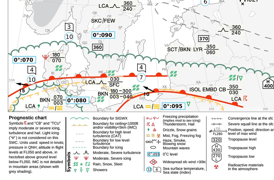
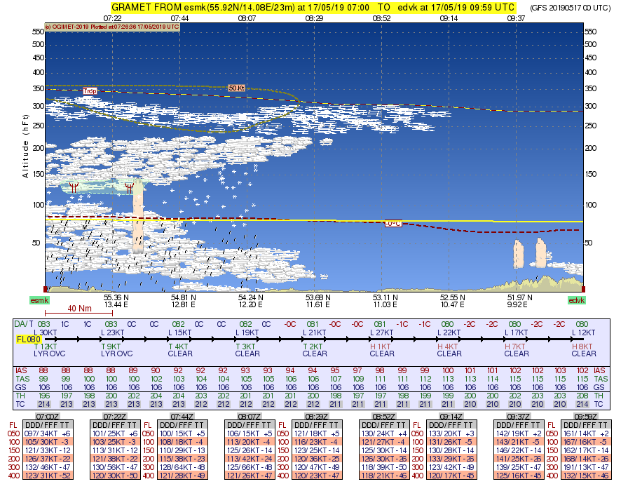
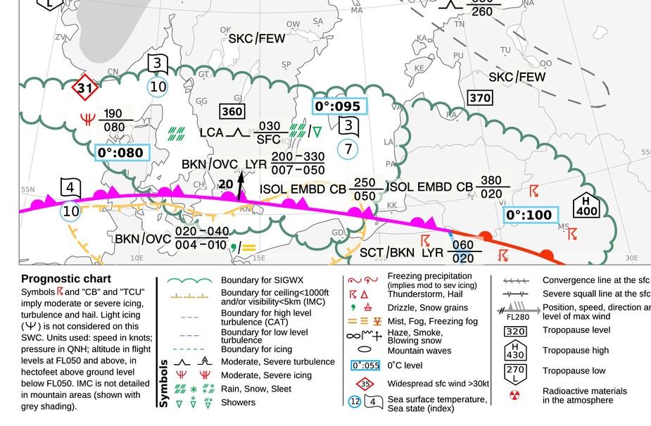
It’s my first real IFR flight on my own, maybe I’m being too conservative, but don’t want to fall for getthereitis.
Good decision Arne.
Always decide on the “technical data”, and that is not really available until the day of the flight.
Also, the IR works best VMC on top 
Arne wrote:
how can I trust ATS will keep me out of the convective cells? Can I at all?
Yes, good decision. No need to push it on first flights (edit: also on subsequent, when you get confident) We were worrying about arrival weather two days ago and now it changed to departure/enroute :-) When weather is unsure I sometimes obsess about it days before. No need for that, as forecasts change.