This is a photo write-up of a nice VFR flight from the Frankfurt area over to Spa (EBSP) in the south of Belgium, which I did on Sunday. The conditions were partly difficult for good photos, but still, I managed to take a few nice ones on the way.
I hadn’t flown at all since my last flight at the very end of 2014 – that’s six and a half weeks without flying. I can’t remember the last time this has happened to me in the last 15 years!
I was all the more set on going flying again this past weekend and I had the group’s Piper Arrow for myself on Sunday. With QNHs of about 1013, one can’t really say it was a high pressure area over Germany, but still, the forecast called for almost cloudless conditions, with just the usual risk of low fog. In fact, the forecasts were very undecided and also somwhat in contradicton with each other, a testament to the fact that fog remains hard to predict, even nowadays.
At 11 o’clock, this is what the sat image looked like. I added the approximate route of the flight to the image and you can see that I was lucky that the fog stayed south of my base airfield, EDFC.
Visibility in the Frankfurt area was still rather poor, between 5 and 10 kilometres, but I understood it would be much better towards the west, which made my choice of destination look like a good idea.
From EDFC to Spa in a straight line would mean crossing Frankfurt CTR. While this is usually possible, it only applies to north/south crossings. An east-west crossing is more problematic. Also, the detour wouldn’t be all that bad, so I decided not to bother and fly around, via the northeast corner.
As a preview, here is the track I ended up flying:
According to that general plan, a VFR flight plan was filed, using Rocketroute (still can’t do these with the autorouter, Achim!). Just over 135 track miles. Flightplanned ETE (with prevailing easterly winds aloft) was about 55 minutes. These VFR flightplans seem so utterly pointless nowadays…
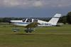
Here she is in the hangar, N822AG, a 1979 Arrow IV.

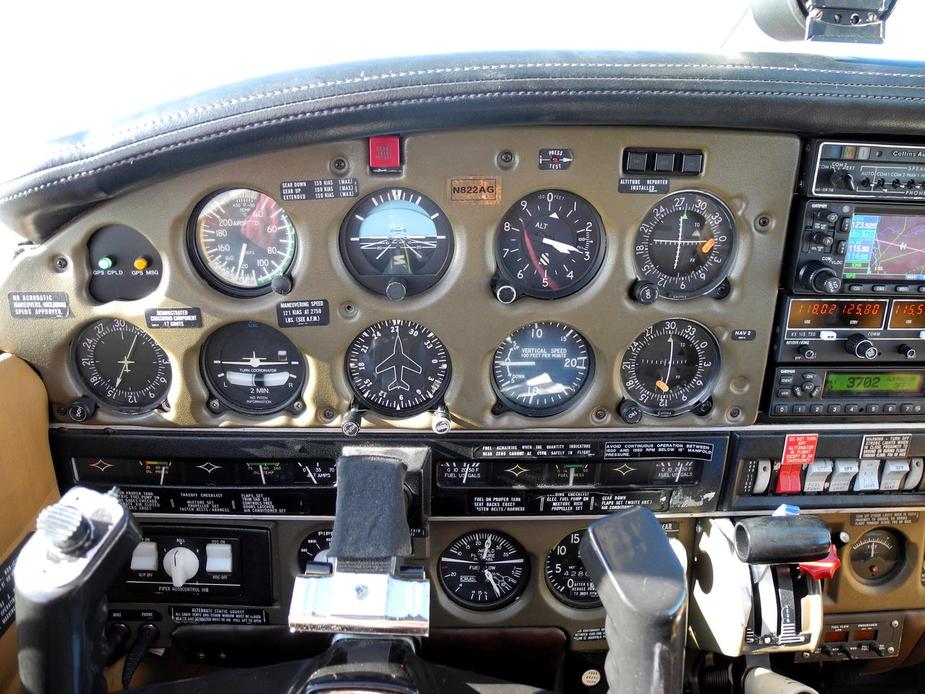
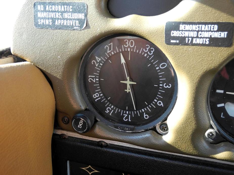
And the panel:

By the way, relating to recent threads about winter flying, engine care, etc.: the aircraft had previously not moved for almost three months! I was the last to have flown it in the end of November. According to general wisdom, that is torture, especially for a Lycoming engine with its top-mounted camshaft. But hey, that’s just the way it is sometimes, with private aircraft. They all sit a lot in winter.
OAT was about 4 degrees at the time. I made sure I started the engine with minimal stress, setting 800-900 RPM in the first few seconds. The battery was totally fine, but I understand it is still rather new, which sure helped.
I allowed the engine to warm up nicely, then departed and headed towards Frankfurt. As I said, visibility was really not great initially. This is all I could get of the Frankfurt skyline: 

By the way, the Frankfurt airspace Charlie lower limit is 1500 feet MSL in this inner area, with the terrain elevation being anything from between 500 and 1500 feet (!):
Passing to the north of Frankfurt, here are some of the more upmarket residential places in the Taunus. Kronberg…

….and Falkenstein:

Once clear of the inner zone of the Frankfurt airspace Charlie, the lower limit rises to 3,500 feet. Looking behind, the left one is the highest peak of the Taunus, the Feldberg (2,887 feet).

Set up for cruise at 3.300 feet:

Crossing the Rhine, just south of Koblenz.

Koblenz-Winningen airfield (EDRK).

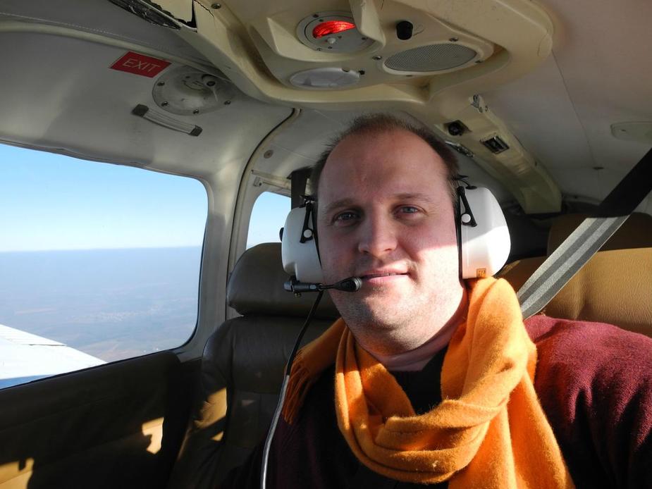
Selfie 
Here’s a short video I took:
Some snow across the Eifel. The visibility was much better now.


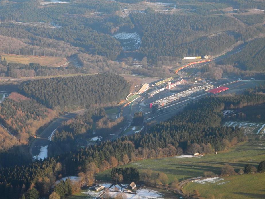
A look to the left reveals a part of the historic Nürburgring racetrack (“Nordschleife”). Some autoracing buff might even know the name of these turns here.

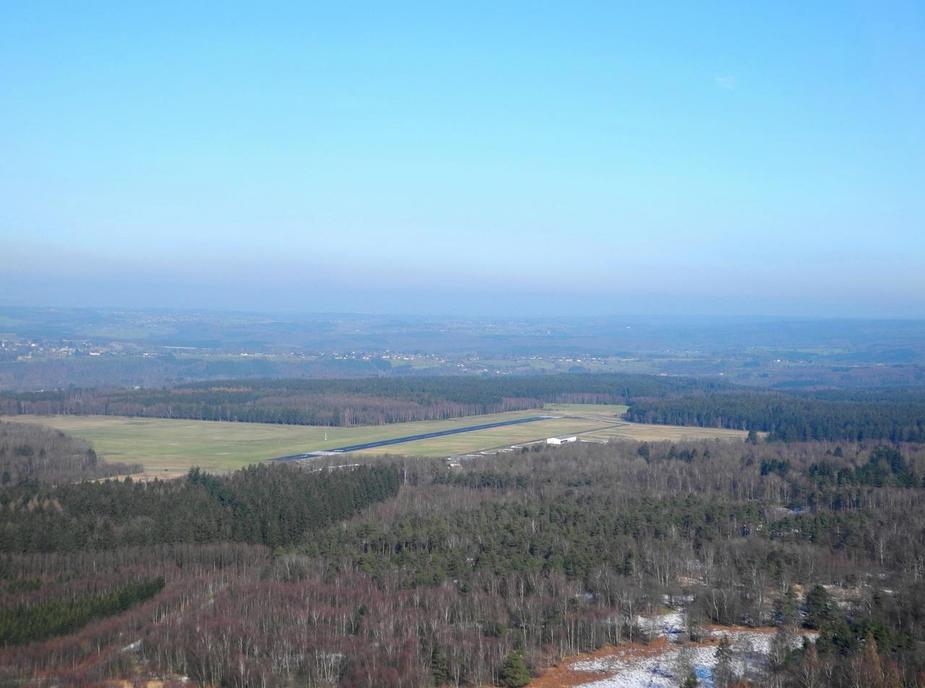
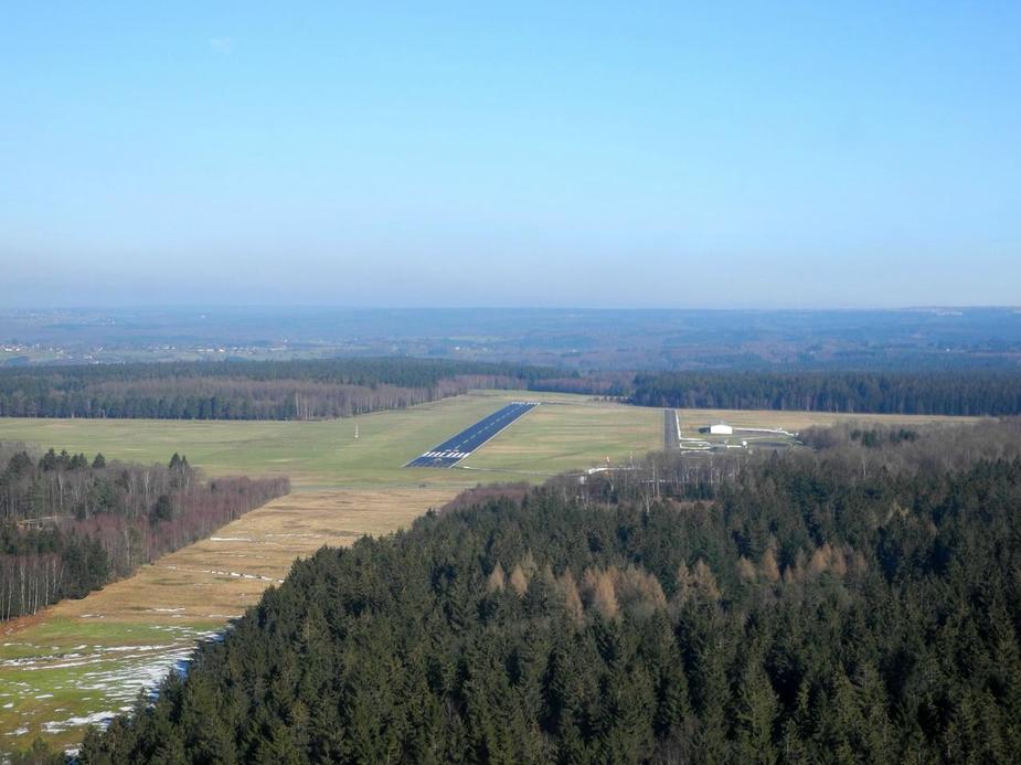
Flying overhead Dahlemer Binz airfield (EDKA).


A nice steady bearing on the Spa NDB, as shown on the ancient Collins ADF.
Meanwhile, approaching the boundary, I switched to Brussels Information who confirmed that none of the TRAs, EB-Ds, etc. were active. Now over the Ardennes region in Belgium, with more snow.


Ten miles out from Spa, I changed to the airfield’s radio frequency. It is officially “FR only” yet the radio operator does his best with English as well, as do the local pilots.
Just about to turn right hand downwind for runway 05.

Base and final. The surroundings are quite beautiful.
Parked up at Spa.

Just as the engine stops, someone rushes out and helps out with chocks, which is a good idea at that place, due to the significant slope in the ramp.

A cozy small VFR airfield.

I paid the landing fee in the office and asked for a taxi to town, which arrived within a few minutes. Here’s just a couple of impressions from Spa, taken with the crappy iphone 4 camera. It’s a nice place for a short afternoon visit. The temperature hit 10 degrees in the early afternoon.


Whilst I was in town, I prepared and sent the return flight plan using just the iphone. Clever piece of kit!
Regarding the routing, I decided to stay just south of the Frankfurt CTR this time. Here is the track I ended up flying.
Back at the airfield, still runway 05 in use.

Warming up the engine at the hold (always nicely leaned).

Leaving the circuit via the downwind leg, here’s the town of Francorchamps….

….and the famous Spa racetrack, with “La Source” and “Eau Rouge”.
Flying past Malmedy.

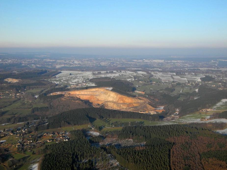
One of the numerous quarries in the south of Belgium.
Here’s another short video clip. A little more turbulence on this part of the flight, but hey, that’s a part of flying after all.


And here we are at the (modern) Nürburgring racetrack.


Check the Nürburg in the background.

A few more miles to the east, I intercepted the Rhine and then followed it southbound all the way to Bingen. Visibility back to to “so-so”.

Boppard.

That strech of the Rhine (between Koblenz and Bingen) is quite beautiful, with countless castles.


After Bingen, it was via just south of Mainz, and back to home base. Here we are, crossing the Rhine again near Nackenheim.
 .
.
An uneventful landing followed after one hour and ten minutes enroute. Airplane ready to be stowed away.

Thanks for this – I’m working on a list of nearby places for last minute “Hey it’s good weather let’s fly somewhere for lunch”-days and this place, just 68 NM from base, fits perfectly into that scheme.
I bet you must have irritated some of the Egelsbach departures/arrivals via D2 and D1 – I can imagine a high metal-to-air ratio there on a day like this…
There is a nice walking path from the Spa airfield to the city center.
It’s the famous GR5 , which goes from The Netherlands all the way to Nice in the south of France.
From the airfield it’s a nice 45 minutes downhill walk through the forests…

Thanks for the report. Some thoughts:
-) myself prefer Verviers EBTX over EBSP but it is a grass runway. Much more relaxed though.
-) Both EBSP and EDKV tend to be busy with parajumping, I would not have routed straight over Dahlemer Binz (which makes a nice destination btw) but it was probably too cold for them;
-) strange that your moving map does show the glider field at Useldange (ELUS) but not the ULM-field at Büllingen (Belgium’s only German speaking aerodrome !); I also miss several glider fields in the Eifel, Utscheid for one;
-) still stranger the circular bit of airspace shown south-west of EDKV, it is not on any of my (paper) maps. What is it?
-) you did well to fly on Sunday. There are some shooting ranges round there, in the Hohes Venn, and also an UAV airfield (at Elsenborn) and they are sometimes active on weekdays, though not very often. Consulting Brussels info on the subject was wise – but my poor Icom sometimes has trouble to reach them, from that remote corner, I need to fly high enough;
-) the race track is called “Francorchamps” rather than “Spa”. When there are races, EBSP is closed to general traffic due to intense helicopter activity. He who has the money sets the rules…
-) and let us not forget that it is good to have EBSP alive and available again; it has been closed for a couple of months not so very long ago, following some political row. It is still state run, by the Walloon regional government (Landesregierung).
re. Nurburgring corners, on the far top left you have Flugplatz, then Aremberg, then Fuchsrohre, Adenauer Forst and Metzgesfeld, bottom corner complex is Kallenhard :)
@Boscomantico once again you are the king of the flying trip report that is both technical and a travelogue. Great writeup.
What is your leaning strategy when in cruise by the way? 12gph sounds like alot for a Arrow IV?
As a wet renter, I obviously run it on rather high power (75%). As we all know, POHs always usually say 50F ROP for best performance (an attempt to keep the fuel flow numbers in the sales brochure acceptable…) but this, as we know, is the toughest possible setting (for the engine) one could chose. Therefore, whenever I do run 75%, I tend to fly it a bit richer (more like 100F ROP), which obviously produces a little higher fuel flow.
Maybe I wasn’t fully set up yet; I usually aim for 11GPH.
Nice report!
125 knots and 12gph sounds like a fuel to noise converter.
Quote125 knots and 12gph sounds like a fuel to noise converter.
Ouch – even the brick-aerodynamics of the TB10 can do 125knots at 9GPH on a good day.
Very nice though. One of my favourite airfields.