Fantastic trip and report Antonio, don’t leave us craving too long for the next episodes please!
Jujupilote wrote:
The ‘909’ ship
Interesting!
Antonio wrote:
Does that mean it makes economical sense to own a SEP in Europe for travelling? I do not think so.
Does that mean it makes sense to own a SEP in Europe for travelling? Oh yes!
Very good analysis @Antonio.
Slight thread drift (…), for me the major advantage to owning is doing my own schedule, and going to place where no airline is going 
I’m surprised at how good your Cessna P210N is performing, very nice. I’ve never flown one, having jumped numbers from the Cardinal 177RG to the Crusader T303 twin, both of them very nice machines.
You indirectly mention RVs, and yes, all but for the -10 (4 seater) and the -3 (single seater) are 2 seaters. But they are mainly sports airplanes. They have the performance, but certainly not the ruggedness nor the load carrying capability nor the cabin space of most of those high performance singles.
Your Cessna P210N sure is a good performer 
Antonio wrote:
Does that mean it makes sense to own a SEP in Europe for travelling? Oh yes!
Well, you own what’s arguably the best touring SEP ever made – P210. I have some hours in these (and more than a hundred in other C210s) and it’s a fabulous airplane, exactly the right machine for going places. Keep up the travel and the posts here! Really enjoy reading them.
Nice trip. Keep writing !! I give you all motivation you need ;-)
aart wrote:
don’t leave us craving too long for the next episodes please!
I’m working, I’m working!
I think I am going to hire you for trip write ups: I really liked the one you did for our trip to the altiport.
OK, here it comes…
DAY 2
This was to be our flight to the Great North. Now we had a general plan in place. We had booked a hotel at Bodo and the idea was to fly there ( err…the airport nearby, not the hotel itself), spend some time at the aviation museum, stroll through the city and get ready for our visit to the Lofotens the following day. Easy peasy!
THE PLAN
Before doing any planning for flying in Norway , we had armed ourselves with a thorough read of the Norway thread at EuroGA. The Norwegian VFR Guide is a must, even if you are flying IFR, with lots of useful info. A couple of tricks : airport opening hours are not reported as such: they simply match AFIS or ATC opening hours as reported on the Avinor web. A lot of Avinor airports are never closed as such, at least for day-VFR. You can operate there with the PFly agreement referred at the guide, obtainable after some training. The real issue is that you may be on the ground at the airfield but on your own and without any way to cross airside-groundside, for which a separate ad-hoc security card or agreement with the locals (usually the firemen) is required.
A lot of us aviation enthusiasts tend to like speed. Speed is good for bragging rights, right? Additionally, mooniacs (@Mooneydriver comes to mind) will tell you, and they are right, that speed is good because of the associated efficiency. It is pure physics: an airplane that flies faster on the same power will be using less fuel and will be cheaper and greener. I have a third important reason for speed which is very pertinent to us, and even more for this trip: range. For practical reasons the amount of time you can keep non-flyers inside a metal tube is finite. Fair enough, it may also apply to flyers, and some others may say their tube is reinforced plastic, but it does not change the message: speed gives you more milage for whatever time limit your POB have. If said limit is 4 hrs and you average 100KTS, then we are talking 400NM, if 140 KTS, then 560NM, if 180KTS, then 720NM…you get the point.
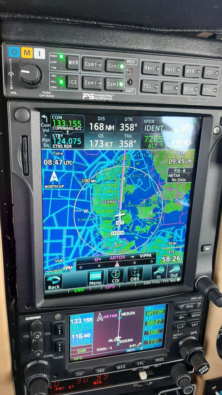
IN this case, we tried several possible FPL routes Kiel to Bodo to minimize wx impact. They ranged from 800 to 900NM. Based on the forecast we were hoping for an average 10KTS tailwind at altitude which should allow high-alt cruise at close to 200KTS GS and, factoring climb and descent, perhaps an average better than 185KTS. So we could expect to fly 4.2-5 hrs depending on routing. Few SEP’s will give you this level of performance unless on O2, and being pressurized makes high-flying with pax a much more realistic option. Of course you can also fly at mid- or low-altitudes but then you lose speed and efficiency. It can be useful to manage headwinds, or for sightseeing. Down low our airplane is more like a 150KTAS machine, but still much more fuel-efficient than turbine-powered birds.
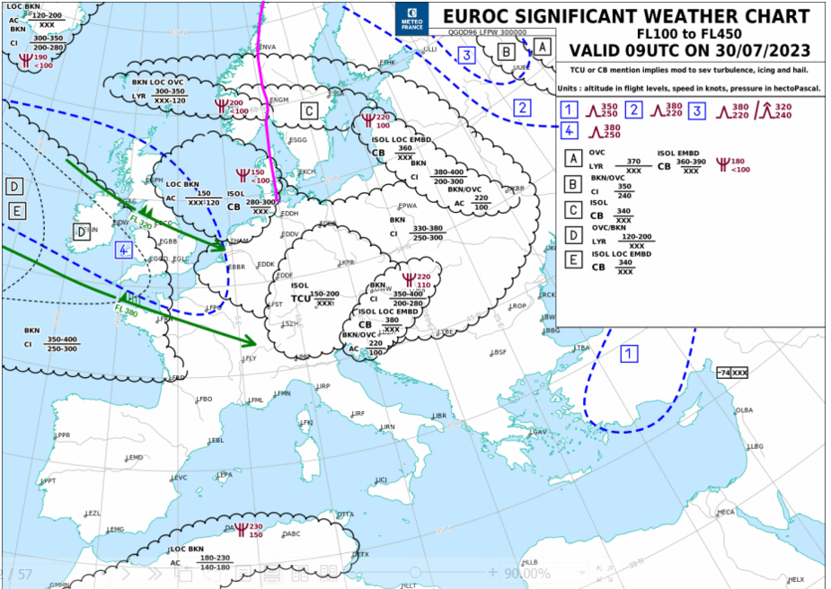
For this flight weather really dictated we must fly high yet again:
There was another trough bringing bad wx to Denmark and N-Germany around 12Z, but we planned to be out by then.
Then there was this strong N-moving occluded front running W-E all across S-Norway: no way around it. Low ceilings and visibilities, lots of precipitation, some CB’s and lots of terrain. Best we could plan for was over it. Waiting it out was not an option since the following day departure from Kiel would be way worse.
Last, there was an LP in the Norway-Finland border that threatened to bring another occluded front into Bodo, but that would be after our arrival, or would it?
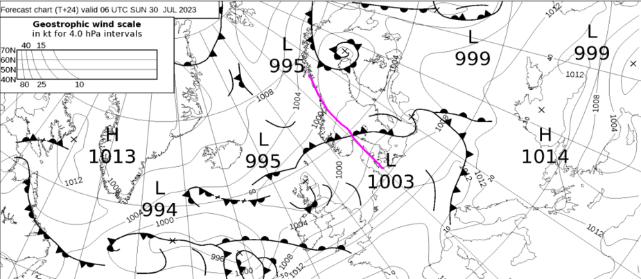
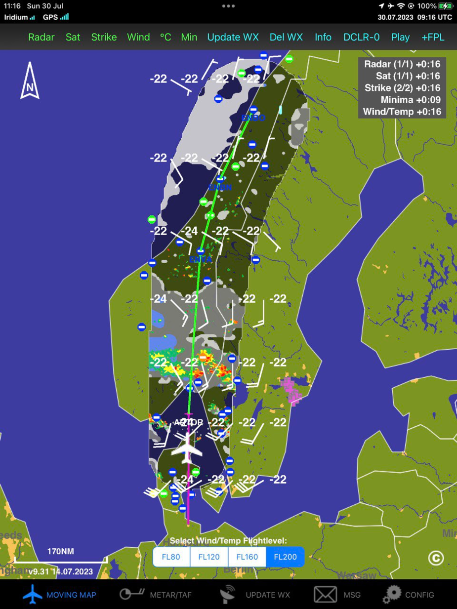
The more or less direct route perpendicular across the Southern Norway front meant that for about 200NM we would be in a bad wx area
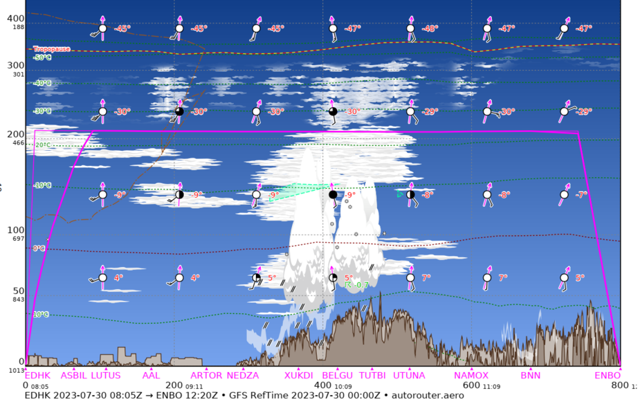
and some of the potential enroute alternates were rather bad . The main one in the direct path would be Oslo with this crappy weather expected:
TAF ENGM 300500Z 3006/3106 18007KT 9999 BKN012
TEMPO 3006/3008 2000 BR BKN004
TEMPO 3008/3013 4000 SHRA BKN008 SCT020CB
BECMG 3011/3013 BKN020
TEMPO 3013/3018 SHRA SCT030CB
PROB40 3100/3106 3000 BR BKN005=
We considered the longer route IFR following Norway’s W-coast where low-altitude weather could be slightly better for a diversion, but the extent of the bad weather area we would overfly was more like 400NM. Even VFR along the west coast might be possible in reduced visibility and potentially “VFR” but the views would be bad, lots of islands along the coast endangering “VFR”, the flying slower, the bumpiness higher, and the milage at least 100NM more, so there was no point, the more so when factoring pax.
A quick risk analysis meant a direct route would be much better since the worst part of the flight would be limited to under 1h. One significant improvement was that if we had to be in IMC at high altitudes, temperatures would be lower (ISA+5) than on yesterday’s flight (ISA+15) so the risk of icing was much lower.
Another relevant risk was the overwater crossing of the Skagerrak strait between Jutland and Norway. Sea temperature was not too low, at 17C and if flown at high-altitude we would only be out of dry-land gliding range for around 15 minutes. Therefore no consideration was given to any cold water protection other than our standard worn lifevests , liferaft and maritime survival kit.
Last main risk to consider was a destination alternate, and this was trickier than enroute alternates since it had to have avgas. This left few options. We ended up filing ENBN Bronnoysund, 120NM from Bodo (the closest field with Avgas S of Bodo), and Svolvaer ENSH, with no Avgas but it was our intended destination for the following day (and week) . We had anyway enough fuel to fly the 60NM from Bodo and then back for refuelling before our flight back South if required…at least we would be at the right place… ENDU Bardufoss was also an option with Avgas but this is 160NM N of Bodo so not very practical.
THE FLIGHT
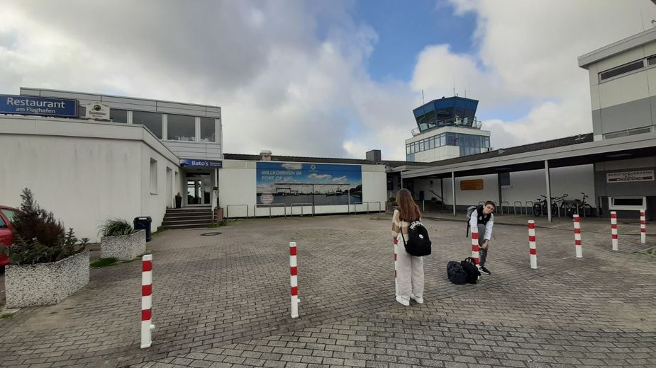
We took a taxi to the airport which, except for AFIS, was totally deserted. No sign of customs, police or otherwise. We had provided notice (and we were probably now on their “cleared” list after yesterday’s Rendsburg encounter) so we were not planning to wait for them, despite our intent to leave the EU.
Our only counterpart was a computer terminal where we could pay landing fees
While we were at it another crew arrived intending to fly their Cirrus Southwards before wx locked them in.
We wasted no time, paid , then went to the airplane to get ready, only to find out we had another CTOT…ah the virtues of IFR in summer….Yet again, we could not blame French ATC (as if blaming would help). Oh, well, at least it was only 10 mins…no big deal. Readied everything, fired up, copied clearance from AFIS and off we went.
We lined up on R26 under the watchful eye of two German Transall transports
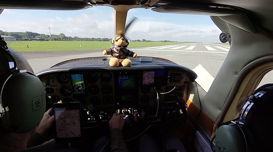
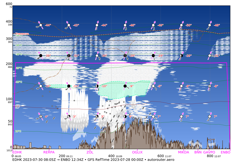
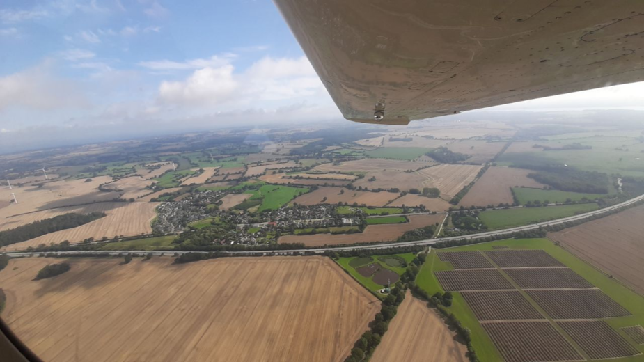
This time we were having a chance to enjoy nice views of N-Germany and Jutlandish Denmark though we wasted no time staying low: we had a long flight ahead and we also wanted to be high for the Skagerrak sea crossing.
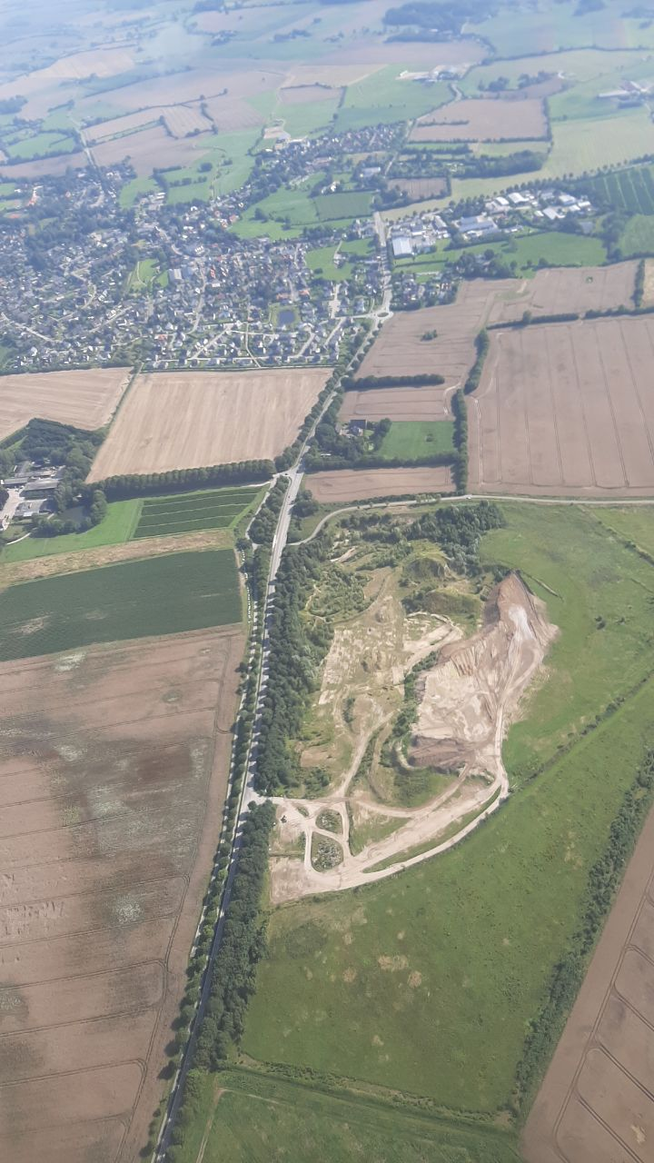
An abandoned quarry (it does not look so bad once nature starts to regain hold @Dan )
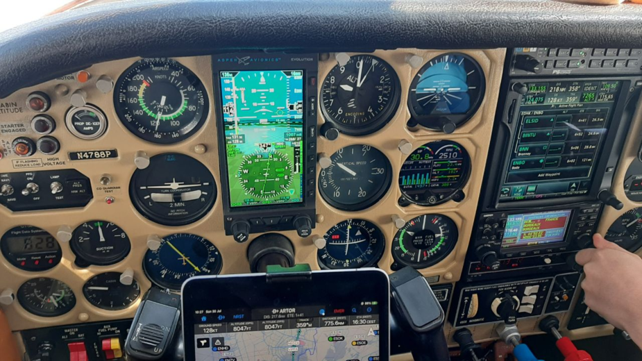
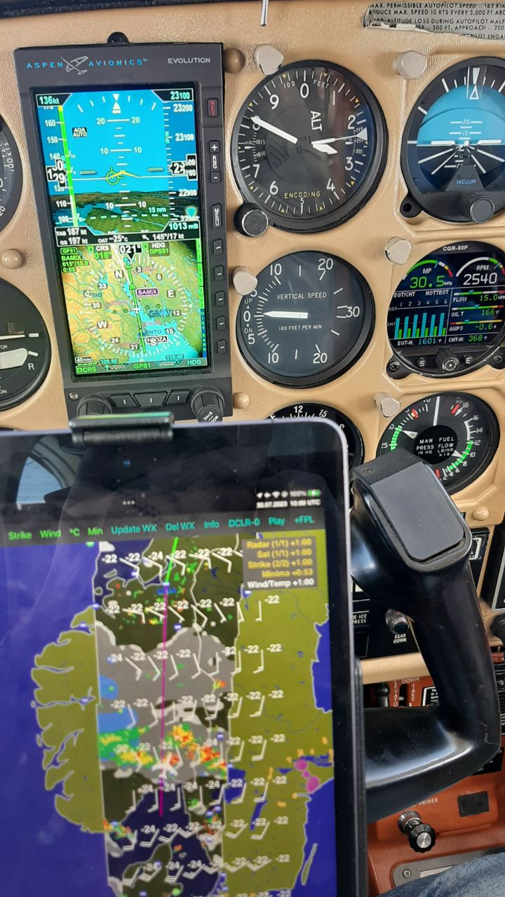
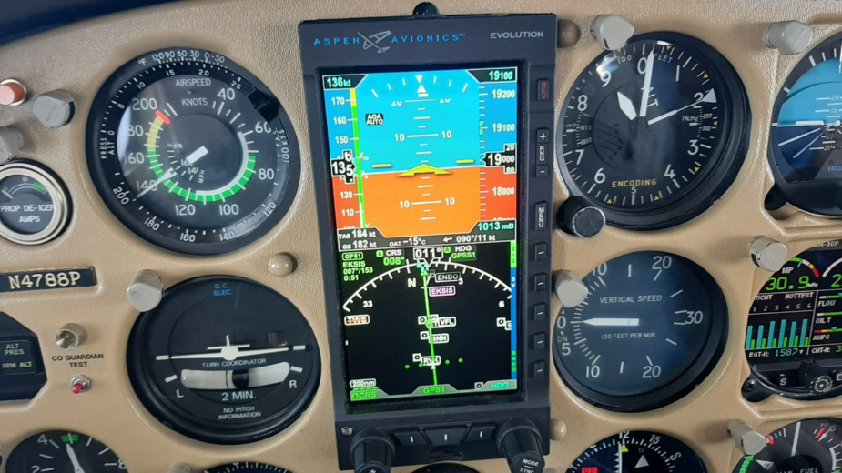
Established in the climb, starting to pressurize. You can see delta P and cabin alt in the lower LH dial. @jujupilote the scary fuel figure is the 90-100 lph fuel flow in the climb with a low GS…fortunately your milage doubles once in cruise.
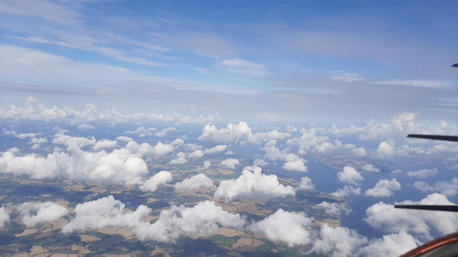
Funny how cumuli do not grow over the sea
Looking far to the East we could get a hint of the weather we knew lay ahead.
39 mins after take-off, we reach FL210. The bad part is we are 17USG poorer (65 lt, 140 eur, why do you have to burst my balloon?) . No rocket but not bad for an old bird carrying 560kg of fuel, flesh and goodies. I tell you it does not do that well at ISA+20. Once established in the cruise, we would get some help from the tailwind that we knew would wane as we progressed North. Always nice to see ISA on the OAT and 200 on the GS.
Oh, wait a minute, it is actually TAS that you see at 200.
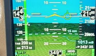
Oh, wait a minute, oh, no! I forgot to lean: it is actually climb power (80%) which is set, burning close to the infamous 100lph
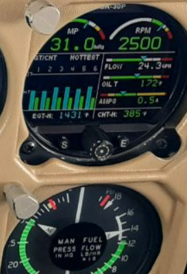
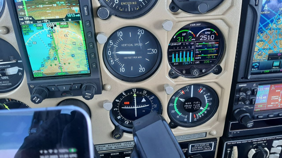
This is better: 65% and 15.5GPH, but still seeing better than 200KTS on the GS, good thing we have some tailwind
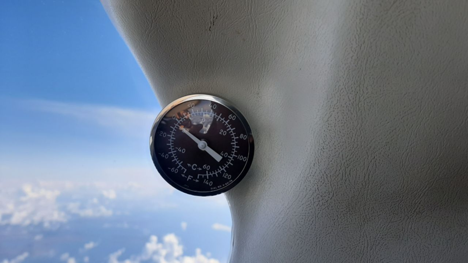
OAT at FL210 is around ISA, a rare commodity nowadays (but one of the items we were after on our trip up North)
We eventually set for a milder 15GPH or around 60% power.
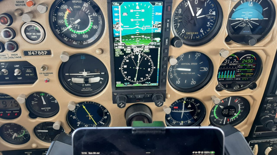
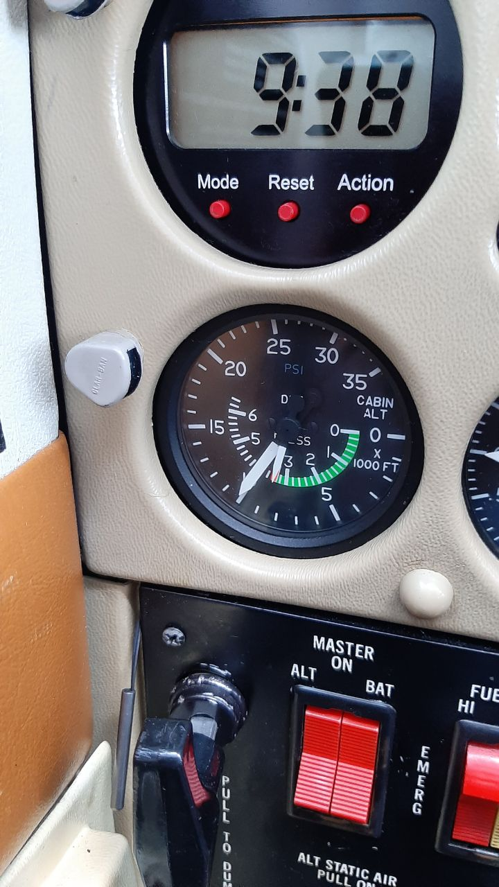
This is the cabin pressure settings at FL210, which is very good for a P210.
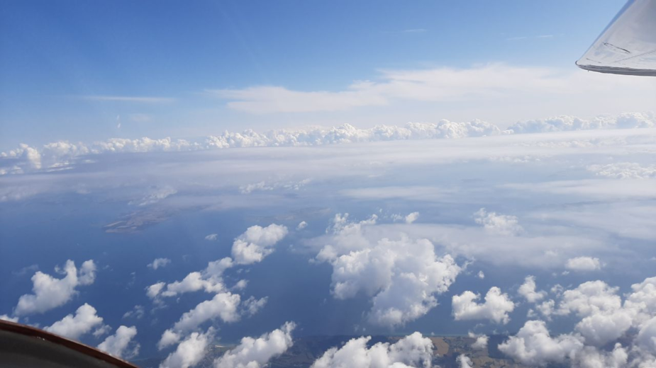
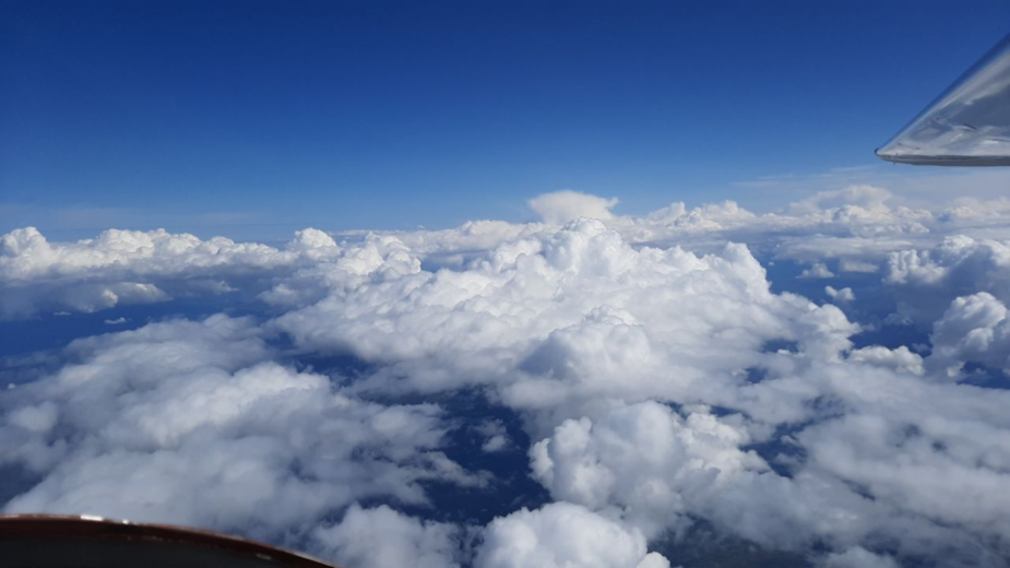
But now we have to worry about wx ahead…this is the outlook on the ADL, with some low cloud and seafog over the sea W of Bodo and the big occluded front in S-Norway.
I was not worried about the former: the ENBO TAF looked good. As to the latter, taking a closer look we might just be able to top it
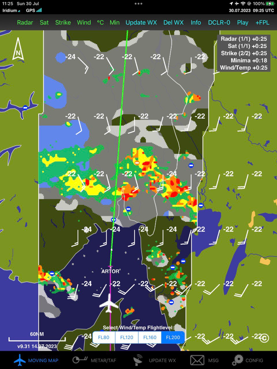
…but looking out the window, we will surely need to climb for VMC.
At least there are no lightning strikes, the front cross-section seems less than 150nm and IMC at <-22C should not be a big problem. We will surely get no ice in the low temps and our cabin heating works fine.
It also seems the tailwind will turn into a headwind as we travel North.
We get transferred from Copenhaguen to Polaris Control (the call sign for the ACC covering most or all of Norway). We would be with Polaris throughout all our flying in Norway, VFR and IFR, high and low, except TMA’s and airport ATZ’s.
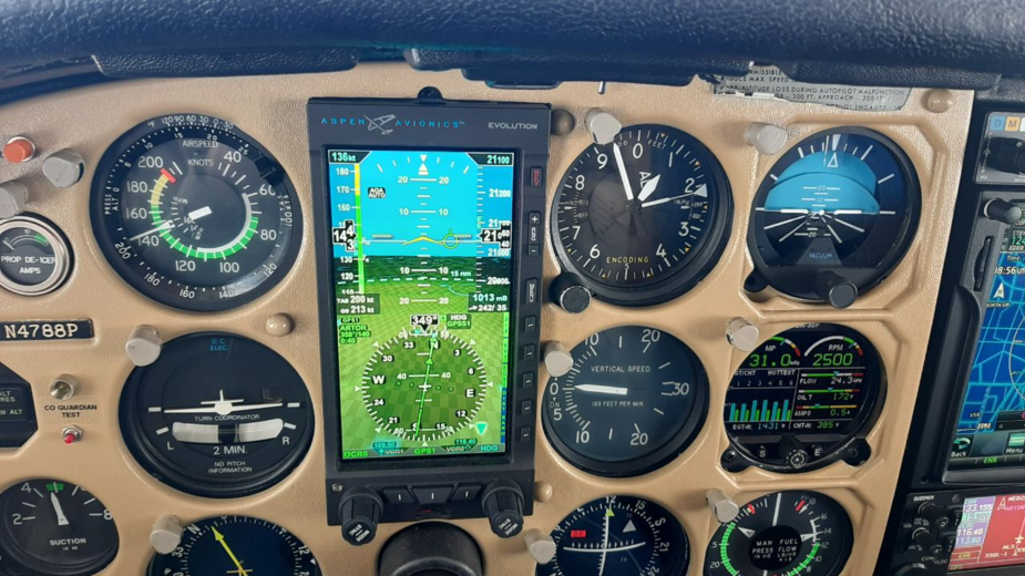
As if wx concerns were not enough, it now seems the magnetic detector in our Aspen does not like the weird vertical components of the Earth’s magnetic field at these latitudes…
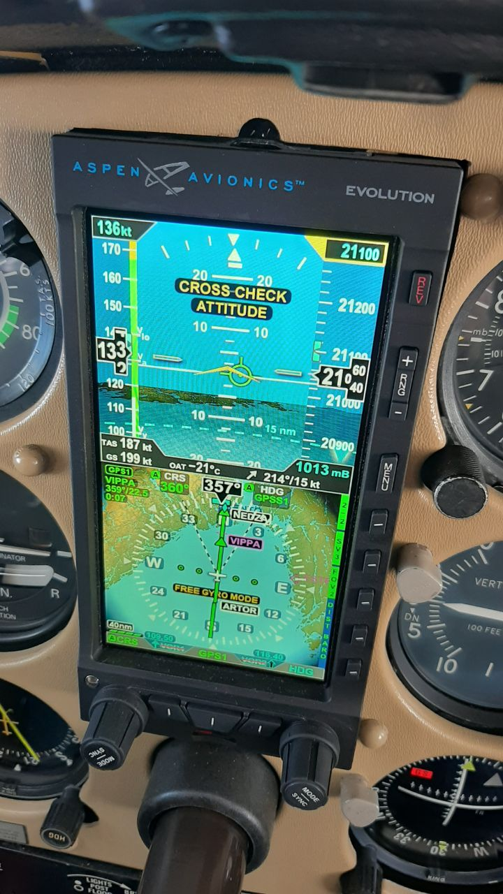
It is not a big deal since I am using GPS for nav anyway, and the autopilot uses the vaccusaurus attitude indicator, but a potential concern going forwards. For the time being gyro-only heading is not drifting, so not bad…
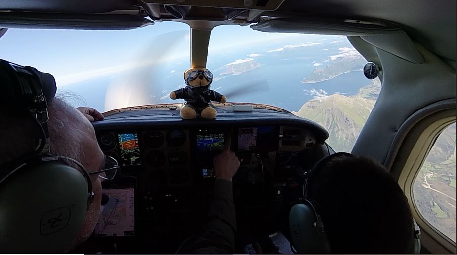
Oblivious to my worries, my daughter is reading a book in the back while my son plays his tablet games.
A few minutes after the heading was lost, it came back as it left.
We request and get a climb FL230 to avoid IMC and not knowing whether it will suffice to top cloud. Even if it does not, as long as it is not turbulent, things will be fine and the kids could not care less.
The aircraft climbs great at the low temps and in little over 4 minutes we reach our new cruising altitude. On an ISA day like today it looks like it could easily climb 5 thousand feet further.
Established in the cruise, OAT was relatively higher at ISA+5. I now need to use a bit higher RPM to obtain required MP while LOP. You will note the analog altimeter is indicating lower. It has some hystheresis near the certified allowance, higher as you go high, but is calibrated so it indicates correct during descent.
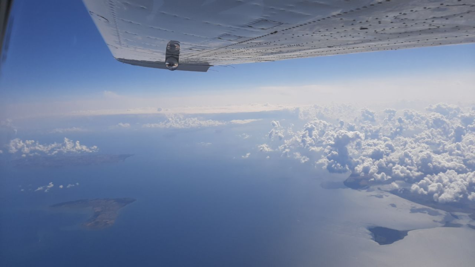
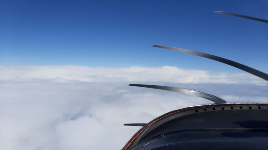
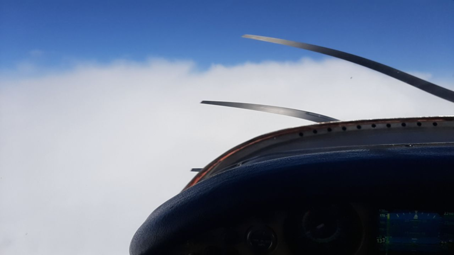
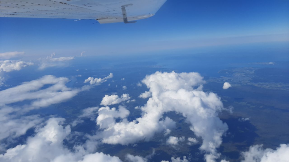
We zig-zag a bit to avoid cloud but eventually cannot avoid clipping the tops of some clouds.
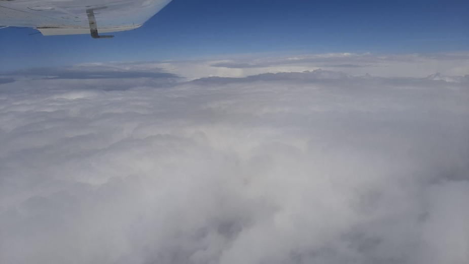
Barely any turbulence, though, so the kids are still in their thing…our boy does note we seem to be travelling quite fast as we go in and out of cloud…in the meantime zero ice of course.
After about 20 mins, we are clear of the worst and the cloud tops start falling from under us until we are comfortable to go back FL210. Again ATC is happy. No doubt our decision to follow the quick-through routing was the right one.
However, once back at FL210, the tailwind has all but disappeared and we decide to go lower, ATC won’t grant FL200, so we settle for FL190: performance will be a bit worse but we know there will anyway be a headwind down the line, and this way also cabin alt will be lower at 9000ft: better for a long flight.
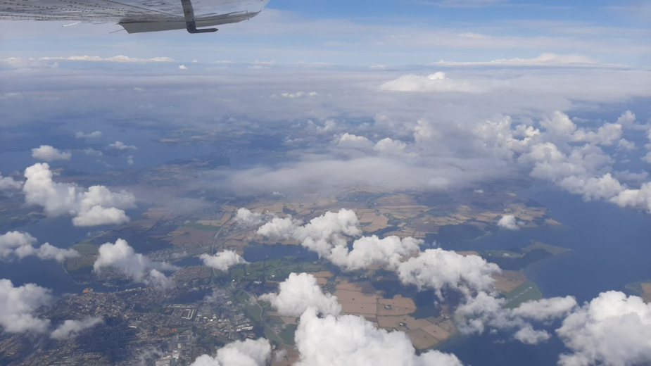
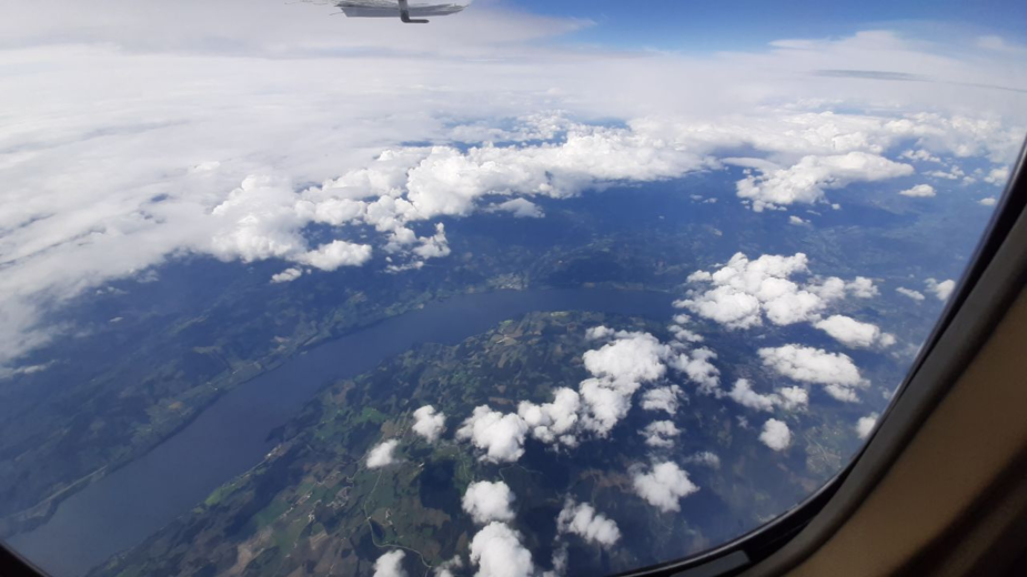
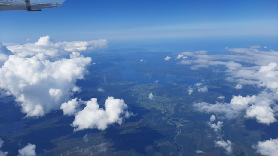
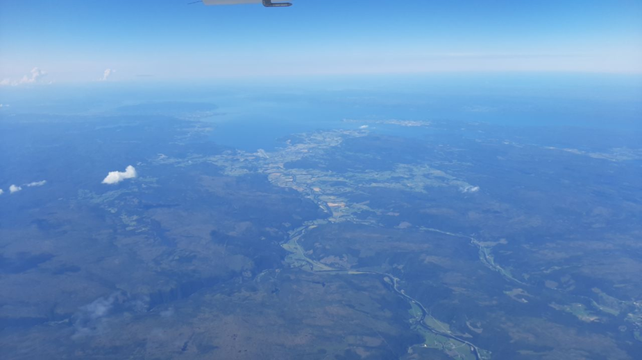
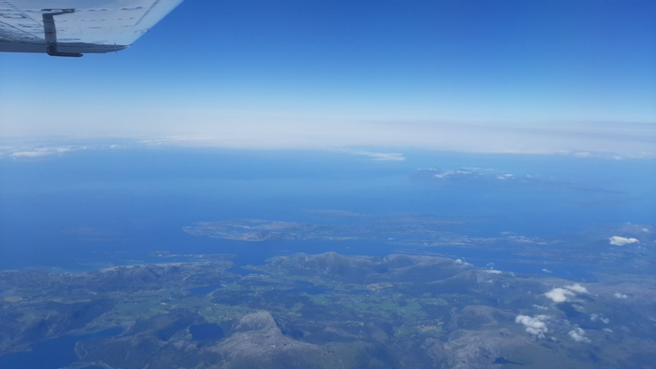
The cloud cover progressively disappears until we find ourselves in excellent weather, which allows us to take good looks at the changes in landscape as we go North. Our girl distributes some drinks and food in the now more relaxed atmosphere (as if they had not been relaxed throughout…) .
We recheck power settings for the long cruise and reverify we are around 90LOP at 15GPH (it varies a bit with alt and temp)
We pass Trondheim, where we had suggested in the forums we could arrange a meetup with a couple of members in the area. We could have done it today, but I did not trust the weather…maybe on the way back South.
Then we get another Aspen failure warning: SV DATA UNAVAILABLE and TWS is crossed out. It seems our Aspen terrain database does not go further N than 64N. Well, at least the terrain database in the Garmins does…but how far N?
The Synthetic Vision display disappears and is replaced by the typical blue over brown:
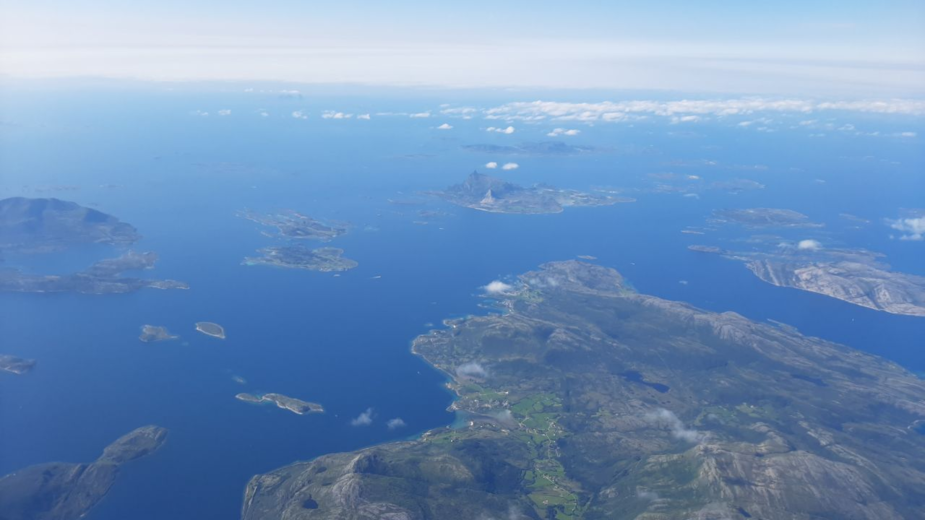
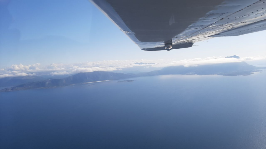
As we continue the trip North, we note the low cloud to our left, offshore: the forecast widespread seafog seems to be real as we cross the arctic circle.
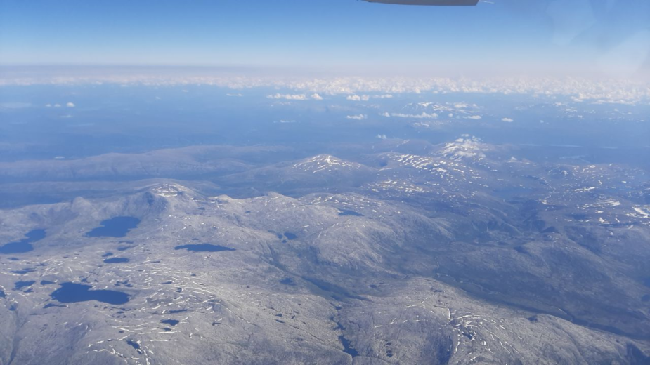
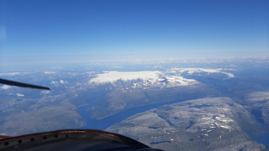
A check on wx reports at Bodo still shows good prospects so no worries, right? For the first time this trip, we start seeing snow-capped mountains
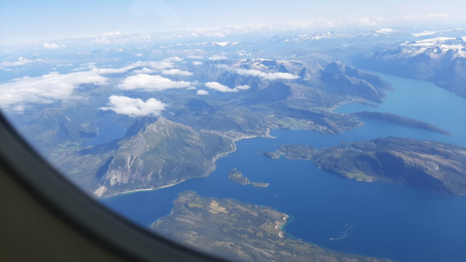
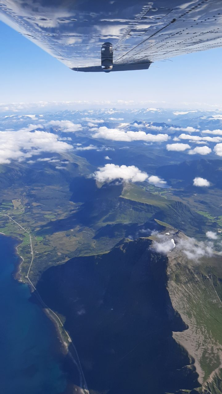
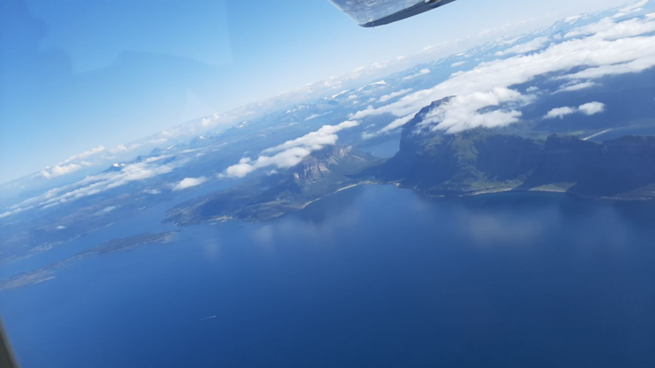
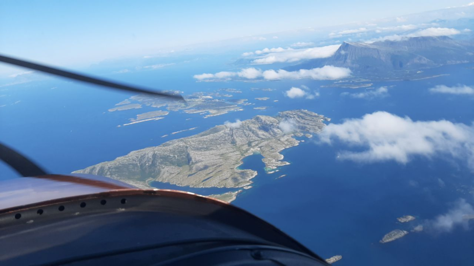
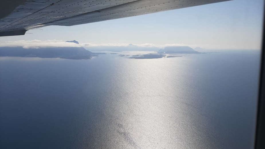
Stokka airport ENST is hidden behind this impressive dragon’s jaw ridge
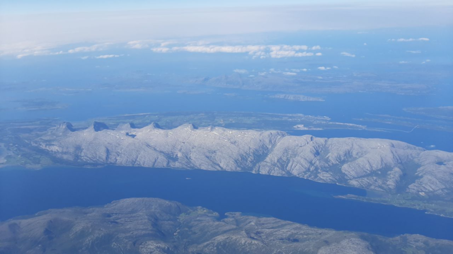
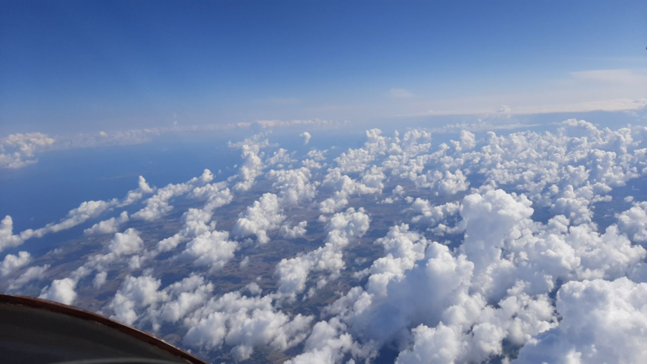
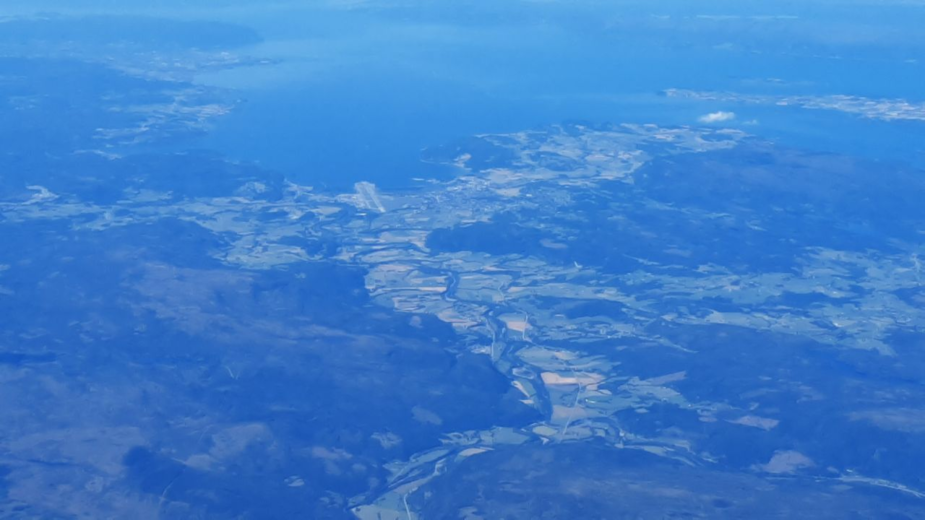
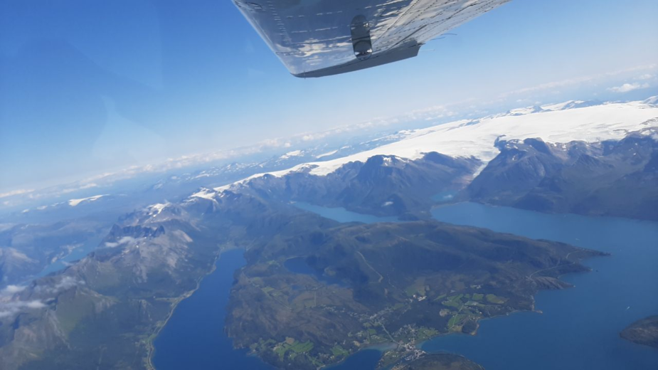
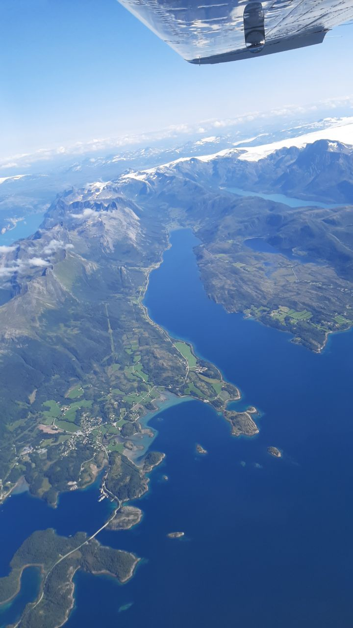
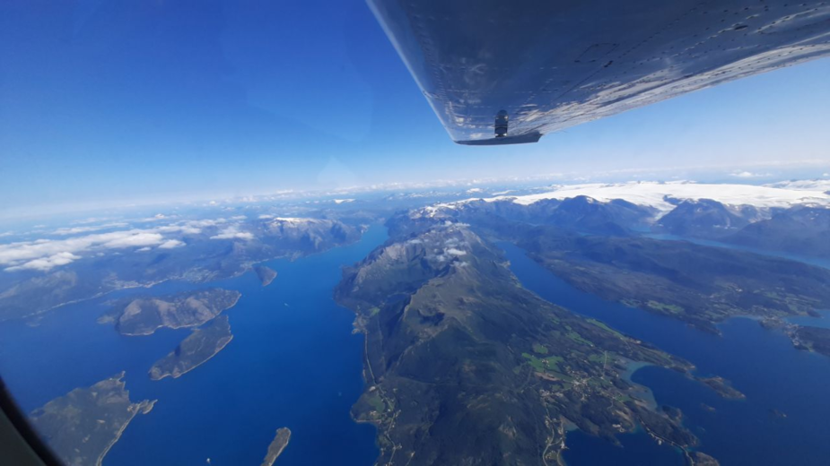
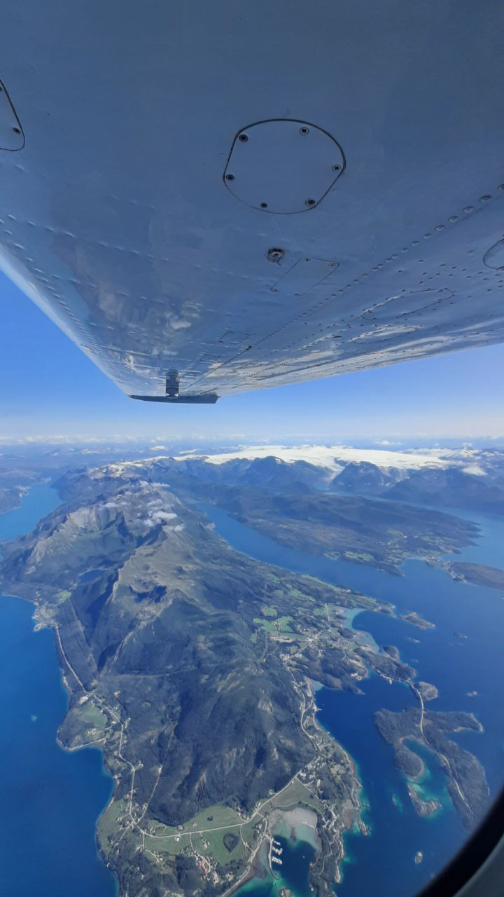
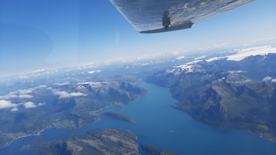
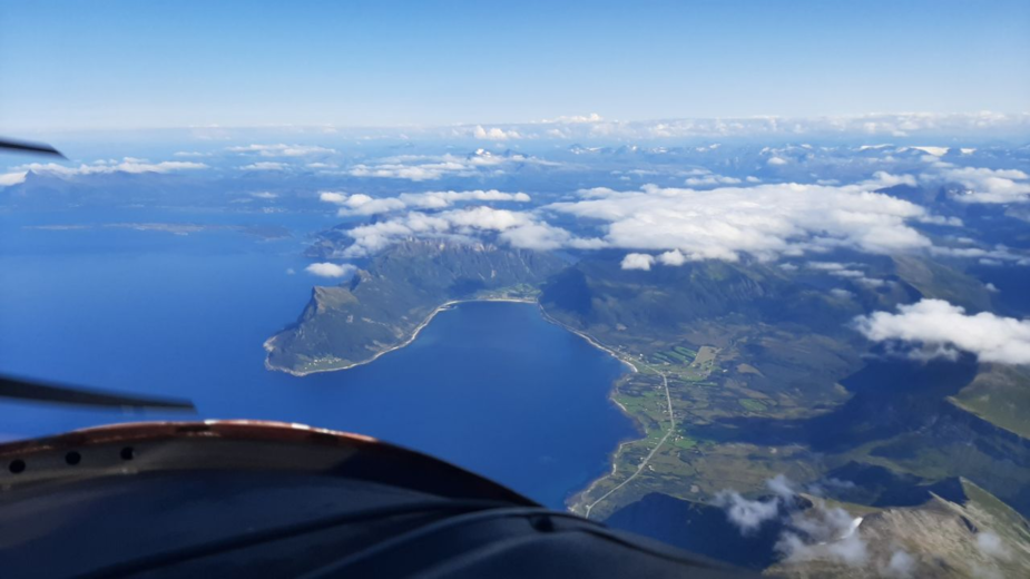
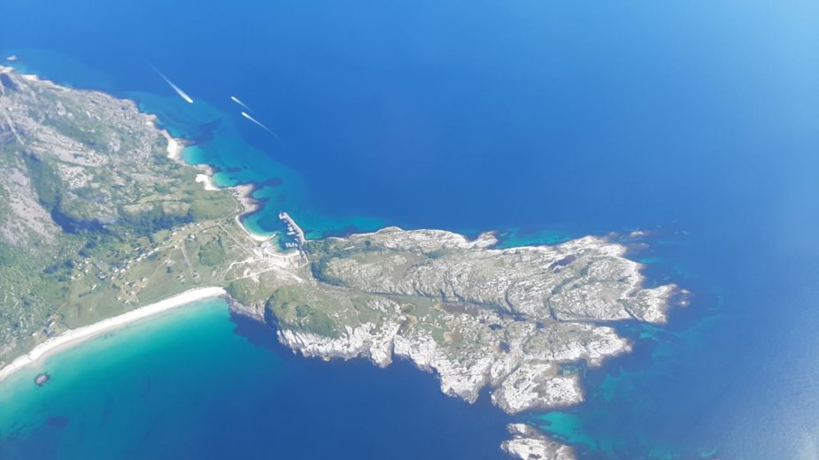
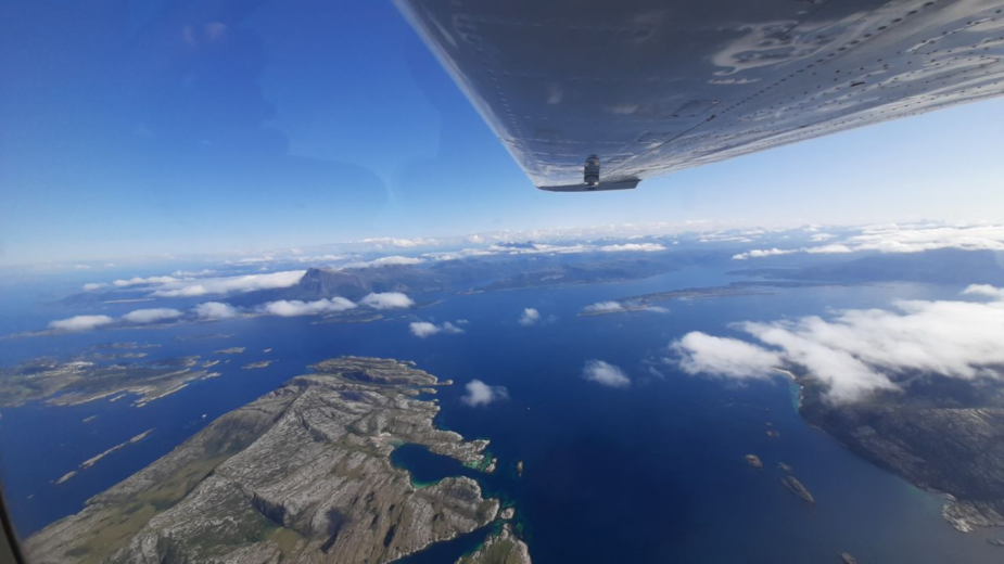
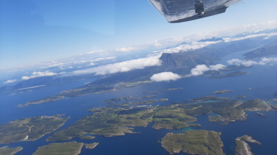
The landscape gets more and more impressive both inland and on the coast, and we just can’t stop taking pictures
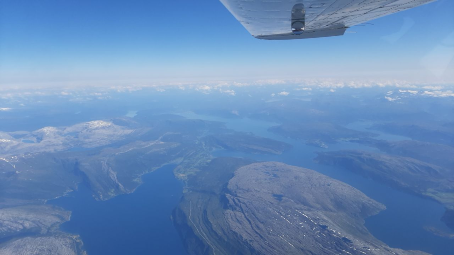
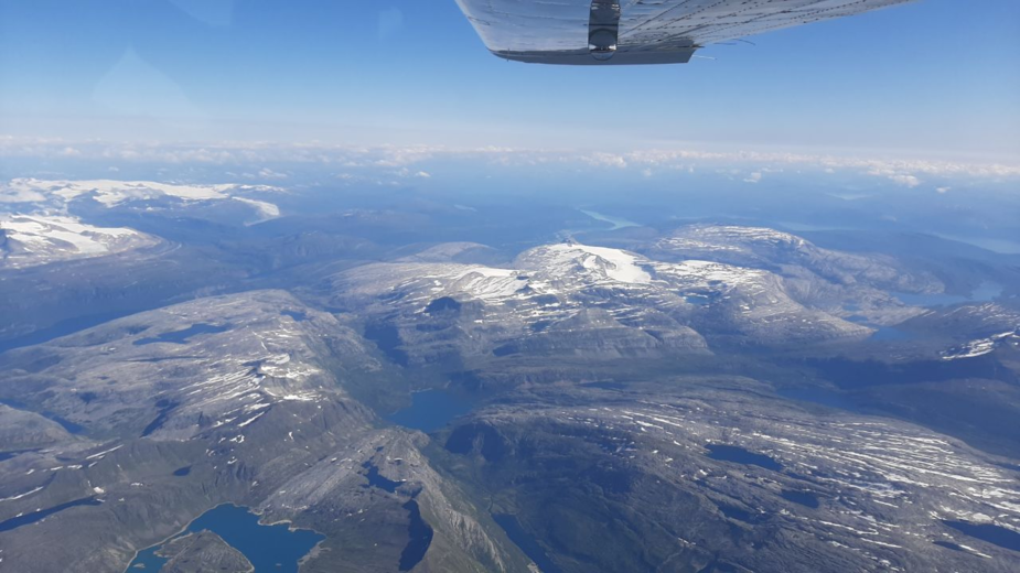
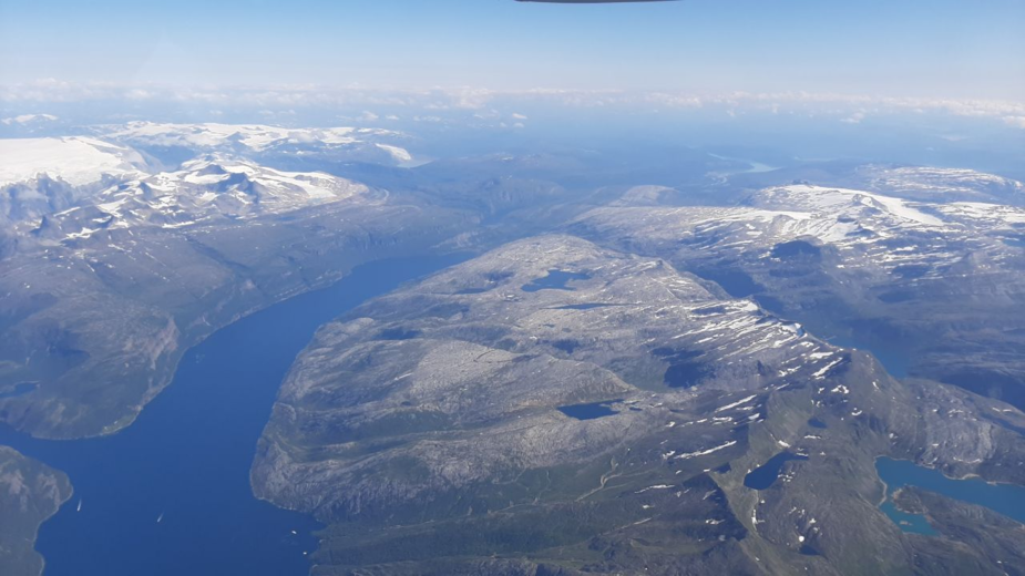
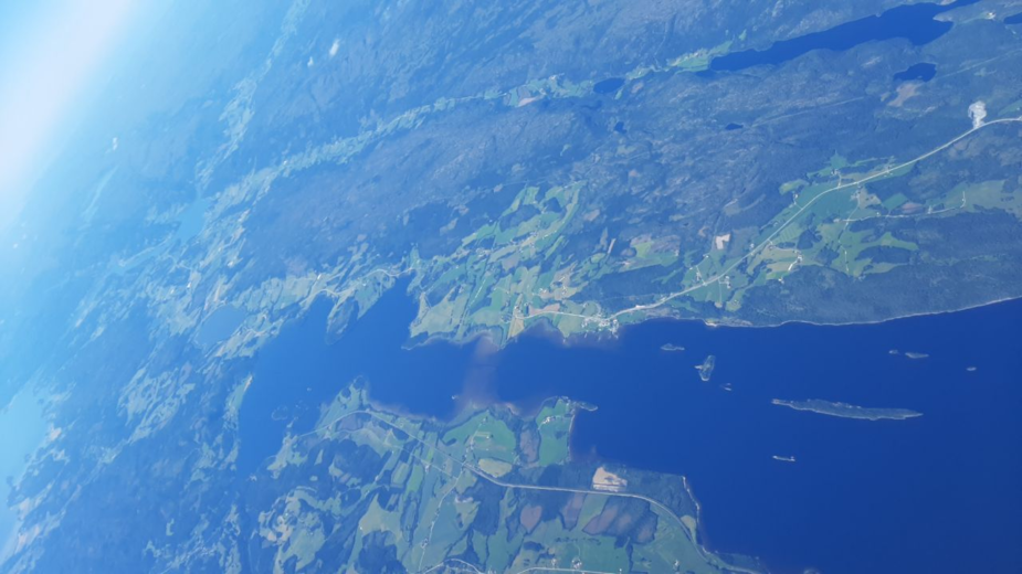
As we get to an area of lower terrain, the snow-caps are replaced by beautiful cloud-caps, but the amount of snow is high for the advanced state of the season
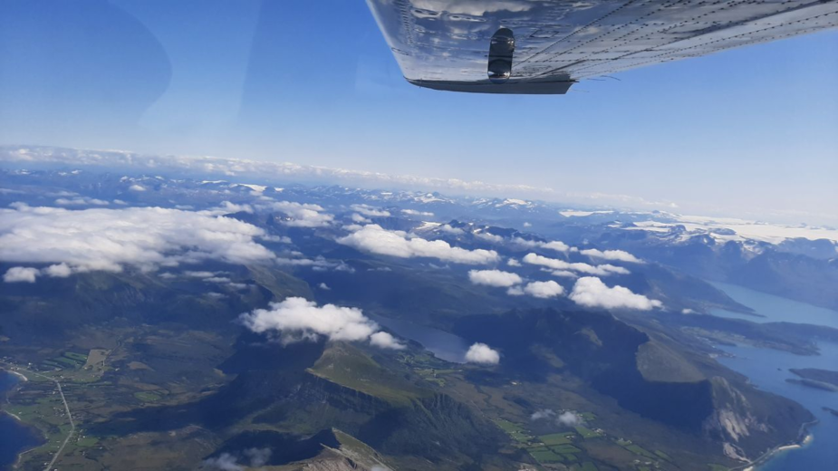
and before we realize, 3h55mins after t/o it is time to initiate our descent as we cross the Arctic Circle. We keep taking pictures (yes, we, even the kids are now taking pictures!)
THE WRONG DATABASE
We are transferred from Polaris Control to Bodo (pronounced similar to the Asian prince-monk) Approach . Our descent is stopped temporarily for traffic and soon we are authorized to follow a certain STAR to an altitude…but I cannot find the STAR… I vaguely remember having read a NOTAM about runway configuration (does anybody read all NOTAMS nowadays with the amount of crap therein?) . OK this is what I had read but did not remember exactly as we received our clearance:
TRIGGER NOTAM – AIP AIRAC SUP 06/23 WEF 18 MAY 2023
CONSTRUCTION WORK AT BODOE AIRPORT BTN 20 APR – 07 SEP.
RWY CONFIGURATION WILL BE TEMPORARILY CHANGED. SEVERAL INSTRUMENT
APCH PROCEDURES SUSPENDED AND TEMPORARILY ESTABLISHED DURING THE
PERIOD.
I query again the STAR name “Strommen 8C” or “STM 8C” comes back but no sign of it on the Garmin Pilot app. Our boy fires up SD but also the same thing. One month later, I now know it was part of the AIRAC SUP but not in my apps..I did not know then. . I call back “unable , not in my DB. Can you give me another routing or vector us? “ The clearance was amended to include a couple of waypoints in my DB followed by RNP T approach to RWY 27…easy enough, right? Well, no! I find RNP X, RNP Y but no “T” to be seen anywhere…what the X$&% ! I am sure I paid my fees to Garmin and Jepp! Wait a minute, what does it matter if I paid or not, I updated all my DB’s before the trip! Aha! operative word is Garmin AND Jepp,…I use Jeppesen (not Garmin) for my certified GPS Nav DB subscription, maybe it is different from the apps…? Sure enough as I scroll through the approaches in the GTN750 I do find RNP T (Eureka!) , but still no sign of STM 8C…who cares? I now have a routing I can use! The only thing is I do not have the approach platform altitude (oh yes it is on the GTN750 but not on the GNS430) or the minimums…well RNP T is an LPV, so I should be good…if I don’t get detailed descent clearances, I guess I will have to query, but in this weather
METAR ENBO 301220Z 36006KT 330V040 9999 FEW025 17/10 Q1001 NOSIG=
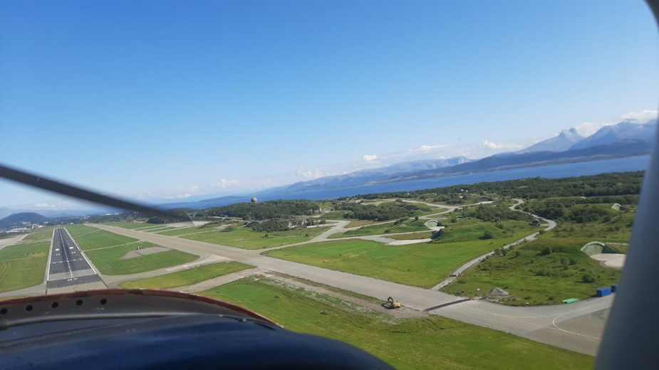
I am not too worried about having the correct figure for minimums (is that legal? Should I have asked ATC?) Soon I can see the airport from far away. ATC tells us the threshold is temporarily displaced 3000ft for works, and the glidepaths have been amended accordingly.
As we continue descending frost starts forming on the underside of our wing tanks, but this frequent occurrence never affects performance
A view of downtown Bodo N of the runway…
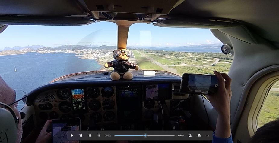
The autopilot intercepted the LPV GS fine, but not trusting databases any more I look at the PAPI, just in case GS takes me to the wrong threshold 3000ft short.
I query ATC if the PAPI to the LH of the RWY is usable and they confirm it is moved to cater for the displaced threshold ( silly question, they would not light it up otherwise, or would they?) . It all works fine and we are in seriously good weather anyway.
Impressive view of the fighter bunkers on the S side of the runway. A big chunk of Norway’s F-35 fleet is based here…was there a private F-104 Starfighter operating still around? I eventually forgot to query.
We just land and vacate to the GA apron, populated by a lone Norwegian SR-22.
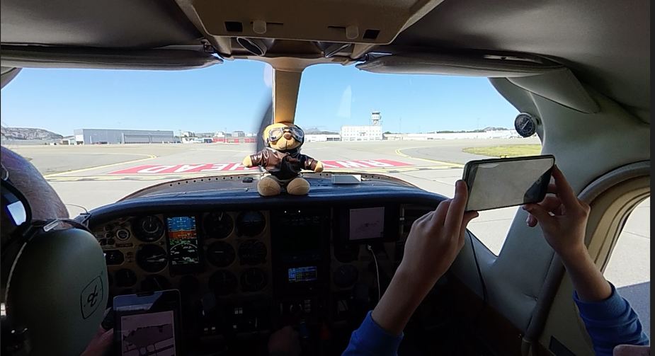
We park, S/D and everybody is happy to have received their arctic baptism: we are N of the Arctic Circle!
We decide to postpone refuelling until tomorrow’s departure to the Lofotens. Never a good idea, but we were eager to visit the aviation museum and wanted to have plenty of time for lunch and our visit before closing!
All in all the flight took 4h25 mins and, for @jujupilote 😉 , used about 75USG fuel for 804NM flown. The wind was not as helpful on this leg, but the cooler air surely helped climb faster and more efficiently.

I’ll post more Bodo pics and continue our story in our next episode. Thanks for reading!
Thank you Antonio for yet another super report
You got some “interesting data” on database behaviour… I don’t understand why terrain data should be suppressed above a certain latitude. And GPS is supposed to work around the poles too. Maybe worth a thread.
If you saw ISA conditions you should document that It’s such a rare thing. Most of my flying is ISA+10 to ISA+20, and I don’t mean going south.
Absolutely freaking amazing! What incredible views, and so much detail on planning and execution. Thank you so much for sharing!
@Antonio thank you for the great reports. Some years back I had similar database issues on a leg to Namsos, where the relevant RNP approach wasn’t in the, current!, database. Weather not bad but some high ground/fjord on the approach, had to work around with a cloud break procedure and using the OBS. Fortunately ceiling comfortably above MSA. These northern towns have a proliferation/predilection for Thai restaurants, but that is a peculiarly local ethno-anthropological quirk :)
This TV series in lockdown placed Lofoten as a destination to try and get to
https://en.m.wikipedia.org/wiki/Twin_(TV_series)
Thank you for refreshing the topic.