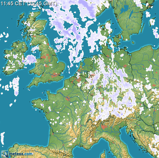
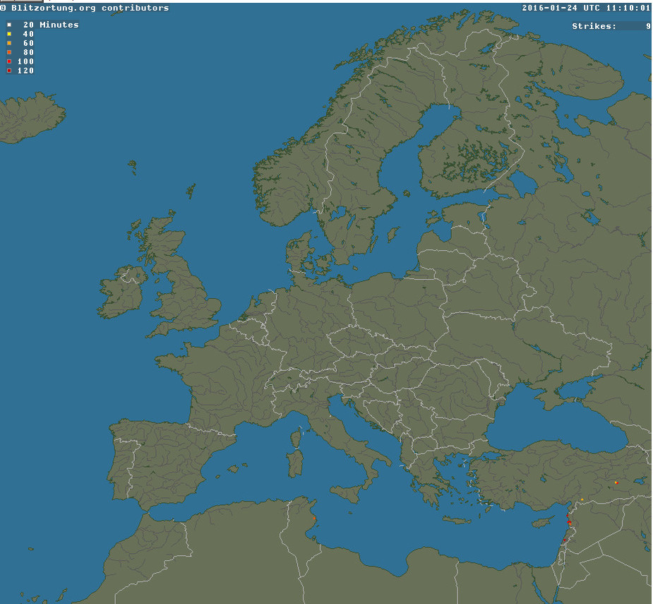
In addition to my WX500 Stormscope I use an ADL120 Satellite Receiver to avoid areas of heavy precipitation and thunderstorms when flying in IMC.
@Dave_Philipps
@Cobalt
Do you not agree that these systems can help a lot in avoiding serious wx? I was a bit surprosed by your sceptical answers in the other thread. Is a 15 minute radar image update useless in your eyes?
Dave: I did not mean to replace the weather briefing with the satellite receiver ;-)
Copied from other thread:
Weather radar detects precipitation, not lightening…which usually occurs during the build up stage before any precipitation…Also a TS can pop up quite suddenly…and produce lightening within the 15min lag cycle of telemetered radar picture….airplanes get struck despite any technology even with airborne radar…
Does the ADL deliver the Blitzortung sferics data and if so how often? The source is updated every 1 minute and IME is very accurate.
I think that the extent of the issue caused by the 15 minute delay depends on how close you are cutting it in terms of proximity to the weather, and the nature of the weather in terms of how easy it is to extrapolate visually from where the weather has been to where it is going.
If you are using it to avoid TS that are popping up everywhere then you are obviously liable to have one pop up right in front of you within a 15 minute time frame.
In other words I don’t think it can ever provide the same level of “tactical” weather avoidance as radar.
What is the deal with the 15 minute delay? Is that a function of how often the radar data is recorded, or is it just an artificial (licensing) limitation? Are there any sources of less delayed radar data for Europe?
The DWD (German Weather Office) issues the radar images every 15 minutes, and ADL120 is based on a DWD subscription (“PCmet”).
The 15 mins is the fastest update you can get on weather radar in Europe, without paying vast amounts of money. 15 minute images are available free nowadays from some advert-funded sites. The data is closely guarded and charged for.
With sferics you can do a 1 minute update. The data comes from a network of detectors run by private individuals. Their business model, IIRC, is that if you purchase and agree to site a detector in your garden, you get free access to the data in digital (lat/long) format. But they have too many detectors in some areas now and don’t allow any more, which limits access to the raw data necessary to easily deliver a georeferenced product. @Achimha had the details of this, IIRC.
I am curious how the ADL product georeferences that data around the aircraft location.
Weather radar is just a part of the picture, and a very variable part. This winter, for example, you can see radar all the time e.g.

but there is nothing seriously convective inside

The ADL120 has a built in GPS, and mine is also connected to the GNS430W #1 and the iPad app automatically uploads the active route and shows it on the iPad.
The original question was how useful it is to identify/avoid TS. The ADL does not only download the radar data but strikes aswell. But in general I simply avoid the yellow areas and especially the red ones with the heaviest precip.
Could lightning be possible outside the green area with light precip? Shouldn’t that be very unlikely/impossible?
Anyway, with the ADL you recieve also the strike data auf the DWD. So combined with IR weather and the percip aeras with intensity you will have a good idea about weather in flight 15 minutes old. Using the wind information additionaly and the play function of the ADL you can calculate the movement of aeras and an additional stormscope does help to transform actual and past times information to good decisions to avoid weather hazards in flight.