+-100 ft is not really relevant. Go 500ft off and see how you go!
The radar op won’t. But all the FR24 guys will. We don’t show on FR24 unless we’re on Glasgow radar.
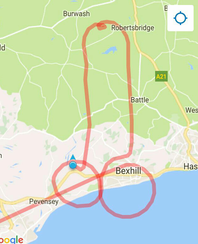
The track shown linked the points where it picked up the Mode S as I flew around the Arrochar hold.
From what I recall, they consider you departed your level at +/- 300 ft, so quite a lot of room for less than perfect altitude holding. I imagine they might ask you something like “confirm your altitude / altimeter setting” a bit before that.
Emulating post #4…
It is surprisingly hard to do, and the FR24 rendition is poor

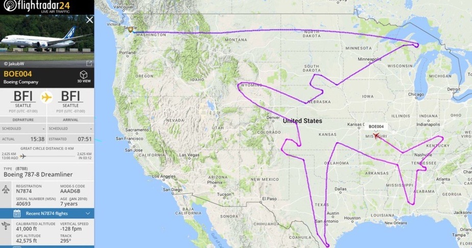
The whole thing can be seen on FR24 searcing for N7874 
The above was Boeing doing ETOPS testing.
Owners of Socata aircraft may (or may not) find that funny
I wonder how you get ATC clearance for these huge pics? Presumably it involves getting a given level (say FL390) reserved for the whole country? I can’t believe they filed the route as a flight plan.
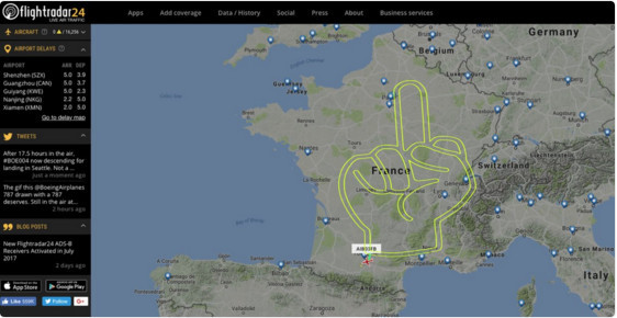
I call fake, how would you otherwise disconnect the inner line of the index, middle and ring fingers?
Also, I am sure Airbus people are a very polite bunch.
Arne wrote:
I call fake, how would you otherwise disconnect the inner line of the index, middle and ring fingers?
Turn off the master switch :) ?
The word on the internet is that the Airbus finger-up is a fake…
It’s also too smooth for FR24.
Peter wrote:
The word on the internet is that the Airbus finger-up is a fake…
That comes as a big surprise.