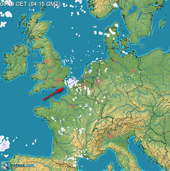
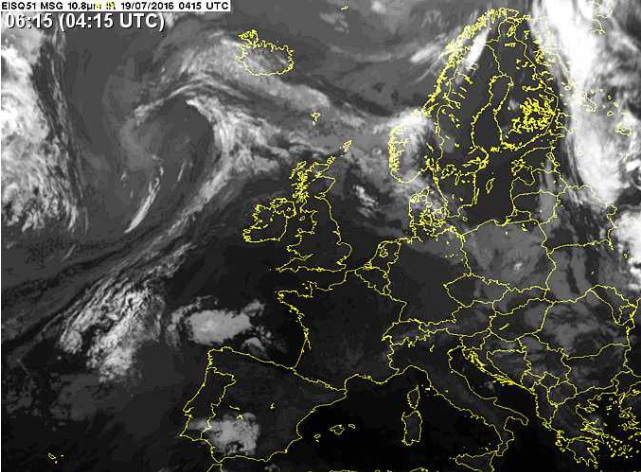
Not often you see that!
Hi Peter where do you get these images from ?
Peter wrote:
Not often you see that!
The radar returns over the channel are artefacts — there’s no precip there. You see that quite a lot in fact, when there’s a low level inversion. You’re actually seeing backscatter from the surface ducted by the atmosphere.
Well that’s why you look at multiple sources. Even if you didn’t look at the IR, the day was as flat as a pancake. There was nothing to make it rain. And it was a perfect day for ducting.
the day was as flat as a pancake. There was nothing to make it rain. And it was a perfect day for ducting.
How would one know?
I am trying to learn. I have never heard of this effect. Can you post more detail?
I hadn’t heard of it either, but this NOAA link looked educational.
I think the idea is that the radar return from the ground looks like an extremely dense cloud :-)
Peter wrote:
How would one know?
I agree; I flew there at the time.
There were some small clouds. I think I got a photo but my pc has packed up…
Peter wrote:
but my pc has packed up…
Your XP which was no longer supported by Google drive or whatnot? Probably was way overdue for replacement