Is there any way to get good topo data for FF? This (on the left) is what I fly with when crossing the Alps above an overcast
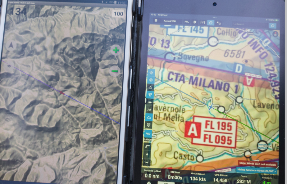
There are FF charts which approximate the topo presentation but they are much lower resolution.

Can’t you see the all around pics altitude in aero map with relief?
Yeah that one is not too bad

Is there some general way to add topo data to FF? I see @dimme did it in post #1 for Sweden but how? My data is in tiles, downloaded about 15 years ago from Google Terrain, using an app called Mobac (mobile atlas creator). They were in BMP format, IIRC, and were processed to the much more compact Oziexplorer ozf2 format (total size ~5GB) which obviously cannot run on an Ipad in any way. I would have to re-download them with Mobac, since the original download was ~100GB and was deleted.
They are somewhere on my disk.
I’ll take a look later.
The old link now works again:
https://www.jottacloud.com/s/184a39caf88337e4c98906185fbb3b7d6df
Thank you so much, Dimme! Really grown fond of these maps :)
Glad to know they’re being put to good use.
Any chance for update of
Austria 2023
https://www.austrocontrol.at/jart/prj3/ac/data/dokumente/ICAO500_20230323_v1-0_VS_rgb_digital_2023-03-22_120341.pdf
Slovenia 2022 (is there a 2023?)
https://www.sloveniacontrol.si/en/Documents/VFR%20Chart/VFR%20Chart%20front%202022.pdf
Totally understand if it’s too time consuming. 🙏🙏