Peter wrote:
except the TAF will on average be better than you because that guy is doing them all day for a livingThis has always been my criticism of Met theory. They teach you stuff which is useless unless you have the data to stuff into the theory, but all the sites which have the data also do graphical presentations.
In some place in the world, TAFs are few and far in between – particularly on weekends and evenings. Also (as was discussed recently here) the change criteria of TAFs mean that particularly cloud cover can be expected to change substantially without being mentioned in the TAF. E.g. if the weather starts out as CAVOK but a cloud cover at 2000 ft is expected later, it is completely correct for a TAF to state CAVOK for the entire period.
I wonder how much having on-board radar actually improves your dispatch rate. You have to be pretty confident about using it in order to make a no-go decision into a go-decision because you have radar. But indeed its niche (if you can call it that) is precisely embedded CB/TCU when flying IMC. Snow is maybe harder to detect but I’m pretty sure hail is detected just fine.
Peter wrote:
This has always been my criticism of Met theory.
If there is a TAF, I agree it’s better at giving a good picture. But it covers an extremely small area. And TEMSI charts don’t have a lot of detail (i.e. cloud forecasts covering a vast area, don’t necessarily mean that it’s unflyable). So your “homemade” weather assessment allows you to use more data and improve your mental picture of the actual weather, even though you may not be as good as a meteorologist to extract what it will actually be like from raw data. I find TAF / TEMSI sources to be extremely sparse in terms of temporal / spatial resolution. METARs are slightly better because more fields have it, but there are huge areas without any METAR so you instead rely on radar / IR images and raw data forecasts.
maxbc wrote:
I wonder how much having on-board radar actually improves your dispatch rate.
The radar dish on some GA radar is so small and feeble that a morning mist might already cause attenuation.
maxbc wrote:
I wonder how much having on-board radar actually improves your dispatch rate
The problem is that radar in 100kts aircraft is useless for avoidance with dynamic convective weather and strong winds
A CB can pop-up in 5min which is 10nm at 100kts (5nm at 50kts), this is not enough to keep 25nm from turbulence
You have to slow down in TCU/CB to green arc (Va, Vb, Vno) at some point you are barely clocking 50kts against +50kts headwinds (CB create their own winds), so it is easy to get stuck in the middle when it goes po-corn, even if you can see the stuff, no speed = no avoidance !
If you are keeping the nasty stuff to one side (you have to fly in front of CB, not behind it), then something like ADL + Avgas is enough and you can cut corners depending on how you feel about it, however, you have an exit to one side
if the weather starts out as CAVOK but a cloud cover at 2000 ft is expected later, it is completely correct for a TAF to state CAVOK for the entire period.
One can sort of see the rationale for that
The problem is that almost nobody knows this little nasty trick. Like most PPLs don’t know that a forecast of say OVC008 until 1600, on a TAF whose validity ends at 1600, means the OVC008 will extend past 1600. There must be a “hack rule” there; let me start a new thread.
The problem is that radar in 100kts aircraft is useless for avoidance with dynamic convective weather and strong winds
A CB can pop-up in 5min which is 10nm at 100kts (5nm at 50kts), this is not enough to keep 25nm from turbulence
Useless?
You need weather radar and speed for tactical avoidance (weather radar alone won’t help that much if aircraft can’t fly away quickly)
Even with visual avoidance,
If aircraft does +5000fpm vertically and +400kts laterally, it’s a different game
There is also a brain, which enables one to see trends – even if one can’t zoom through a current opening at mach 0.82.
And if “You see tops 5000ft above” then you are in VMC.
You seem to be arguing that pilots are stupid.
Peter wrote:
You seem to be arguing that pilots are stupid.
Optimistic or mis-judge trends is the right word
You get caught due to the lack of speed and climb, it happens  you see airport in VMC from 20nm with 100km by the time you get there, it’s heavy rain and strong winds, it happens…
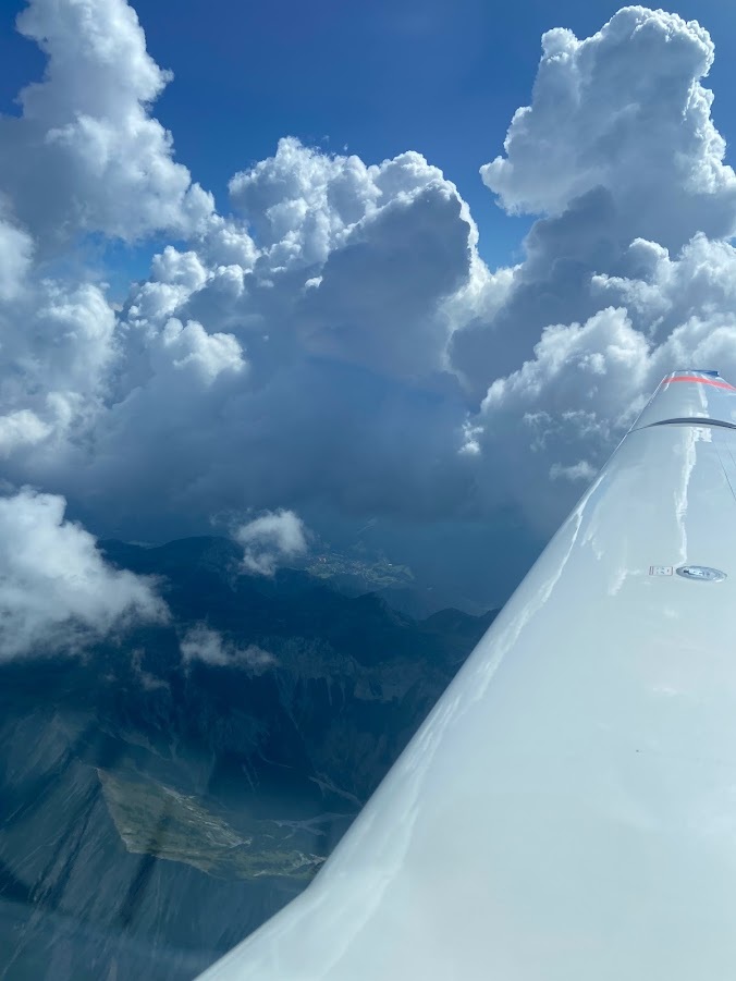
ADL, Stormscope, eyeballs works for me in my Beech, don’t like convective weather over the mountains. Sometimes wishing for Turbo but even then …on this one only eyeballs in a TMG and an escape route to the left. That was at 10 000 Ft TCUs go in minutes above 15K.
Over this terrain you need to make decisions before crossing, anyone flown along the Linz area West of Vienna knows the challenges during summer time. IFR its less of problem VFR you are right in the TMA of Vienna or you have just enough space btw the terrain and mountains
