However, with such stationary high pressure, it can all change very quickly (especially on the seaside at the beginning of summer)….

amazing I whish I had a green light when driving around like that

However, with such stationary high pressure, it can all change very quickly (especially on the seaside at the beginning of summer)…
Indeed. Just heard that a winery not far from here fears for the entire harvest.

We were 3 days on the Channel Islands and had always ( day and night) gusts up to 34kts and broken in 600ft this morning when we left EGJB.
You can see the isobars getting squeezed where the C.I. are

Yes, and that wind was in the forecast for the CI since the middle of last week. We therefore skipped Alderney last weekend.
34kts is not the point to give up. At least not for me but it‘s a strange weather condition this year

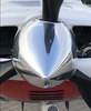
This was on the isle of Jersey on tuesday. So we had some nice days on the CI
And it has collapsed pretty fast:


I hope this clears up soon because in some recent years much of mainland Europe was unflyable for week after week during the summer.
These images tend to make things look worse than they really are. Just flew from Northern Germany to Rome on Wednesday and back today. Didn’t touch a cloud and was actually a piece of cake. Some weather “here and there”
is actually normal in the summer months. As long as it isn’t too organized its just a matter of adjusting one’s timing a bit and some slight route variations. Of course, today’s weather tools, including, but not only, the Golze, make it easier.
Yes; there are gaps in between the TSs. However, the sferics image updates about every 10-20s, so that is pretty well a real time image of huge TSs. The IR image updates every 15 mins IIRC.
Golze ADL is great.