
I’ve been required to switch over to Navblue charts (on Charts+) and have noticed a discrepancy with the en route charts vs Jeppesen.
Looking at this area east of EGCN Jeppesen provides a MORA of 2600 ft.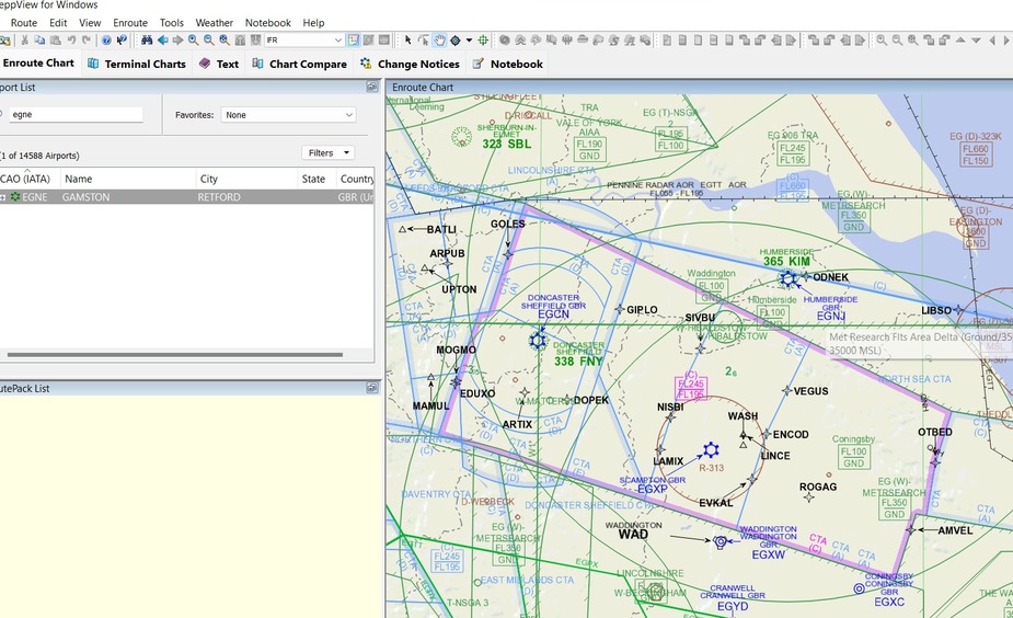
The highest obstacle in that area is an antenna at 1566 AMSL so this makes sense. 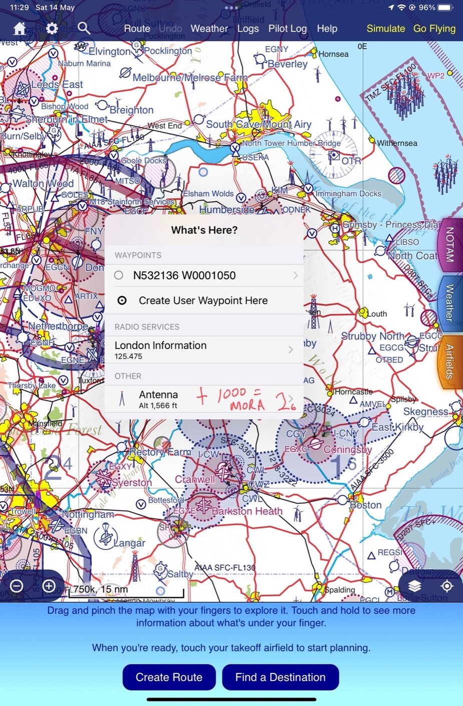
Charts+ however has a MORA of only 1900 ft 
What might be the reason for the difference?
I would expect 2600ft amsl as MSA/MORA in that corner
SkyDemon shows 1600ft amsl, which is the altitude where you would hit something

Skydemons MEF is not really of interest since as you say… it’s just the attitude you won’t hit something. The only reason I show the skydemon screenshot is to illustrate the obstacle.
It’s concerning that Navblue doesn’t provide 1000 ft of obstacle clearance as one would expect from an en-route charts MORA.
This variation is not historically unusual. The UK CAA charts do not add 1000ft either.
Cttime wrote:
What might be the reason for the difference?
Are you certain that
1) Navblue and Jeppesen use the same grid?
2) the Navblue figures really are MORA and not MEF?
Airborne_Again wrote:
Are you certain that1) Navblue and Jeppesen use the same grid?
2) the Navblue figures really are MORA and not MEF?
Essentially (the 1566 AMSL obstacle is well within both the Jepp and Navblue grids), yes. Both cross through EGCN to the west, between AMVEL and OTBED to the east, south of EGYD, and south of ERKIT in the north.
Here is an excerpt from the legend.

Peter wrote:
The UK CAA charts do not add 1000ft either.
Does the UK CAA produce an IFR en route chart?
CAA VFR chart is the one used to calculate route MSA & grid MORA for IFR (SkyDemon & Jepps), obstacles above 300ft agl are shown on that map, they used to be listed in AIP ENR5.4 but it’s a internet file now
The obstacle is shown here in the AIP ENR 5.4…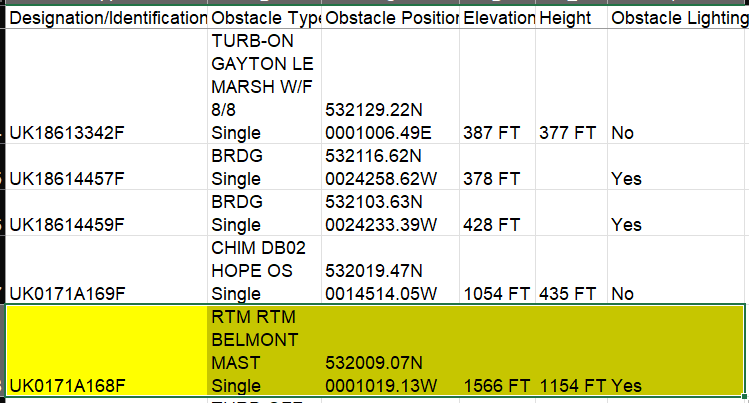
Does no one know why the grid MORAs on Navblue charts are not 1000 ft above the highest obstacle in said sector?
Is this a one-off, IOW does this present only in the sector you are referencing or is this a general issue? If the former, it may well be an error, if the latter then something else is going on.


