Graham wrote:
They were always very clear that they were VFR-only.
That has changed since several years. The most obvious change is in the disclaimer which used to state that SD was not to be used for IFR and now states that it should not be used for primary navigation in IMC.
Peter wrote:
Yes; Jepp’s dropping of MFDVFR
This is not about MFDVFR. It’s about JeppMFD which is an iOS application for displaying IFR charts. The app is free of charge. (Of course you need a Jepp chart subscription, but the same goes for Foreflight and Garmin Pilot.)
Never heard of that one. I used the now-abandoned JeppTC, years ago.
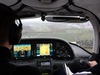
That disclaimer was always daft. What else will one use a satnav app for if it isn’t primary navigation? Most SD users have no other means of navigating (no panel mount GPS). “VMC only” is more understandable because if somebody busts CAS or does a CFIT, you can walk away from it, by quoting the ICAO PPL training syllabus which says dead reckoning is perfect 
Peter wrote:
What else will one use a satnav app for if it isn’t primary navigation?
The disclaimer nowadays is about not using the app for primary navigation in IMC. And for IFR SD is a great tool to display enroute and approach charts, NOTAMS, weather and of course for overall situational awareness. But certainly not for “primary navigation” – and I am not aware of anyone using it for that…
And I would be surprised if Boeing allowed one group company, Jepp, to damage another group company, FF, by Jepp licensing its data to an external satnav company, SD. But who knows?
Well, the group will try to maximize the group revenue. If they can sell more Jepp subscriptions through Skydemon than by making people change to ForeFlight (especially as most who are willing to do so may have switched by now), why not address the SD crowd, too?
tschnell wrote:
And for IFR SD is a great tool to display enroute and approach charts, NOTAMS, weather and of course for overall situational awareness.
… and for the geo-referenced AIP approach plates.
Peter wrote:
That disclaimer was always daft. What else will one use a satnav app for if it isn’t primary navigation?
For situational awareness. I use a certified GPS box for primary navigation when I fly IFR and I’m sure you do, too! VFR is different, of course.
It’s funny this talk about using “tablets for primary IMC navigation”, of course, it’s not approved for flying IFR published routes, you need TSO’ed equipment with VLOC/GPS/ADF to drive your HSI/CDI/RMI and fly published IFR routes and approaches (VOR Airways, RNAV waypoints, IAP/SID procedures), the VOR & GPS & ADF has to be certified and approved in AFM to drive the CDI or HSI
Now when it gets interesting is for flying off-route and say OBS/DCT is not enough, well you have to fly your printed PLOG headings? ATC vectors? SkyDemon/ForeFlight headings? even crystal balls dead reckoning headings if you wish….you take those headings and put them on into your HSI and fly them, who says it’s illegal to fly a heading bug on your HSI?
How about flying IFR to airfields not in database (with ZZZZ in flight plan ) when OBS/DCT is not enough?
Also, UK specific, how about avoiding airspace when uncontrolled IFR in IMC, no s**t s****k you need to use ForeFlight or SkyDemon to keep your licence (as long as one has a licence they can parrot all the day about “it’s not for primary navigation in IMC” ), you legally need the cockpit panel GPS/VOR to fly the published routes but you don’t even have to use them when wondering off-route, it’s better to keep a good situational awareness of airspace & terrain around using a cheap tablet, they do a great job: the best way I found is SkyDemon/ForeFlight PLOG for headings and moving map for position !
I would be impressed if someone can show me a legal text that says you can’t fly tablet headings while outside published routes & waypoints (PS: you can legally do it with whizz wheel, printed map, watch & compass )
The legal position is that you are required to carry the equipment specified for the airspace. What equipment you actually use to navigate is up to you (in private flying i.e. not having to comply with an AOC procedures manual, etc).
Yes; I have a panel mounted GPS, but the vast majority of SD users are VFR-only, and they don’t.
That I agree, the rules are about equipment to be carried , what you use when flying (privately) is up to you
I think SkyDemon disclaimer is because 80% of “PPL & IMCR” aircrafts as well as pilots & instructors & examiners who fly them do not have a single clue what an IFR GPS, let alone flip VLOC/GPS on CDI to fly it, even when there is one in the panel it has a “VFR only sticker”: it costs a lot of money & hassle to update GPS database, add GPS to AFM during install and besides these pilots are told they can do a brilliant job with ADF & DR navigation, the tablet GPS or panel GPS will make them lose some precious life saving skills the disclaimer just states the obvious that tablet GPS (or handheld VOR/ILS) do not count as “aircraft equipment”…
@Peter @Ibra I don’t think that’s quite correct. The ‘standard fitment’ for a club PA28 these days is a GNS430. It’s true many won’t be able to use them more completely than picking a waypoint and flying to it, but in the UK (with few GA-usable RNP procedures) that probably doesn’t matter much.
I would be surprised if many/any are attempting to fly IFR OCAS with no panel-mounted GPS.
SD-only operation is probably largely limited to the vintage/ultralight fleet, and they don’t tend to fly IFR.