Thank you very much.
I have Avioportolano Maps. I like such challenge but I also like to enjoy the flight (it means to be free enough to observe). Normally I prefer to fly low, but aboard, as my english is not very good (just a 4 OACI level) I like simple plan. In an other hand I like to prepare carefully, this is a strenght.
I will studie your option, thank you again
PPG
They then tend to also respond in their language (Spain and Italy almost certainly, plus they almost never respond unless the approach is done in their language)
This incidentally isn’t due to some kind of ‘language arrogance’ that certain countries are noted for. In reality, Spain is even worse than the UK when it comes to people learning second languages, and that takes some doing.
I have Avioportolano Maps.
Pierre, don’t use those maps. They don’t show the TMAs, which would be a big problem for your flight.
What are the current complete VFR charts for Italy, and are they available in an electronic format? I don’t mean the vector based flight planning apps.
Boscomantico,
Thank you for this advise. It is very strange ! I also use maps on airnav pro, TMA and airspaces are normally correct on it I will check.
What map you use ? For lower airspace (VFR non pressurized)
Pierre Philippe
Pierre,
It is very strange ! I also use maps on airnav pro, TMA and airspaces are normally correct on it
How do you know?
You can believe me. TMAs are not correctly depicted by various products, and this includes Avioportolano. That is in part the fault of the non-ICAO compliant airspace structure so far adopted for the Italian TMAs Rome and Milan (“VFR sectors”)
There are basically two problems with these Avioportolano maps for you:
1. is the above mentioned problem. The chart lacks the depiction of the VFR sectors. In other words: it lacks the three-dimensional shape of the TMA. This was discussed here:
http://www.euroga.org/forums/flying/1066-skydemon-warning#post_14534
back when even Skydemon didn’t depict TMAs correctly.
2. Rome TMA has now (in April 2015) finally been redesigned and is now ICAO-compliant. Fine, but this means that all paper charts produced before that date (which includes the Avioportolano 2015 maps) are now totally out of date as far as Rome TMA is concerned. See here for more details.
http://www.euroga.org/forums/flying/3689-italy-re-designs-its-tmas#60638
So, you need new charts.
What do I recommend? Well, in the digital front, use either Skydemon or Jeppesen MFDVFR. Skydemon has got it mostly right eventually. Jeppesen is flawless, as seems to be EasyVFR. You can also use the AIP-derived ENR6.3 charts on your ipad or whatever, but they are not georeferenced.
If you do want paper, there is little you can do. The “official” Italian ICAO chart is very poorly made. Also, it is reissued every September only, so you won’t find the new TMA structure on the “current” version of that chart.
I know, it’s a depressing situation, but paper VFR charts are a dying species, especially in countries where the VFR GA market is very small. Need to go digital to always have current aeronautical data.
I used to have a 6 month trial subscription to Jeppesen MFDVFR.
It was a nice product (despite having a limited European coverage back then – has it improved?) but at €300/year I was not going to pay for it. But then I would normally fly into/over Italy IFR…
It is rather bad that pilots in these places are having to pay maybe 5x to 10x more for their VFR “charts” than they had to pay for the old printed ones.
And you can’t fly with an older electronic charts product; Jeppesen MFDVFR stops working approx 2 months after the current cycle expires.
And you can’t fly with an older electronic charts product; Jeppesen MFDVFR stops working approx 2 months after the current cycle expires.
Arent they smart?
[quoted text fixed up into a quote – Peter]
Peter,
To answer your question: the ICAO 1:500000 chart of Italy is produced by the Italian Airforce, precisely by an office called C.I.G.A. There is a whopping number of 10 (expensive) sheets:
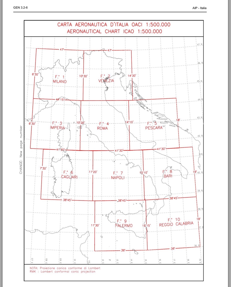
I see that many UK pilot shops don’t even carry them any more. But even if they did, I would never recommend to buy them. They are of horrible quality. Also, as said above, they have the usual problem of paper charts, i.e. They come out once a year, but changes to the airspace are being made all year round.
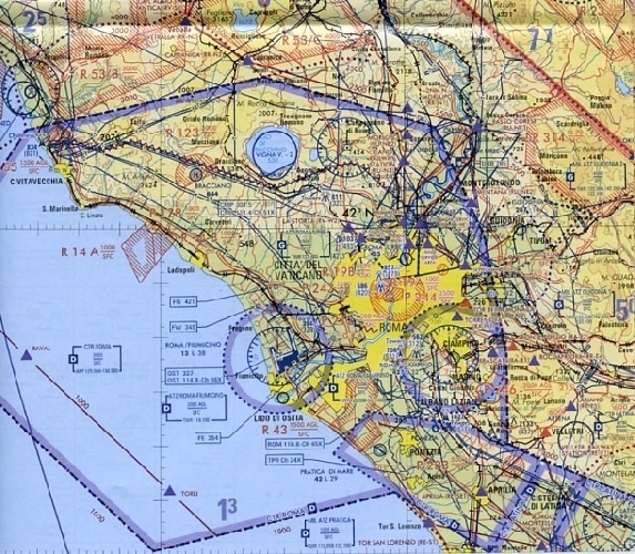
Here’s a little (low quality) snippet of that chart (Rome area), just to give you an idea of what it looks like:
Just to continue on this, here is what the ENR6.3 charts from the AIP look like (not really available on paper):
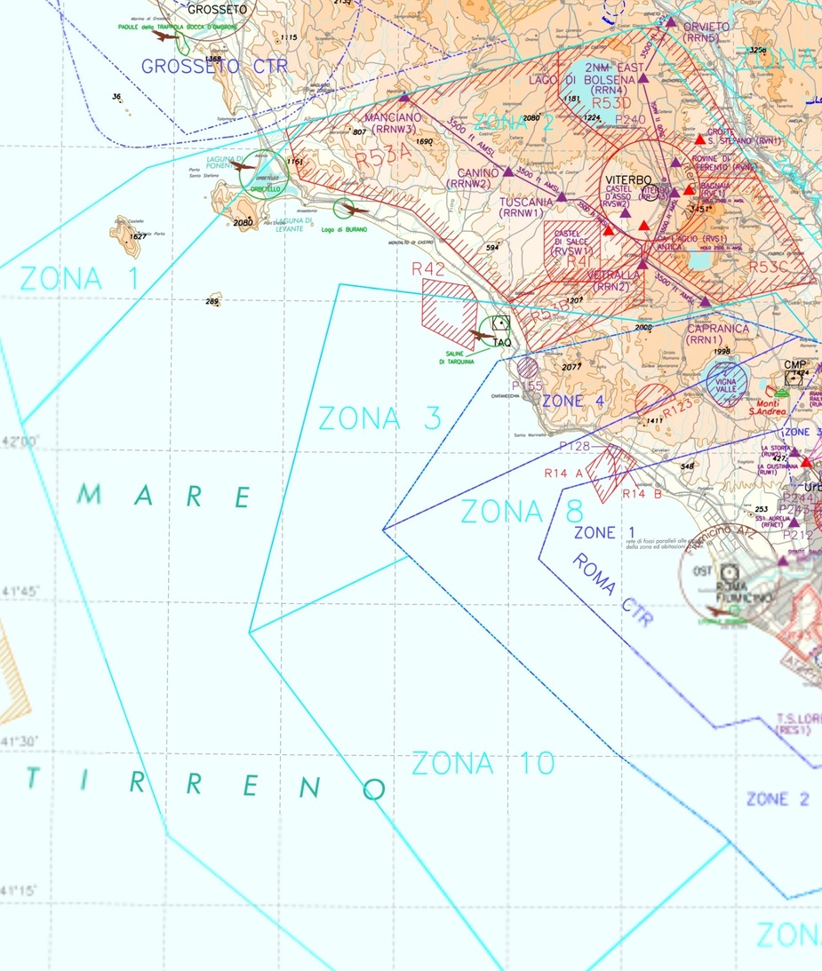
Very hard to read as well, but at least it is always available in a current version and it shows all airspaces.
And here you have the same snippet from the mentioned Avioportolano paper chart.
As you can see, it is not only out of date (due to the recent redesgin of the TMA), but even before that, it was worthless because it wouldn’t show any of the famous VFR sectors.
Solution: wait till next spring (that is when they will presumably also have redesigned the Milan TMA) and then all chart makers will (hopefully) finally depict these airspaces correctly.
And always use digital (vector) charts on the current AIRAC cycle.
On the Lucca trip last year, I used the 2013 Jepp VFR/GPS charts (in electronic form, running under Oziexplorer as a moving map) having checked against the AIP “chart” to see what had actually changed. Obviously that is a crap process to have to do…
But the AIP charts were not totally impossible to use. I had to unlock them (a PDF cracking hack – why the hell does the Italian CAA secure them in this way?) so they could be printed, and then one could do what one wants. They could then be turned into a moving map, or printed off by a bureau with an A1 or similar printer.
Arent they smart?
I complained to them at a seminar, because this (your Ipad suddenly becoming useless) is a safety issue, but they said it is a rental type of product. (Skydemon does the same, I am told). And when I told them I didn’t want to continue with the trial, the product stopped working within the hour, so they must have a way to turning it off remotely. On an Ipad, non-jailbroken, there is no way to stop a particular app accessing the internet, or running with a set-back date+time.