The three screenshots below are different models for a forecast only five hours from now.
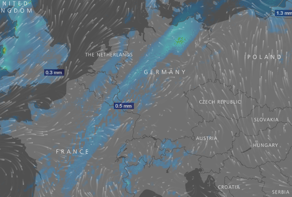
ECMWF:
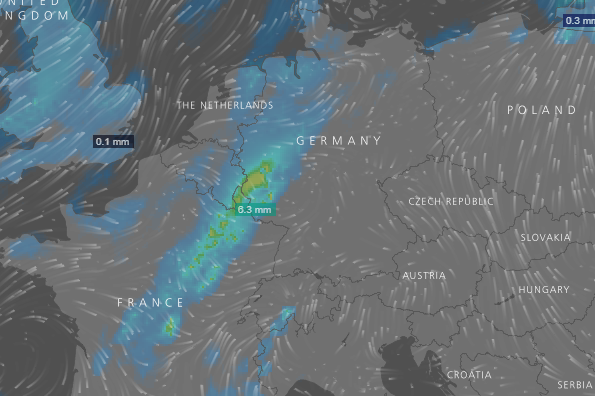
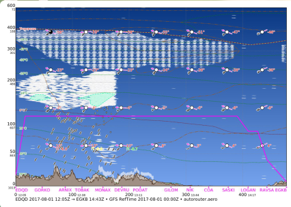
GFS:
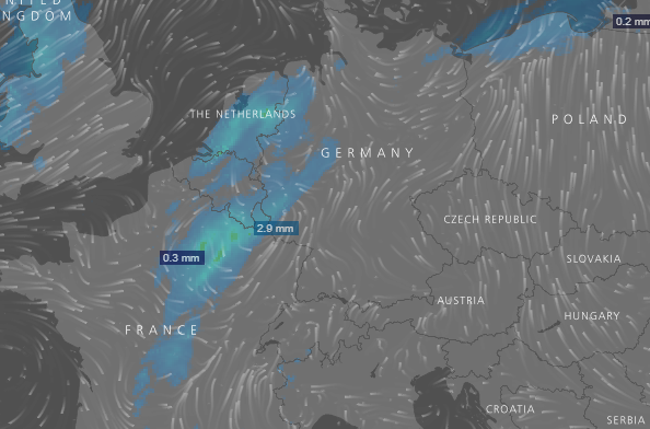
NEMS:
Why are the so different in such a short timescale?
Also the GFS seems to have changed its mind a lot:
Yesterday at 08:00:

Yesterday at 22:00:
This morning:
I can understand long term models being so variable, but in the very short term?
Convective frontal weather? Convection is difficult to accurately predict?
Yep. Fuji is right, convection is a bitch to forecast even short term. I was on duty the last several days and it was very difficult to say something meaningful with a sufficient degree of confidence even for 2 hrs ahead in some situations. These are the days when you come home with a head feeling like the inside of a hot air balloon after 12 hours of being asked where the cells will rain and where not. Anything more than 30 minutes is guesswork, educated but still guesswork.
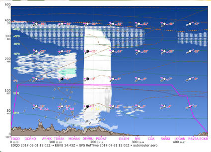
The 3 model plots show the same front but with variable intensity. Basically this stems from the input data as well as the grid width which is different from all 3. GFS interpolates more and often shows higher intensities than real, ECMWF has denser data and I don’t know the third one. The Gramets show a situation where convection was predicted by the models yesterday but failed to materialize today. That is daily business in this kind of situation.
The problem is that there is no “short range” forecast data available free to the public. GFS for example comes out every (something like) 12hrs so by the time the site which produces these nice plots gets it, it could be many hours old. I am sure somebody will correct me on the latency but that is the basic idea.
Same with the UK Met Office MSLP charts. Even today’s one has a huge latency on it – maybe 24hrs.
It takes a lot of time to calculate and then distribute the data. GFS is usually behind on computing power compared to the the European models and until recently, distribution speed was dismal, adding another delay for 1-2h. GFS has 4 datasets per day, i.e. every 6 hours.
The forecast was reasonable. You saw that there is a chance of convective weather and in the last run it told you that it does not expect visible moisture anymore but it gave you a lifting index that pointed to convective potential.
PS: GFS just received a major update last week.
As it turned out, GFS was the most accurate, by a country mile.
In 2012, hurricane Sandy struck the US and caused major damage. GFS predicted it to not hit the cost while the European model ECMWF accurately predicted when, where and how hard it would hit the US. Following that, in 2015 there was another hurricane that GFS predicted to hit the US and ECMWF predicted to not hit the US and again, the US model was wrong. This triggered an evaluation of weather models and GFS scored rather poorly behind the European models. As a consequence, the US weather office got additional funds and started to invest in improvements to GFS. This has already yielded major improvements. A bit of background can be found in Scientific American: https://www.scientificamerican.com/article/are-europeans-better-than-americans-at-forecasting-storms1/
Of course it’s nice to see a joint European effort having the edge but as GFS is public domain and the European models are not (although Germany has recently opened large parts of it to the public domain following the passing of a law bill), GFS is what most 3rd party services depend on so we rely on its continuous improvements.
@achimha
Do you consider the major update of last week, a significant improvement step in forecast accuracy ?
I am not sure, this would require a thorough analysis and comparison which we don’t do. However, others are exactly doing that and it seems there are improvements. A lot of the effort was around prediction of tropical storms (following hurricane Sandy) and in general weather in the tropic regions. It is good that people are pointing fingers at NOAA for poor performance because their self image is certainly not as a tier 3 weather service and the increase effort benefits the whole community. The European weather services we’re talking to keep saying how poor GFS is compared to what they offer but they fail to make us a good offer and I personally prefer open sources over proprietary sources.
The update of last week did cause us some problems though. We were missing certain types of clouds until we figured out the change in semantics.
achimha wrote:
The update of last week did cause us some problems though. We were missing certain types of clouds until we figured out the change in semantics.
I noticed the changes too and saw that, at least for my amateur forecasts, some parameter numbers had changed, although I didn’t find the changes in their updated documents.