
Waypoints are identified by a group of five letters [A-Z], more or less pronouncable. They come in two categories°°:
I should like to collect them, in a machine-treatable format like csv, from the www so as to add them to my homebrew moving map software.
I do find the enroute waypoints in the AIP, mostly (or even always?) in section ENR4.4 ; however they are in pdf, and several AIP publishers seem to purposely make it difficult to collect the data from them. Up till now I open the pdf, select the data, then copy and paste it into a spreadsheet from where it can be saved as csv then further polished up. Works, but it is tedious. Fortunately, the data are rather stable.
The aerodrome-related visual waypoints (the Brits call the VRP’s, for “Visual Reporting Pount” or so) are even worse: I have as yet copied them from the various approach plates. At least for those fields I am likely tio visit, like LFAC Calais-Duinkerke or LFAT Le Touquet.
Is anybody aware of a source where I can gather these data in a more automated way? Needless to see it needs to be open and free – if I wanted to use payware I’d not be writing my own code.
°° or are there more? Then I’ll have to learn about them.
Jan_Olieslagers wrote:
Is anybody aware of a source where I can gather these data in a more automated way? Needless to see it needs to be open and free – if I wanted to use payware I’d not be writing my own code.
I don’t think it exists? I complained to EasyVFR for not updating their database (which is essentially why I pay a huge sum every year). They gave me the same explanation as you did, lots of work.
But, if more of us come together and update your database (and you make it public available), the work should be very manageable. I can happily update for Norway for instance. Changes doesn’t occur that often, but when they do, it is essential to update it. The Tower start using the new point immediately, and expect pilots do do the same. After all, the changes are made official on the AIP.
There are also “terminal waypoints” which are used in arrival/approach/departure procedures. Some of them are 5-letter name codes just like the enroute waypoints. From the pilot’s point of view there is no real difference except that the terminal waypoints are missing from some charts. You can’t expect to find these waypoints in the AIP enroute waypoint listing.
Other terminal waypoints names are combinations of letters and digits. These are used only to define (turning) points on SIDs and STARs.
Airborne_Again wrote:
Other terminal waypoints names are combinations of letters and digits. These are used only to define (turning) points on SIDs and STARs.
Not only SIDs and STARs, but also RNAV approaches. It also looks like point names containing digits are not necessarily unique worldwide.
Most if it is available from Eurocontrol.
Most of it is available from Eurocontrol.
in machine readable form? where?
EAD Data
Thanks, but – unless I am missing something – the wellknown EAD data site only offers the same pdf’s as found with the various national CAA’s. Again, these (or at least the handfull I tried) are made to be on the one hand readable to the human eye, but OTOH obviously a good deal of effort has been spared to make them hard to decipher by software. The pdfminer software certainly broke its teeth on them. Nothing is impossible to software, ultimately, but I was hoping for a friendlier source of data.
I recall from a conversation with @bookworm in Usenet about 100 years ago that there are two classes of the 5-letter waypoints. The 1st group almost never change. The 2nd group are used for sids/stars and they change fairly often.
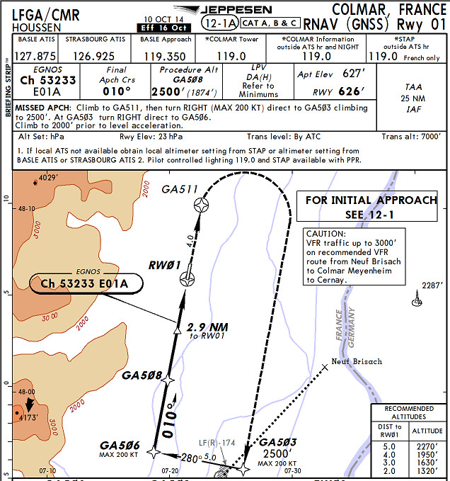
Then there are the Jepp-created ones like GA503 and you won’t likely find those in a database, short of reverse engineering the Jeppview database (or extracted it from a jailbroken Ipad with JeppFD). These waypoints should be unique… GA is obviously from LFGA and the reason they start at 500 is because other xxGA airports consumed the previous 500. You could set DCT GA503 and you won’t be asked to choose between Colmar and some airport in the USSR (that question is presented for e.g. SAM (Southampton) or SAM (Samos, Greece) when setting DCT SAM at Shoreham).
The EAD site (not been there for years) used to have various reports you could run off; I recall a worldwide list of DMEs for example. The output would be something which needs to be parsed however; this is a major headache for flight planning software vendors who have developed loads of scripts for ripping PDFs etc. One long-gone one reverse engineered the Jepp data also  Some vendors don’t necessarily bother to present data which is too difficult to extract from the PDFs.
The only truly machine readable format for everything was DAFIF and that’s long gone from public access because the non-US CAAs want to sell the stuff for €€€€€.
Here : http://www.jprendu.fr
It’s at least a french database of vfr points, updated every 4 weeks.
I use it to insert vfr points of report in my G1000 database.
There are many other worldwide waypoints, VOR etc.
All downloadable in many formats, included csv.


