this is the third part of my reports about a visit to scotland, it may be bit long, just scroll. you can find part 1 here and part 2 there.
after having arrived in Inverness (EGPE) we picked up a rental car with a nice AOPA member discount of about 15%. first time driving on the left though! i was amazed how quickly the brain can adapt. it is the reflexes though, that are very hard to switch. scotland has a lot of curvy roads undulating in the vertical, wide enough for one car. there’s regular passing spaces. i have found the scots to drive quite fast on those roads, and with the TCAS blaring the reflex was to pull the wheel to the right…
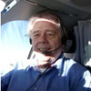
the front mentioned in part 1 and 2 dutifully moved over the UK and as such it was a good decision having brought the departure one day forward. this is how the weather would have been:
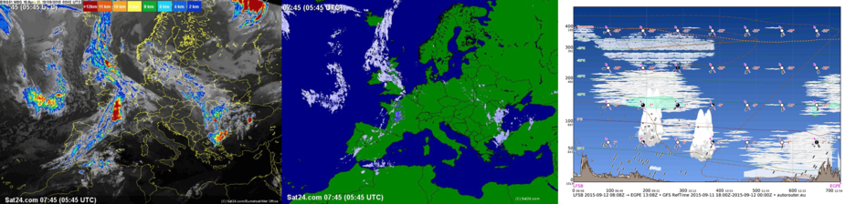
we had booked a B&B in Drummnadrochit , a small town at the shores of Loch Ness very close to the riding stable my girlfriend hat selected. The stable’s welcoming board could be used 1:1 for a flight school, just replace the horse pics with planes :)
even though some hikers walked about and busloads of tourists were carted through Drummnadrochit (mostly to nessie-land and castles outside town), the town offered many calm spots (Café Eighty 2, loch ness shore by the cemetery) and decent restaurants.
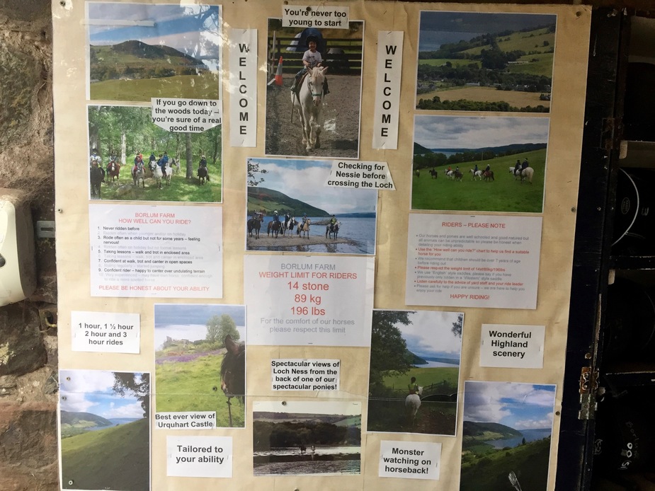
the monster was soon spotted too:
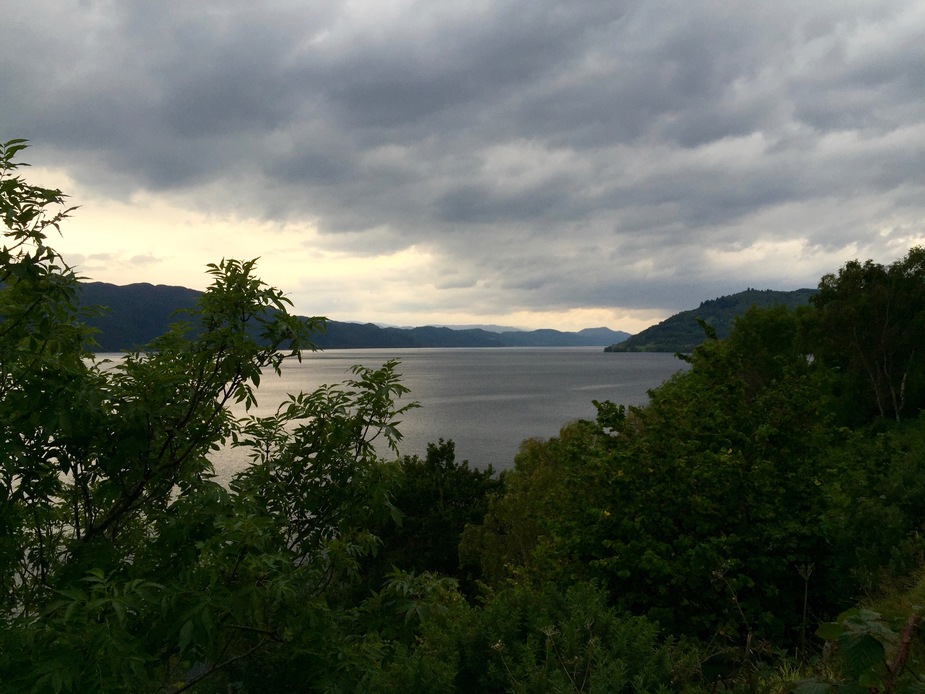
outside of the town, everything was calm (except the winds), empty, a landscape i soon fell in love with:
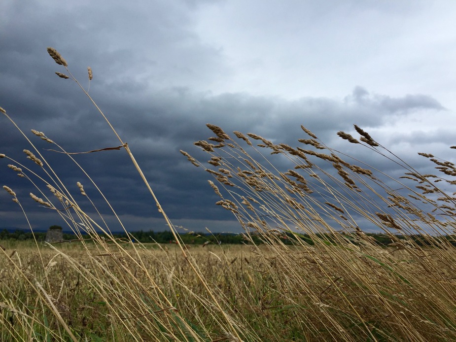
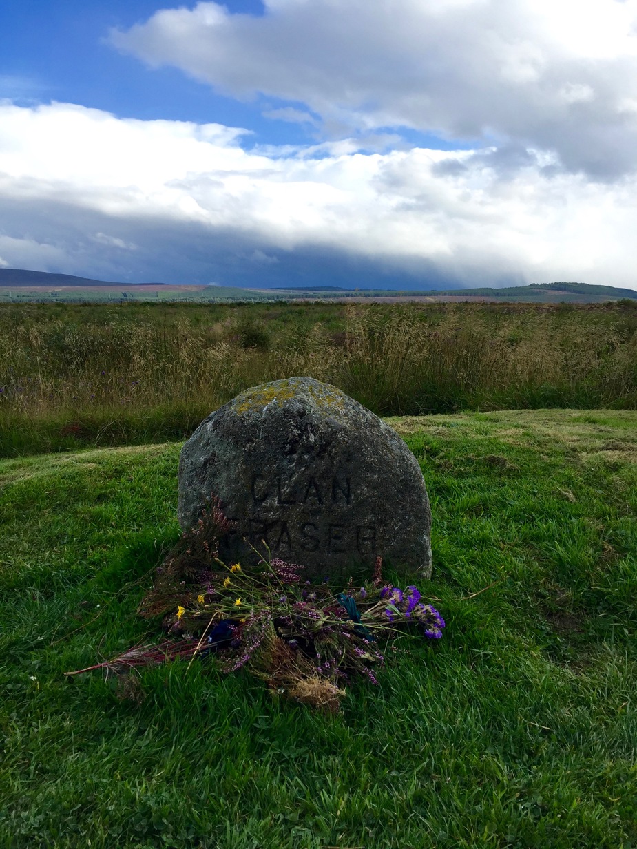
while sitting out the weather, we visited the site of the Battle of Culloden – an important moment of turmoil in Scottish history, with the weather over the moor being quite fitting (METAR of nearby Inverness airport: 09013KT 9999 FEW020 SCT033 15/10 Q0999):
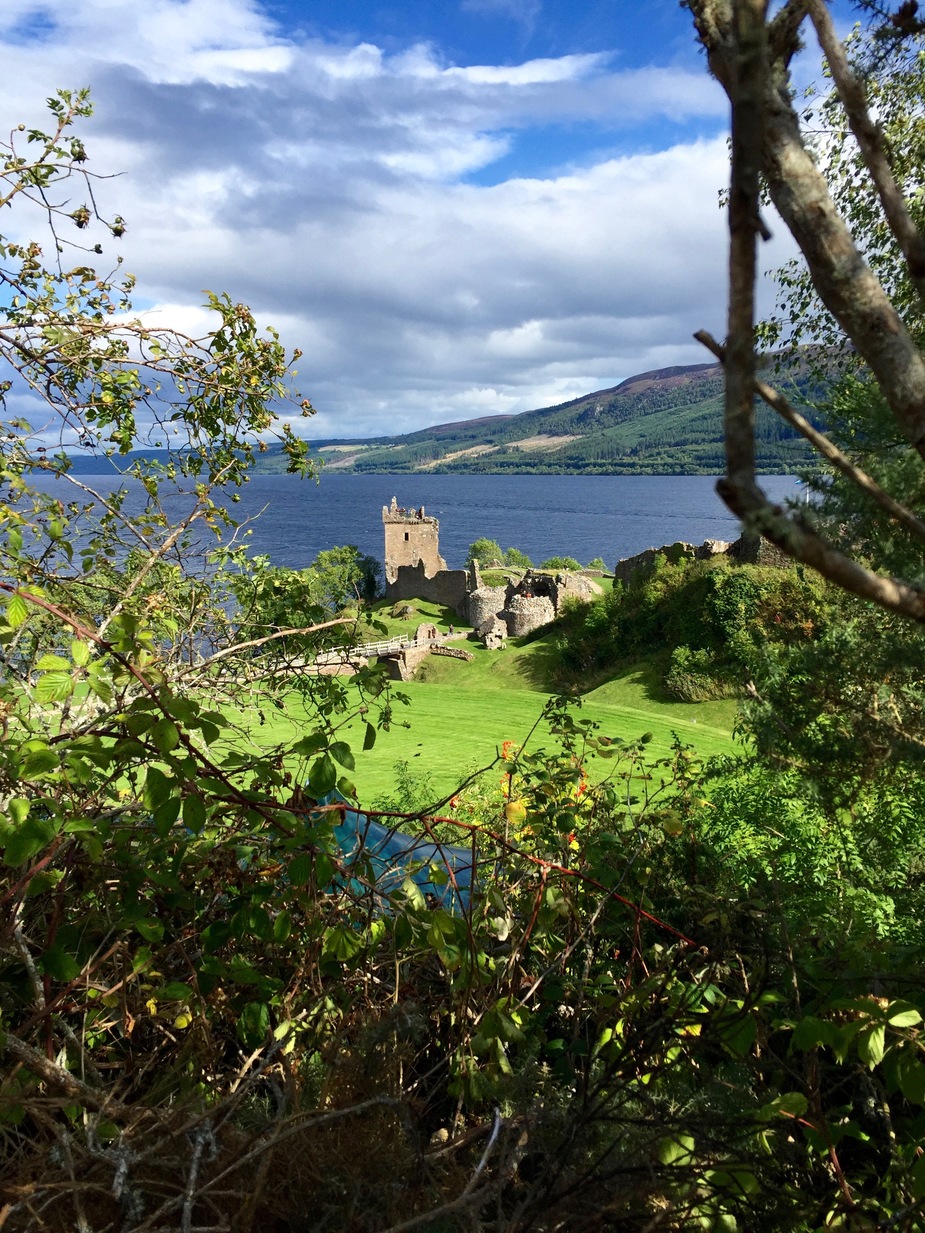
the day was concluded with a short visit to Urquhart Castle and some beer-ness:

Flight To Barra (EGPR)
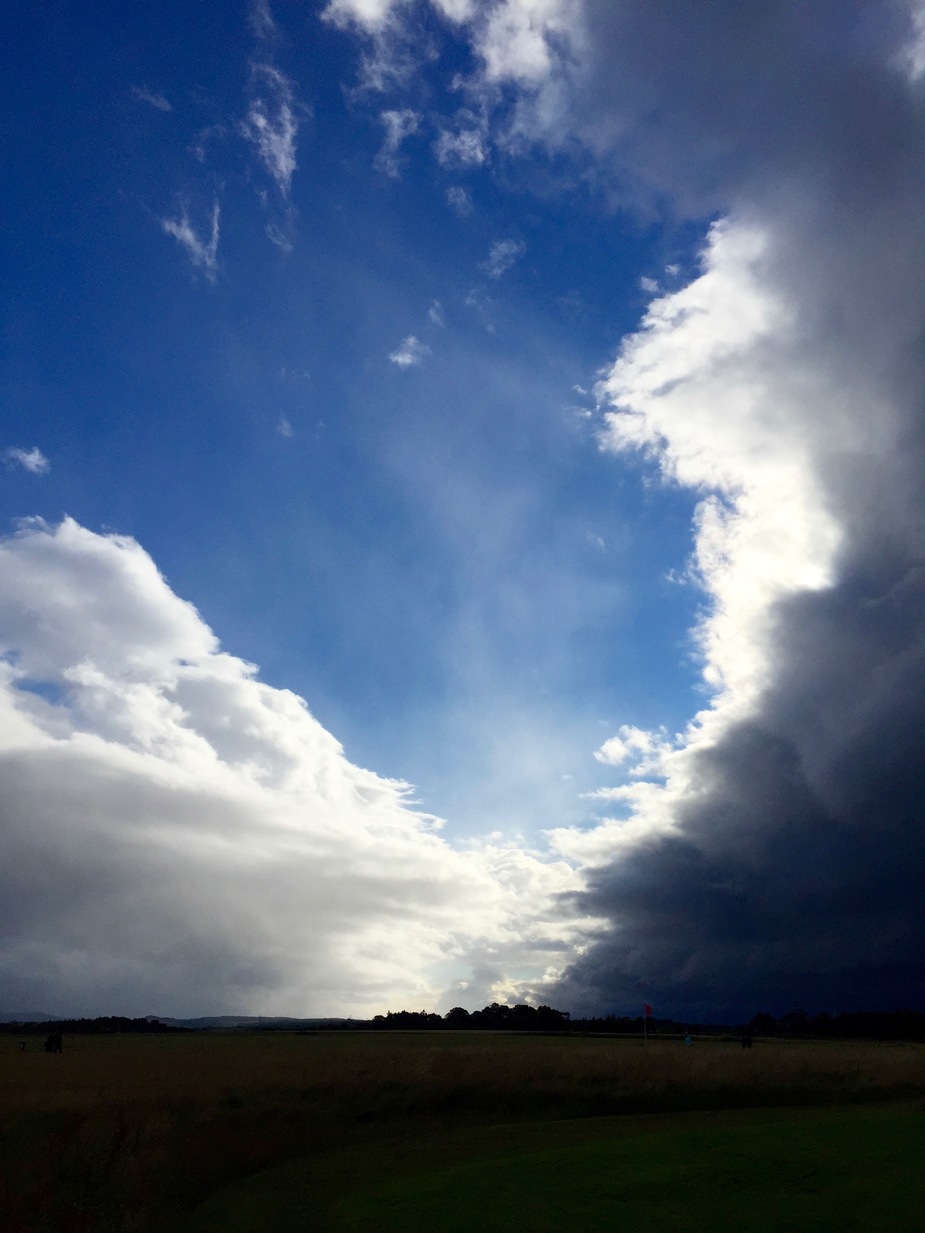
the weather so far had been very windy and rainy with the passage of the front and continued to be fast changing. then it began to look like wednesday would be a good choice.
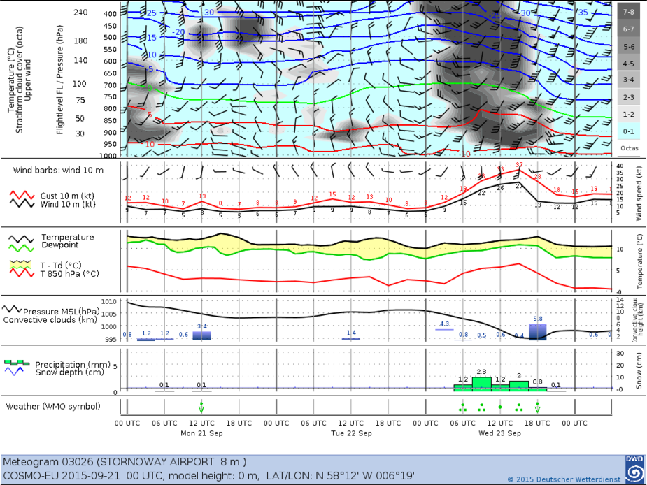
for VFR i almost exclusively rely on the German Weather Service (DWD, pay site) in combination with the fabulous autorouter telegram instant messenger interface. i unfortunately did not keep the imagery relevant at the time, but nevertheless i would like to show two samples.
the DWD 3-day meteograms are very accurate and show a cross-section for many european airports including winds, pressure, convective activity, temperatures, etc.. for the trip to barra each day i observed the meteogram for Stornoway which is sufficiently close to Barra. here’s today’s sample:
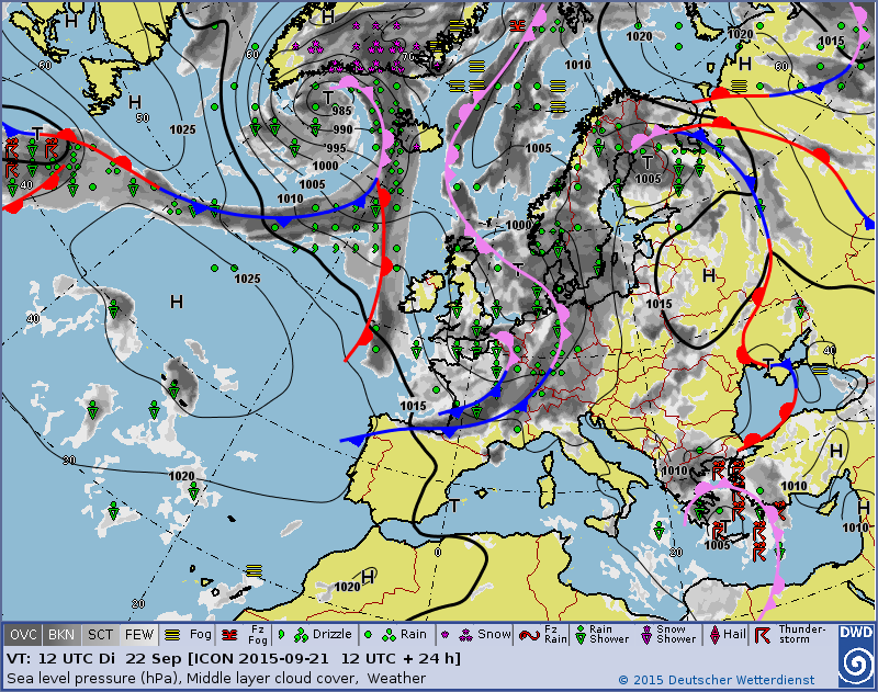
the DWD offers ground analysis + cloud projection for 6 days into the future with two iterations for each day which helps immensely to judge weather development. i guess the UK met office MSLP charts available for free have similar value, but with less information. here’s the sample for tomorrow:
alas, without any convective wx and ceilings > Cat I weather wasn’t so much a factor anymore, as due to the UK liberality with IFR in airspace G i could always enter clouds, change myself to IFR, no flight plan needed and return to Inverness for a full ILS with an endurance of 6 hours.
Barra airfield is subject to tide and ebb and only usable during certain hours of the day with changing surface conditions. Never before have i rejoiced at the need for PPR, but this time i sure did. Based on this i obtained PPR for Barra 24h prior as per requirement. A friendly person told me that on wednesday the airfield is open between 1300 and 1545 LT, with the tide turning at 1500. I thus chose 1400 LT for the landing time, as a balance of giving the water time to recede and be able to make Oban before its early closing time of 1615 LT for the necessary hose-down after salt water exposure for the retractable-gear aircraft. i therefore obtained PPR for OBAN and stated the hose-down request. i could hear them smile, i probably wasn’t the first one with this request :)
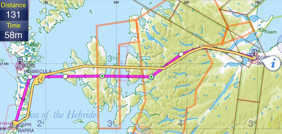
the route to Barra was to follow the A832 and A890 carriageways up to the Isle of Skye for easy pilotage, then a direct to Benbecula with the shortest over-water distance, then follow the islands down to Barra:
the route to Oban would unfortunately have to be DCT, with 50 NM over open water, due to the time constraints of Oban’s closing time.
the route from Oban back to Inverness was to be a leisurely low-level cruise along the Great Glen with no time constraints.
airspaces would not be a consideration, as there’s no CAS in the highlands and the military zones had been recently cancelled by a NOTAM.
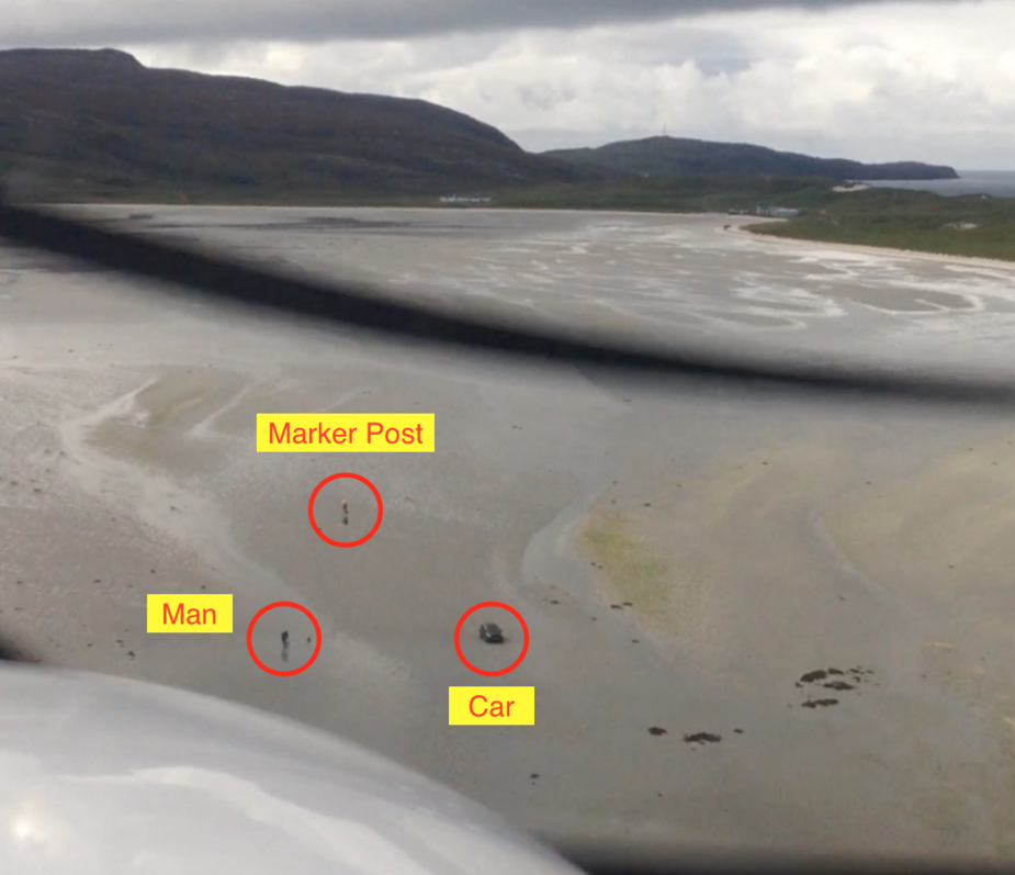
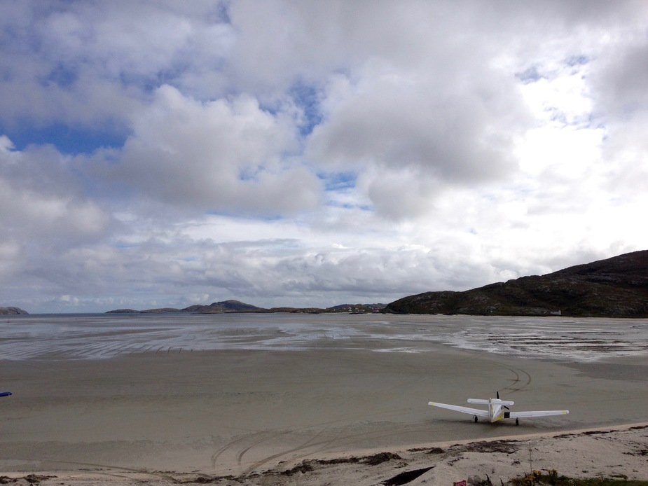
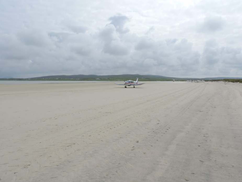
one thing that kept me (in hindsight, over-) thinking was: the airfield has three runways, crossing at their western thresholds, on a surface with no discernible RWY bounds and thresholds, but some marker posts before each displaced threshold:
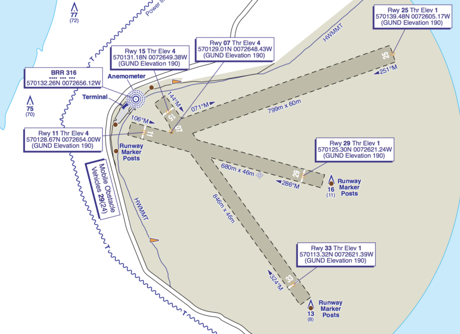
how would i know where to touch down? how would i be able to maintain directional control along the RWY? i had heard that only the RWY areas are checked on foot each day. it was therefore clear that an initial low pass would be required to assess the situation.
a quick google search identified the posts to look for during a planned first low pass:
as the UK AIP plate diligently provides threshold coordinates down to the decimal second, i planned on entering the coords for RWY 11 and 15 thresholds into the GNS430 for a nice OBS lineup on either of the two longest runways with distance information. i could not simply use the airfield itself for the OBS, as the airport reference point unfortunately was placed outside the RWY intersection point.
as the Piper Turbo Arrow POH does not provide takeoff and landing performance data for grass, i calculated for no-wind, MTOM, paved, with a 100% reserve on top, with our actual weight ~70kgs below MTOM. it was also a good opportunity to re-read soft field landing and takeoff procedures.
on the morning of the flight the Stornoway TAF concurred with the meteogram: 161057Z 1612/1621 17008KT 9999 FEW015=
the METAR shortly before departure looked clean: 161150Z 17009KT 9999 FEW017 11/05 Q0993=
so did radar, sferics and satir.
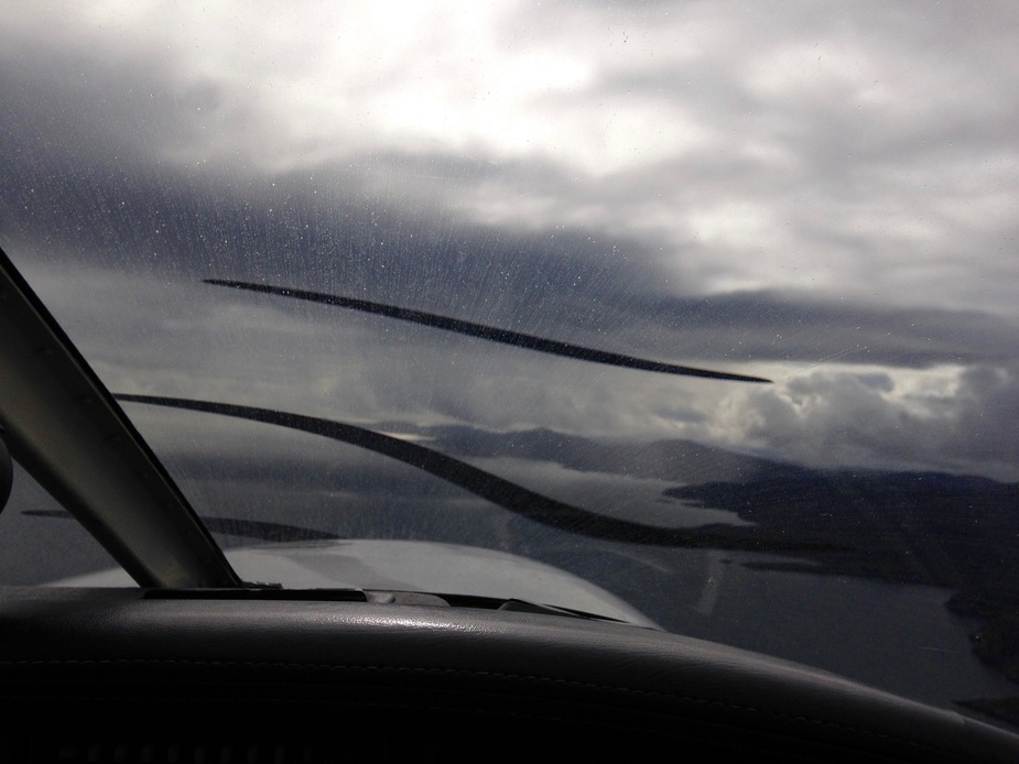
departure under clear skies, with the highlands covered in CU:

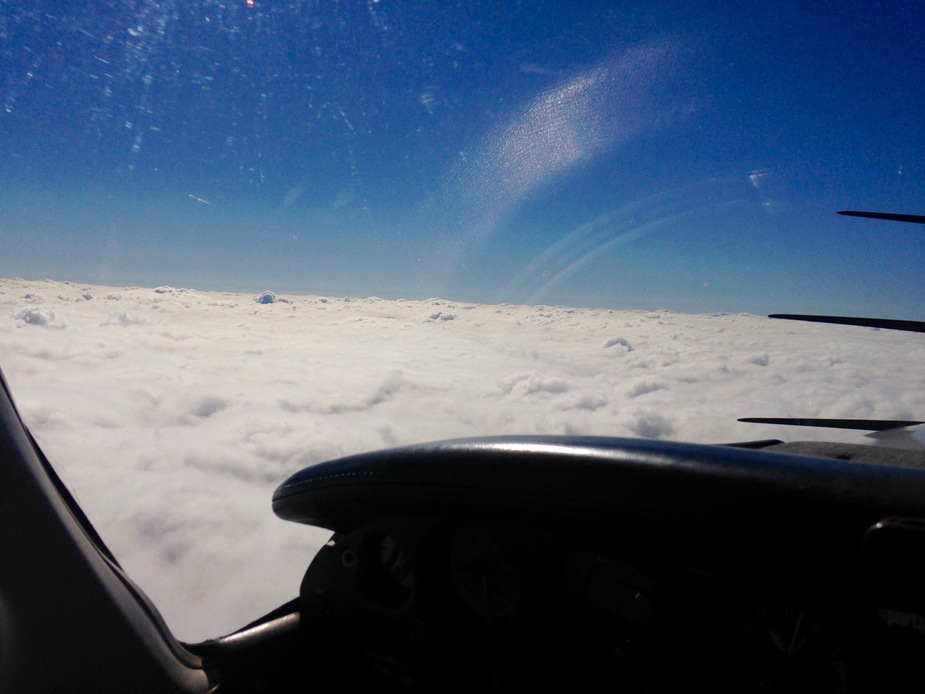
this soon became solid VFR on top at FL100 with the tops at FL80, making pilotage obsolete and resulting in a DCT Benbecula backed up by its VOR + NDB:
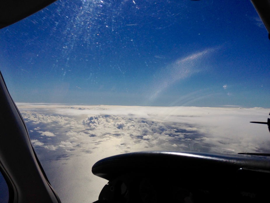
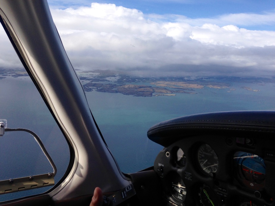
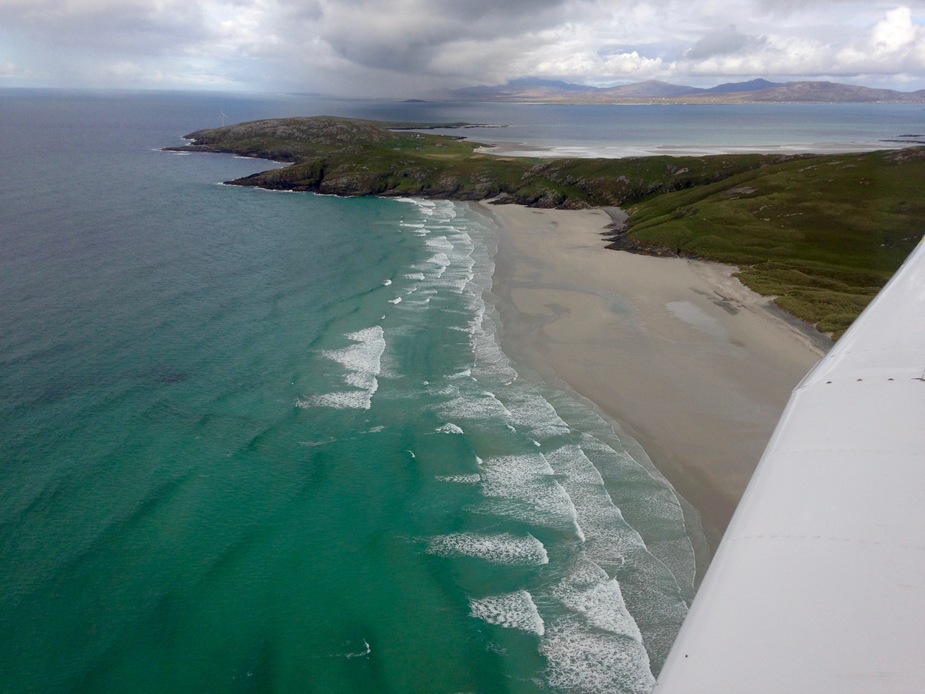
after passing the Isle of Skye, the clouds cleared over water, only to resume over the outer Hebrides:
a circular descent brought us underneath the clouds, to spectacular views:

Barra was now close. i had programmed the threshold coordinates on the ground, just to discover that the GNS430 doesn’t take decimal seconds, which would result in an OBS cross track error of +100m – oh well :) nevertheless i put the OBS for RWY 25, as announced by Barra Info.
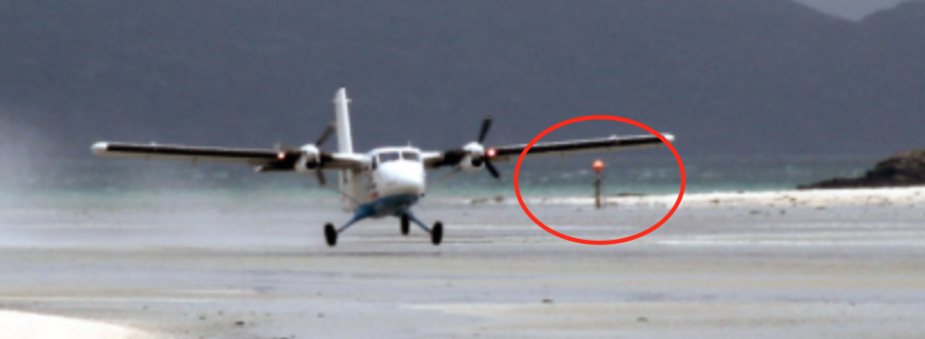
the low pass was granted and used to verify the OBS setting, and sure enough i was displaced from the center line as predicted. to my surprise, the marker post for RWY 25 was very clearly visible, which meant that lining up on the post plus maintaining the RWY compass heading is completely sufficient and doable. my eye was drawn to the marker post because there was a car and a man on the beach close to the marker post. then i saw another car and another man next to the marker post of RWY 29! this couldn’t be a coincidence. sorry for the bad pics, taken from video stills.

the conditions – as far as it is possible for a beach-landing novice to judge – looked fine, with large parts of apparently compact sand, intertwined with puddles of standing water (announced as such on Barra Radio). so i decided to go ahead with the landing.
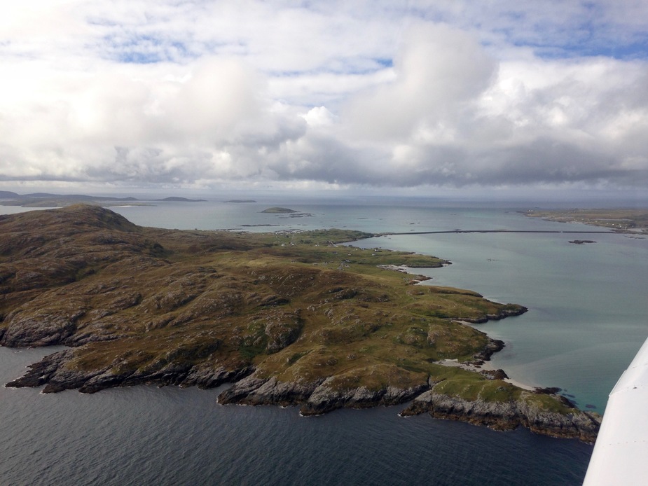
more spectacular sights during the right-hand traffic pattern:

in spite of my excitement, i tried to treat it like any other soft field landing. the wind was reported from the south at 9 knots, which would favor RWY 15, but for some reason RWY 25 was active. full flaps, Vref 75 kts with slight power on the prop and full stall touch down. It worked out fine, cut the power a bit early, firm touch down but no bounce. i touched down in standing water immediately followed by compact sand, then more standing water. i could feel firm deceleration from the standing water, much like on a soaked grass RWY you’ll never take off from although you tried. i did not break, elevator full back, retracted the flaps and let it roll out, stopped in half the RWY length. i hindsight i could have landed long as the second half of the RWY was compact sand with no standing water.
it is a stunning experience, the beautiful Hebrides, a beach landing and gear intact. but that’s only half of the story. i would have to takeoff again, which is usually the more critical manoeuvre. i will tell you about it in the next part of the trip report.
Thanks for taking the time to write your trip up, your enthusiasm is infectious. I’m looking forward to Part 4. 
Brilliant!
I was never brave enough to take our arrow in there.
Excellent report – I have taken a Warrior there but not sure I would want to do it in our ground loving Arrow IV
I’ve never flown in to Barra, been by road. I have been in to Sollas ( a few miles north of Benbecula )by air and would suggest due to the remoteness and lack of facilities at Sollas IE no terminal, staff, markers, just a beach, it is a purer landing on a beach experience. From memory there’s in the order of 1600M.

Misc. wrote:
at Sollas IE no terminal, staff, markers, just a beach, it is a purer landing on a beach experience
thanks, misc, this has been put on the bucket list.
about the markers, i now realized that they’re dynamic, i.e. “the man by the car” stakes to post at different locations depending on the water line, and not always in the RWY axis documented on the plate. how’s that for dynamic RWY length?
You’re welcome, there’s an annual fly in to Sollas, I’ll post next year’s date when known. Which is usually short notice.
Here’s a short video of landing at Sollas filmed from the rear of a DR400 in 2014.
As a reminder of your trip here’s a short video from our flight on Saturday. (Sorry feels as though I’m hijacking your thread, I’m done).
Misc. wrote:
As a reminder of your trip here’s a short video from our flight on Saturday. (Sorry feels as though I’m hijacking your thread,
beautiful vids! i am sure you scared hikers seeking calm and solace in the wilderness :) an no hijacking, the more, the merrier.
Absolutely brilliant trip reports @Solaris! Very, very inspiring. Looking forward to the next instalment….. :-)
Thank you for taking the time to write the trip and report up. Looked fantastic and it is great to be able to follow it through and learn at the same time