In summary, does this mean that SERA will make DIY approaches legal all across Europe?
Peter wrote:
In summary, does this mean that SERA will make DIY approaches legal all across Europe?
I really don’t think that SERA has anything to do with this. SERA is basically the international Rules of the Air which already had the relevant rule — that you may fly below the basic IFR minimum altitude when necessary for take-off and landing.
The important rule change is in the operational rules, specifically the introduction of part-NCO. If we take Sweden for example, the old Swedish regulations (still in force for Annex II etc.) were explicit that landing according to IFR had to be done at an “open instrument aerodrome” regardless of the type of operation (private, CAT, etc.) (“Open” means that there is an ATS unit in operation.) In part-NCO there is no such limitation, while there is in part-CAT.
So I would say that, in summary, this means that part-NCO will make DIY approaches legal all across Europe for private flights.
Peter wrote:
I have never heard of any crash where the pilot was flying some kind of DIY IAP which was “designed”.
Here’s one for you
http://www.aaiu.ie/sites/default/files/report-attachments/REPORT_1998_008.PDF
Clearly it is a worthwhile discussion about how/who designed and whether the profile had sensible tolerances; not completely following the profile resulted in the CFIT. There’s also some very useful legal points within the report. Oh, and it is also worth noting that the aircraft was owned by the same chap who was killed here.
I would suggest, David, that that Irish helicopter crash is not all that applicable to light GA. It was flown by 2 pilots, they probably (1996) didn’t have a moving map GPS, no GPWS, and people don’t fly with such bare kit these days, if they are going to be doing DIY approaches.
This shows the age of it:
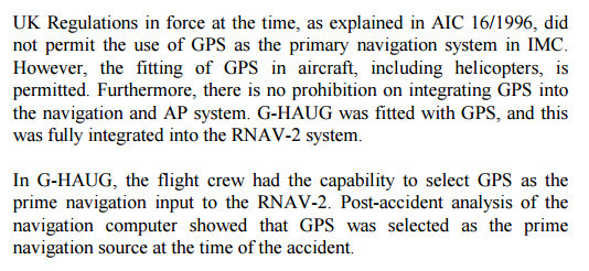
but as I say it doesn’t sound like a moving map unit. I can’t find anything on google about the Racal RNAV-2 so it must be truly ancient.
Peter, there are a lot of very useful lessons in the report. To dismiss the relevance with a
and people don’t fly with such bare kit these days, if they are going to be doing DIY approaches.
is sort of missing the point.
I would think most people doing non-pre-designed DIY approaches are just descending with a moving map GPS and using the spot elevations depicted on that.
Hence the discussion(s) here previously about how deficient most/all of the current moving map products are in that department.
Timothy wrote:
I have written two papers on the subject and submitted them to the CAA and they have both been Humphrey Appleby-ed.
For those who’ve yet to enjoy ‘Yes Minister’ and ‘Yes Prime Minister’, here’s Humphrey explaining his 5 excuses explaining why things happen…..
and probably my favourite is ‘need to know’
I would think most people doing non-pre-designed DIY approaches are just descending with a moving map GPS and using the spot elevations depicted on that.
That is one way, but I think that there is also a level of knowledge and belief that if they descend on a 3° slope from the MSA to the ARP on the extended line, there is very unlikely to be terrain or an obstacle that penetrates that approach (given a conservative MDA) that they are not already aware of.
By that, I mean that “everyone knows” about the trees on the hill at Wellesbourne, the slag heap at Sherburn, the mast at Little Staughton and the mountain at Oban and so on. If you were approaching most “VFR” airfields there would be a reasonable, and justified, expectation that the straight in approach would be safe and clear.
I am not condoning that approach at all, but I imagine that that is the mindset for some who do unplanned approaches.
My belief is that people who die on 2D approaches do so mostly not because of obstacles of which they are unaware, but because they screw up their CDFA or their MDA (for one of a number of reasons), and they do so on both published and unpublished approaches with awful regularity. The only real answer is glidepath indication to all runway ends.
Dave_Phillips wrote:
Clearly it is a worthwhile discussion about how/who designed and whether the profile had sensible tolerances; not completely following the profile resulted in the CFIT.
The semi-width for the final approach segment of an RNP APCH is 0.95 NM (1.5 * TSE + a buffer value of 0.5 NM).
The cross track error at the point of impact was 1.36 NM. At that distance from the final approach track of an RNP APCH, you’re outside even the secondary area.
I’m drawn to the observation:
3.1.20 No evidence was found that would indicate that the aircraft would have
experienced any difficulty in following the selected route, MOIRA -
WARRN – MAP – B, if the aircraft had been operated throughout in the
fully coupled mode, with Nav Capture, and allowed to fly the selected
route without manual intervention.
bookworm wrote:
The semi-width for the final approach segment of an RNP APCH is 0.95 NM (1.5 * TSE + a buffer value of 0.5 NM).The cross track error at the point of impact was 1.36 NM. At that distance from the final approach track of an RNP APCH, you’re outside even the secondary area.
The problem with most (all) RNP capable navigation systems is that they will only switch to RNP 1 or better once established on the final track of an approach which is stored in their supplied database. Otherwise – and that includes DIY procedures – they can/will remain within RNP 5 tolerances. I can observe that myself often enough with our onboard equipment whenever an RNP approach is mishandled by the pilot (e.g. by setting a direct-to the final approach fix or by inserting waypoints between the stored points). In those cases, using the exactly same autopilot mode, the aircraft will deviate from the centerline no more than 20m in “APP” mode but several hundred meters in “TERM” or “ENRT” mode. One of my colleagues once wanted to report this as an FMS fault until I reminded him of what buttons he had pressed…
This for me is one of the problems many pilots do not understand about RNP approaches (official and selfmade) and a constant risk factor.