Wanted to here some opinions here?
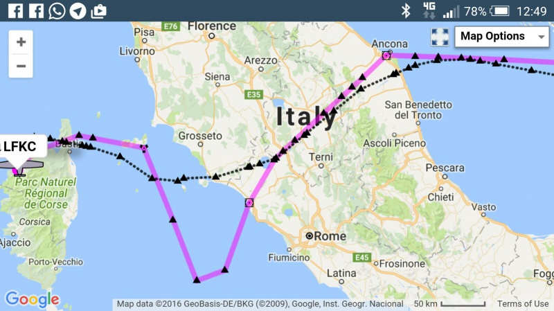
Hungary, Slovenia has implemented FRA till GND. Slovenia basically used the MRVA as the floor of the FRA.
If we don’t have any RNAV based routes how do you think it could impact safety when flying IFR in IMC outside the route structure low level mainly in mountainous terrain?
Open for your opinions
Thank you
What is the connection between free route airspace and safety?
How is it – in practice – different from being given vectors or direct-to some GPS waypoint?
There is still something like a minimum grid altitude. Just for a grid instead of an “airway”. Airways just came into existence because of the line between ground based navaids.
Is it the absence of MEAs that worry you? In that case you should know that MEAs do not only offer terrain clearance, but also nav aid and com reception, as well as complying with airspace restrictions. For terrain you do have grid-MORA (Minimum Off-Route Altitude) which give you a pretty good idea of what altitude you may want to be above (corrected for atmospheric pressure). The Jeppesen low-altitude en-route chart also depicts terminal areas and their vertical extension. What else do you need?
Most of the time you do not follow the airways anyway… so as far as terrain clearance is concerned, the MEA is not much help.

MORA is not the same as MRVA or MVA….MEA is again a different concept. I am not worried I am just asking for opinions :-) as a brainstorming exercise.
I am just wondering in case you are flying FRA you need to go down e.g. due to ice your over the hills . Routes provided some clear references under BRNAV (distance- bearing- vertical from mountains etc). The concept was different with a route with regard to terrain.
Just in relation to this article MORA is more of block of airspace while the MEA provided a path….In relation to mountains this may I think can impact our decision trying to stay clear of terrain in case you need to down the deck. Assuming you don’t have synthetic vision or other terrain warning systems…
http://www.skybrary.aero/index.php/Mountainous_Terrain_Escape_Routes
Vref wrote:
while the MEA provided a path….I
A path you never fly, or if you do you will divert from sooner or later to avoid a CB or for shortcut. So the MEA is just something you need to take into account for route validation by CFMU and nothing else. Grid MORA is Mich more important. Your GPS will normally also provide a MSA.
OK sorry ..it’s concept discussion safety impact analysis on FRA till GND out of the box I was looking for in a friendly way…not a lecture on MEA, MORA, etc…
Aviathor I do fly paths, as we all do under B-RNAV or RNAV 5 to use the correct PBN terminology and yes I request ATC a heading change when to avoid :)
Thank you
I am not sure what the issue is here.
If you want a Plan B for an engine failure above a cloud layer, then you need to be running a moving map GPS showing a topo map of some sort (the 2013 Jepp VFR charts are pretty good for that purpose). There is no getting away from that; flying on some published airway doesn’t help. And most IFR pilots don’t have such a thing running anyway.
For an engine failure in the middle of the night there is little you can do…. I would also steer away from obvious mountains and if possible glide towards an airport which might have runway lights (most GA ones won’t).
I do not think I understood the question/problem either apparently… I do not see any issues with free route airspace as opposed to airways that we do not follow anyway.
There is no issue its a request for think through process what is the impact on GA when FRA to GND is implemented nothing more or less.. E.g the lowest usable deck in FRA to GND seems to be MRVA in Slovenia (radar sectors) (this are known Airspace types to ATC ) which is a different baseline than MEA or MORA. I think this will push the minimum level higher for us GA pilots as this will have to be translated into CFMU acceptance over certain FRA areas (MEA was indeed used for Route Acceptance). In addition as you mention Peter, descent good quality terrain data is even more important in case things don’t go as planned as the published routes where still based on distance bearings from navaids based on certain design requirements to at least support some situational awareness where you are in respect to terrain…maybe we better leave the subject as is…
MEA was indeed used for Route Acceptance
Well, maybe in some places, but an empirically observed exception always disproves the proposition  And you can file EGKA DCT EGMD at 2000ft and it isn’t rejected, but as well as being OCAS it is way below the MEA of any airway there.
It really depends on what rules each country sends to Eurocontrol. Some countries deliberately withold data, to enable them to implement local measures which presumably they regard as more flexible (or maybe protecting local jobs).
I don’t think European airways are much based on MRAs of the navaids which just happen to lie on them. In the USA that is how it was done, and the IFR charts showed the navaid crossover points, etc, and I had to know all that for the FAA IR, but here?
ATC operating FRA will need to run a slightly different system for separation, because two planes both at FL100 might be 50nm apart at the start of Country X but be on converging tracks before leaving the said airspace, so there needs to be a mechanism for either vectoring or telling somebody to go up or down. But that is a technicality… maybe one of the many ATCOs who read EuroGA will have an input?
BTW I think where “we GA” get some massive shortcut, that is usually assisted by there being almost nobody else there, at say FL150… This is really obvious on the radio.