That’s not new. There’s an app called AeroWeather that does that for free. I use it all the time, it’s quicker than opening ForeFlight.
I use it ( the Dutch site ) and find it pretty good for VFR fields without own weather reporting.
172driver wrote:
There’s an app called AeroWeather that does that for free.
I tried Aeroweather and as far as I can see it only shows official METARs and TAFs. Or is there some feature I’ve missed? (And the website I mentioned is also free.)
chflyer wrote:
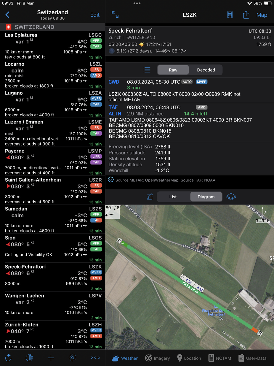
Aeroweather (from Lakehorn here ) is a super app. They do give reports for airfields without official METARs, indicated as GWD rather than METAR. There is always a note at the end indicating the wx source(s), in this case OpenWeatherMap.
That’s the one I’ve tried. (Unless they publish several apps with the same name.) I can’t find any way to get reports (much less forecasts) for airfields without official METAR/TAF. How do you do it? Or is it only available with the paid service?
How do you do it?
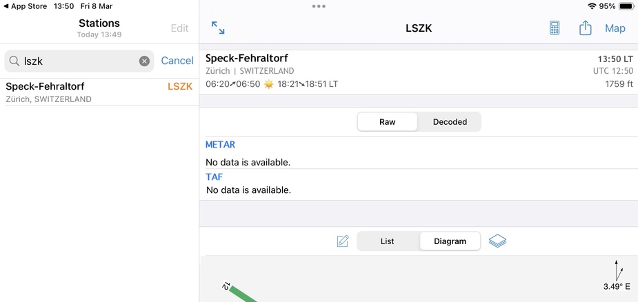
Same? Been using this app for many years since it offers some nice features (vicinity webcams, area wx, etc), but looking at LSZK as I type I only get this:
Almost certainly due to paid version. Everyone wants stuff for free, but I find this to be one app worth even the most expensive $8/yr, especially since I use it on several devices and appreciate the config sync across them all.
Various version differences