
Now that paper charts are getting rare, it might be worth looking at http://www.editerra.fr/rubrique.php?id_rubrique=2
Offer is limited (FR, UK, DE) as for 2013. I feel inclined to give them a try when the 2014 editions appear, or at least compare them to the DFS 1:500000 that I now have.
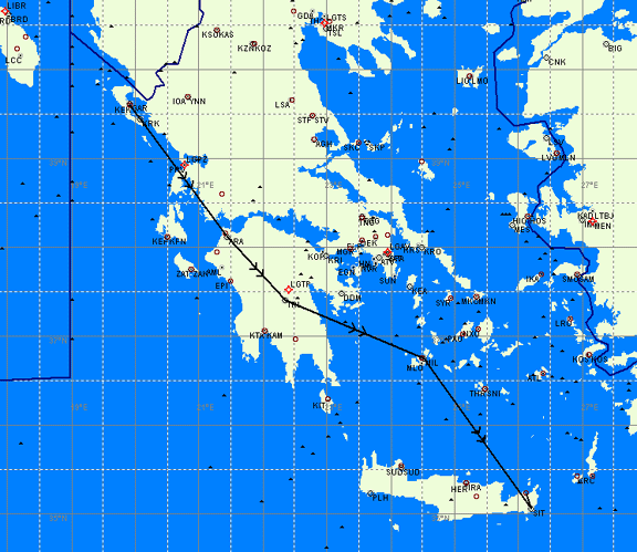
I have previously tried out the 1:1 million French and UK ones. Sadly I concluded there is not sufficient detail in areas of complex airspace, compared to the regular national 1:500k ones or the Jeppesen VFR version. One area I remember is flying from Spain along the Mediterranean coast of France, I tried to persevere with using this French chart to determine where I could go; I gave up and reverted to the national 1:500k.
With the demise of the Jeppesen I wonder whether it is legal to fly with just software charts, like Skydemon?
IMHO, the Editerra charts aka Cartabossy (Jean Bossy created them) are fantastic. I’ve been using the French ones now for over ten years and never really had issues deciphering airspace. OK for pure Vfr without a moving map Gps maybe not as good as the IGN ones to identify land features, but for normal long distance touring ideal. There is also such a wealth of useful info on these, such as BRIA phone numbers, self serve pumps, circuit directions etc that I am perfectly happy to set off only armed with that chart across France. OK it is a bit tough around the Paris Nice or Lyon regions but alseays found the IGN ones not necessarily easier, the local special SIA 250k ones better, but Cartabossy plus a decent colour Gps works fine.
however I was still buying the CAA half mil every year as I was taught on it, and using Jepps for Germany and Spain, never liked them for the UK France bizarrely. This year I m going to give it a try with Editerra for France Germany and UK, and use Skydemon as well. I guess it is all a matter of personal taste and habit. I guess the art of correctly folding the CAA half mil will soon be lost!
Legality wise using just Skydemon I am sure you can argue your corner but I d leave the forum experts debate it. ICAO doesnt stipulate a paper chart, in theory anything correctly depicting the airspace should be acceptable. people have argued annotated outdated charts are legal too, but you will no doubt find the resident aeroclub bore arguing otherwise. one of the instructors at my club in France was maintaining only the SIA ones are legal, not even the IGN ones, let alone Jepp or Editerra. Complete hogwash imho, but I gave up arguing, I have heard so many old wives tales in aviation you ll loose the will to live if you try to correct them all!
Perhaps these charts are one way of being legal. They cover a large area so there isn’t a huge cost involved. They cover numerous countries with a standard format and if your skydemon fails then they are good enough.
I really wish EASA land would come up with a standard chart. Maybe this is the best we can hope for.
I am not aware that any country in Europe requires the carriage of paper charts, let alone a particular brand of paper charts.
If anybody can quote a national CAA regulation which says otherwise, that would be very useful. I will incorporate it in my VFR Europe presentation. When I wrote that in 2012 I did not find a single such regulation.
The problem might be if you bust controlled airspace, in which case a national CAA published chart (if it shows it incorrectly) would be a good defence. But I am fairly sure no national CAA published chart (e.g. SIA for France) is going to show CAS incorrectly 
And since any other chart product you fly with gives you (IMHO) no defence, there is no practical difference
I would not use any mapping product for VFR flight unless there is a reasonable prospect of it having been tested by a sizeable group of pilots in that country. So Skydemon should be good for the UK, plus some other places where it has a significant market penetration and whose pilots are comfortable in English, enough to report errors to SD.
So what one use in say Croatia or Greece? Croatia had had no VFR charts till about 2013 (Jepps) and Greece still has none although the locals have put together various stuff – example. I suppose it didn’t matter because Croatian ATC was always really laid back, and in Greece they want routings on the published IFR routes (e.g. A14) anyway.
Regardless of the legality of e-charting I like a paper chart for the overall situational awareness and rough planning – and I think the Editerra charts are excellent for the big view.
Foe VFR e-charts Jeppesen Mobile Flight Deck VFR has a lot of promise. Rumour has it that a new version is due next week which will see if nothing else, the addition of BeNeLux coverage.
I have no idea if this is true – remember I don’t fly off the creases in the map. But there was a locally based rumour that the dgca police were checking maps used by ukpilots to visit france. And they would not except a UK 500000 chart which covers a touch of northern France
Rumour has it that a new version is due next week which will see if nothing else, the addition of BeNeLux coverage.
Not just a rumour, as you will know.
And probably more news at Aero..
For someone out of the loop with Euro flying, what is the software that has the best VFR coverage (as in most countries) in Europe?
Do any of them have IFR charts and approaches like Foreflight?
what is the software that has the best VFR coverage (as in most countries) in Europe?
I think the answer has to be the good old Navbox. A very basic program in mapdata terms, and the interface frozen for about 10 years.
PocketFMS, which I haven’t tried yet (have very limited need for sophisticated VFR flight planning these days) may be another one.
And there still is the old Jepp Flitestar VFR Europe. In marketing terms that is now a dead product but it is about €100, they still update it, and it does do it all. I have it but haven’t used it for ages (for VFR flight planning) because everything on it is a bit of a torture.
If you buy Jeppview 4 (with the desired geographical coverage) then you get Jepp airport charts. If you install it in the same directory as Flitestar, you can access all the stuff from within Flitestar and that is quite slick. But Jepp airport charts are very expensive – around €2000/year for all of “political Europe”. So most pilots use the free AIP airport charts and some apps can download those.
Skydemon is the most fashionable and feature-packed product in the UK.
But as a direct answer to your question, my answers above stand, to the best of my knowledge.
For me, the basic problem with VFR software is that unless you have superb topo etc data and can run it as a GPS moving map, you still need the printed chart (or an electronic copy of the printed chart) which means you may as well stick with a simple program. Which is why I still use Navbox. Of course many disagree


