Well, in your first post, was that during flight?
Yes
“distances appear to depend on groundspeed”
Probably, too much of corrections including relativity has been thrown in ;)
Do you get that in the sim setup? or while flying in the air?
Do you get that in the sim setup? or while flying in the air?
I have only looked at in any depth on the sim. It would be quite an ask while flying. However, the sim is superbly accurate, I have every confidence that it behaves precisely the same as the real thing.
I have a light day on Tuesday. I’ll do some more focussed testing.
As promised, I have done the first round of the experiment.
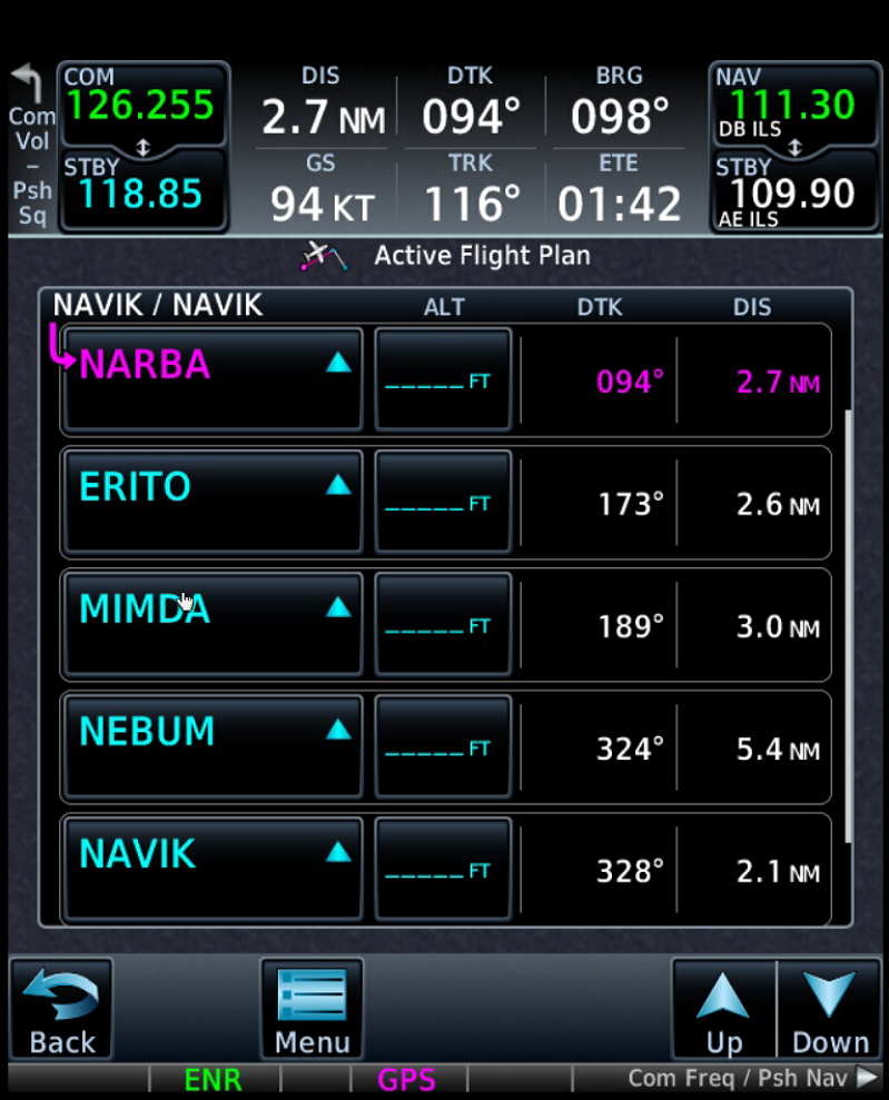
I wanted to exclude any possibility of seconds vs decimal minutes being part of this, so I found five database waypoints close together:
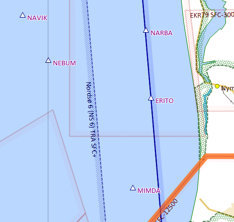
Creating a circular route between them looks like this on SD:
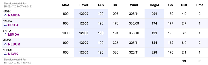
It seems that even when using SD on the sim, it picks up real world wind from the internet, rather than what is set on the sim. I am in such awe that any of these connectivities is available and forgive the interface that oversight! But it does mean that headings must be ignored. So you have TrkT on SD and TrkM on the GTN. I guess I could change one or the other if anyone is fussed, but it’s a bit of a faff.
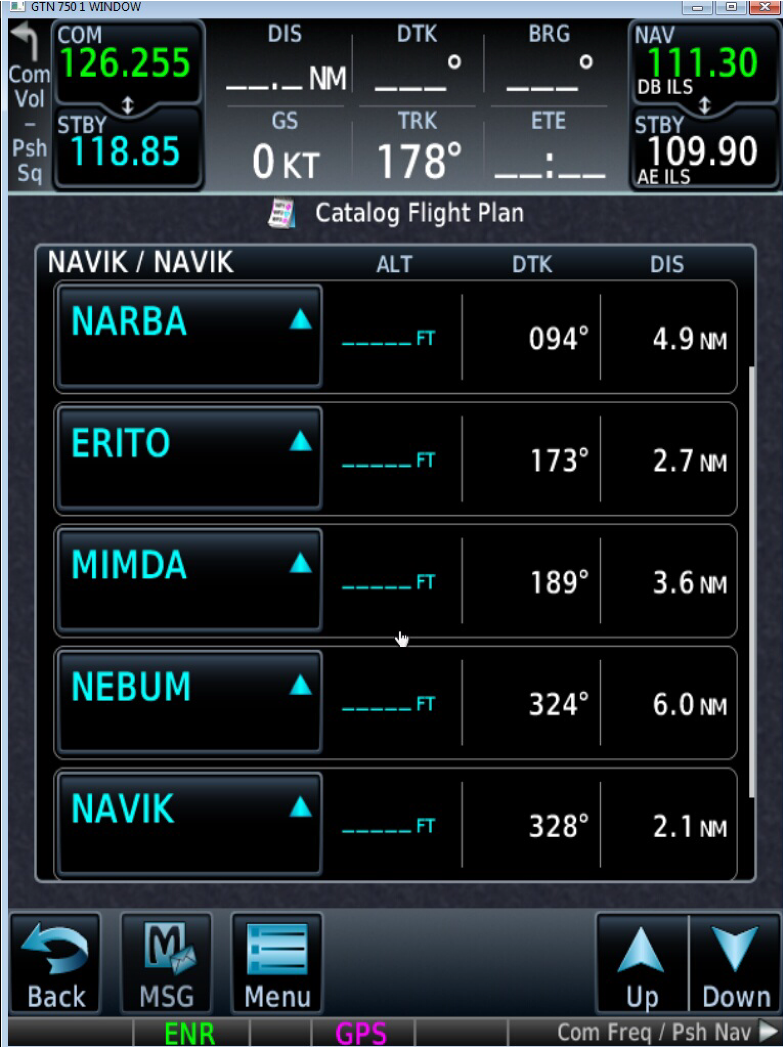
Looking at in the catalogue of the GTN, distances are the same:
Now, if I fly at 94kts I get:
And at 204kts:
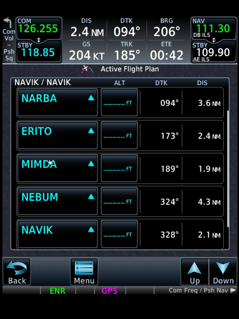
Notice that NEBUM to NAVIK never changes, which must be because there is no track change MIMDA-NEBUM-NAVIK.
So, there you have it, I can only think that it is giving flown distances making allowance for fly-by turns. If anyone wants me to do any further tests, please let me know.
Timothy wrote:
It seems that even when using SD on the sim, it picks up real world wind from the internet, rather than what is set on the sim. I am in such awe that any of these connectivities is available and forgive the interface that oversight! But it does mean that headings must be ignored.
You can tell SD to not use real world wind in at least two ways:
• Specify a takeoff time/date in the past or several days into the future.
• Set “Wind conditions” for the route to “360/00” (not “000/00”)
Just to keep you all updated, I have been in conversation with Tim Dawson, and it turns out that he has been working on this very issue in beta anyway.
The software does now do great circle, but his difficulty is that many, many people will have stored routes which contain rhumb lines, so he can’t just change everything to GC overnight, potentially changing or invalidating the content of their plans.
He therefore has to find a way to build a choice into the UI. He will be thinking about this.
In the meantime, he has sent me a route which is pre-configured to be GC, and so all I have to do is move the start and end points to whereever I like, and then rubber band to any intermediate waypoints, and I will have a GC route.
I have agreed to do some testing on that basis, and, at some point, he will build the functionality into the production version.
I flew a moderately long E/W leg today (EGKB – EBOS) and can confirm that the beta SD GC track exactly matched the GTN track.
I don’t think it’s my place. Why not ask Tim?