by user Aveling
My trips are strictly VFR and pretty tame compared with the achievements of many of you. However, they do cover some terrain and illustrate the point made in the thread about pilot numbers: flying has never been easier, in the US and also in Europe, at least partly thanks to the marvellous hand held devices we enjoy today.
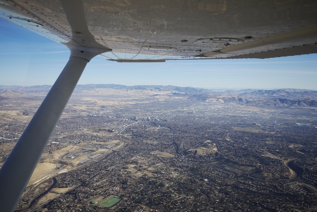
This is a round trip out of Prescott KPRC, Arizona for 2 weeks in January 2018 taking in a visit to the Rockies, a trade show in Las Vegas, and an excursion into beautiful Oregon. And, Prescott being 100 miles from the Grand Canyon, a crossing of the Great Chasm as well.
I’m going to split this report into chapters, as I write them. This is Chapter 1 – To Durango!
The aircraft is a 172SP, and on these winter days and with one (sometimes two) on board, she springs from Prescott’s mile high runway.
There’s no finer place for VFR flying than Prescott. At least 300 flyable days each year with no controlled airspace (apart from it’s own friendly class ‘D’) for 100+ miles, it is within a day’s round trip of some of the world’s greatest wonders: The Canyon (of course), Monument Valley, Meteor Crater, Hoover Dam, the Colorado river and of course sin city itself, Las Vegas. And plenty more.
But before departure, a formality forms part of my routine: a call to Flight Serivice (1-800-wx-brief) to file a VFR FPL and “request a standard briefing”. I always file out here, partly because when I’m on my own usually no-one else knows I’m even flying today, far less when and where. After all, I didn’t decide myself until watching the weather channel last night! It is January, after all. And the briefing is a chance to discuss the outlook with a like minded individual, as the briefers always seem to be. I’ve already studied the Prog Charts on Foreflight along with Tafs and Metars along my route, but often the briefer can suppliment the forcast with pireps and other observations that help my decision making.
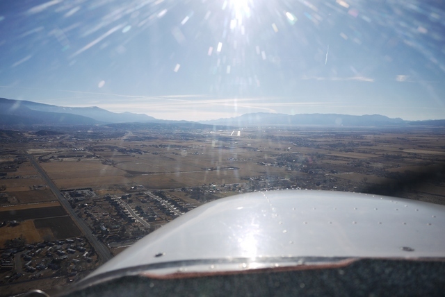
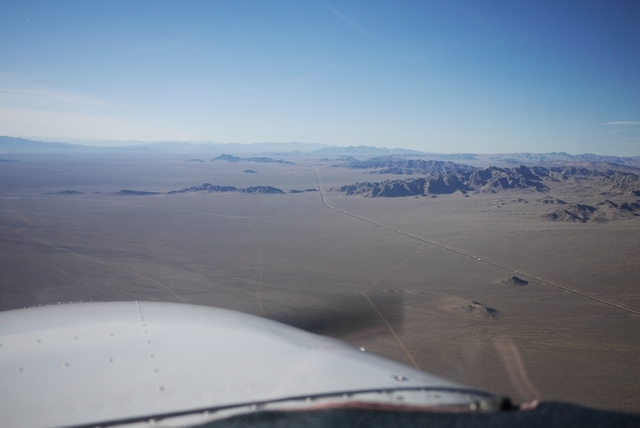
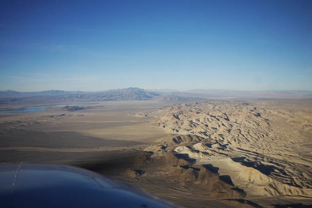
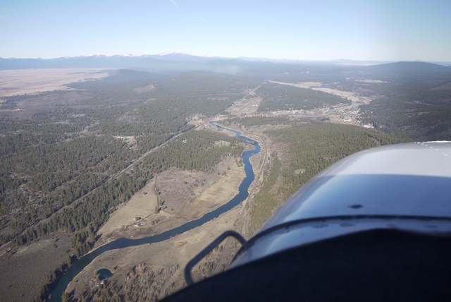
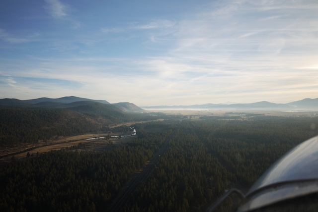
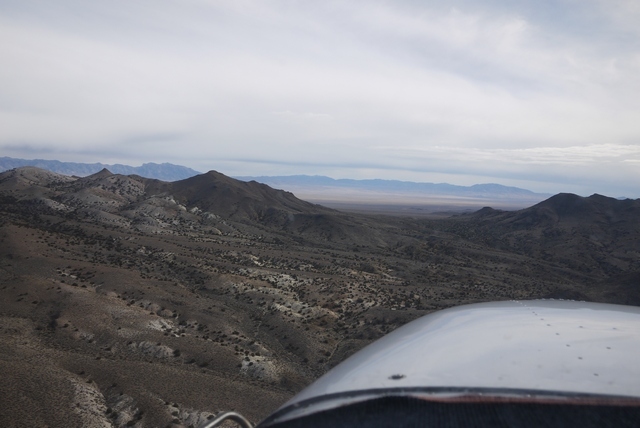
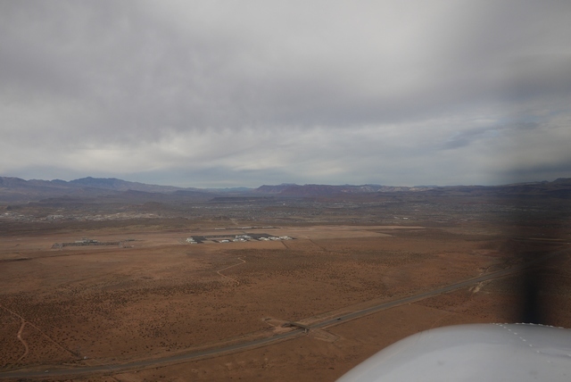
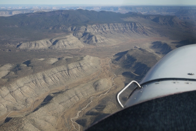
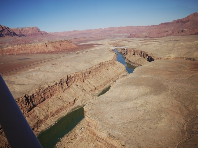
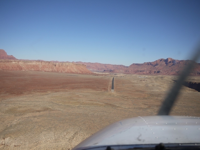
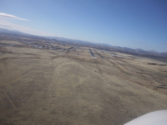
My route today takes me North East, past glorious Sedona, the ‘aircraft carrier’, (No time to visit the brand new airport restaurant today), Flagstaff, Arizona, past the San Fransisco mountains and on into Shiprock, New Mexico in the four corners area before landing at Durango, Colorado. All in one afternoon.
On the horizon is the Shiprock, “like a sailing ship of old standing out to sea”.
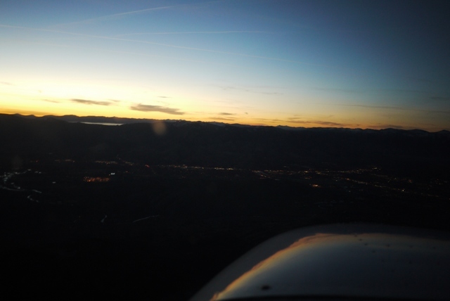
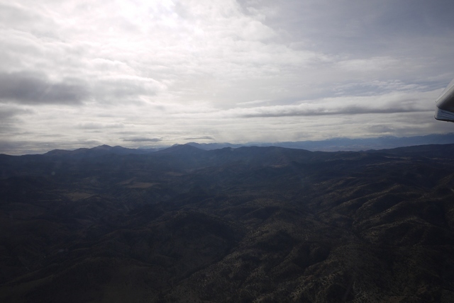
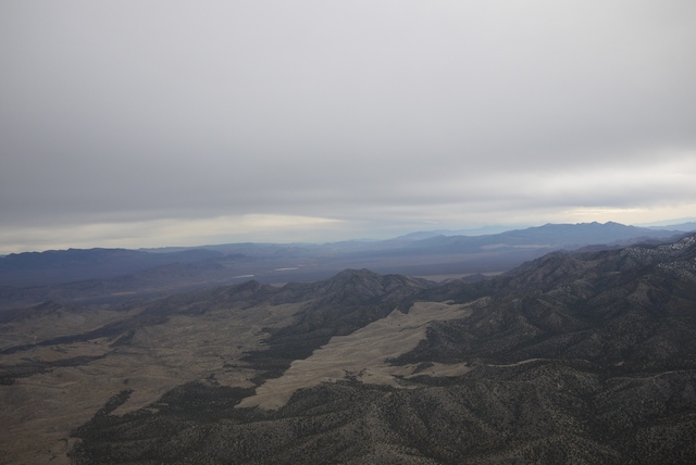
The briefer had already pointed to the weather in the Rockies “we have to say this” he says, “VFR flight not recommended in areas of mountain obscuration”. Well that’s right, but I know the terrain and the various bolt holes to the South and West, like Farmington, New Mexico. And today Durango is in the clear, despite the vast mountain range behind it being completely invisible. I don’t want to sound cavalier about this though – I’ve never had a weather scare out here in more than 30 years flying, partly because of the excellent forcasting and partly because I’m very, very timid about this stuff.
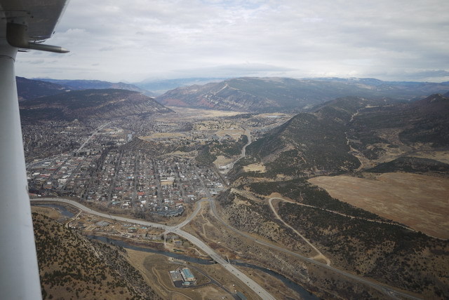
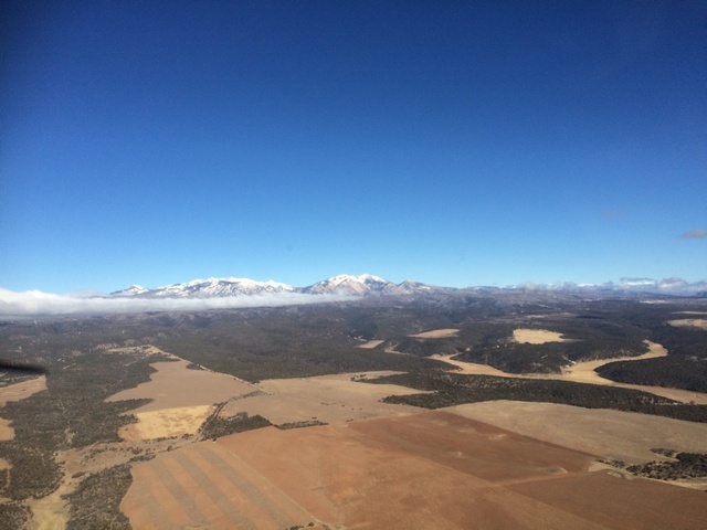
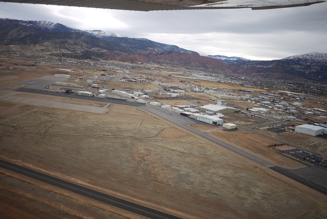
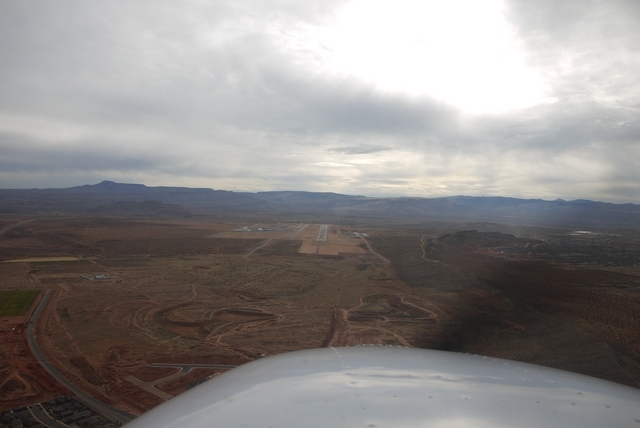
This is Durango, with the San Juan range of the Rockies rising to 14,000’ within 30 miles, in the direction of this picture.
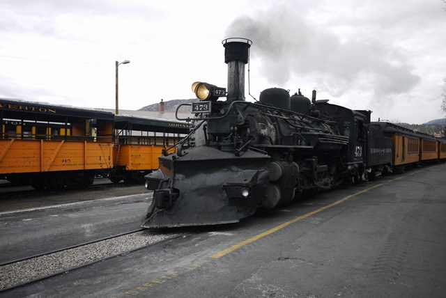
Today I’m landing at Animas Air Park KOOC, which is closer to town than the Durango airport , since I don’t need a rental car for my overnight stop and know from bitter experience that it’s expensive to get a ride there. The friendly FBO refuels my plane and calls a cab for the short ride into town and my hotel, down by the train station. And the train is the main reason people come to Durango.
The Silverton and Durango Railway runs 55 miles through the spectacular Animas River gorge, entirely worked by enormous coal fired steam trains running on a narrow 3’ gauge. And it owes it’s origin to the UK, because the founder got the idea for narrow gauge while visiting the Ffestinog Railway in Wales.
I’m here in time to see the evening train come in, but will have to forgo the chance to ride myself because the next Pacific system is closing in, and I need to be in Vegas on Monday. Never mind – I’ve been here before!
Next time: to Vegas
Chapter 2 – To Vegas
Next morning, low cloud prevails and the Durango airport is giving IFR. Time for a stroll around town! Far to the west, the next Pacific system is charging toward the California coast and promises to bring a lot of moisture into the SW. This has been an unusual winter, because in spite of the atrocious weather in the Eastern US with it’s ‘weather bombs’ and other outrages, the West has been warm and dry. There’s no snow in Durango, something that’s very unusual at this time of year. At least I don’t have to be worried about the plane being iced, or snowed, up.
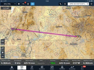
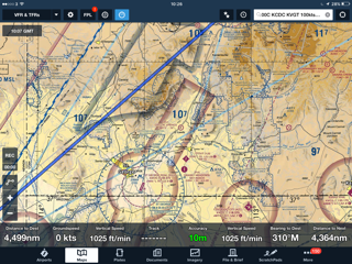
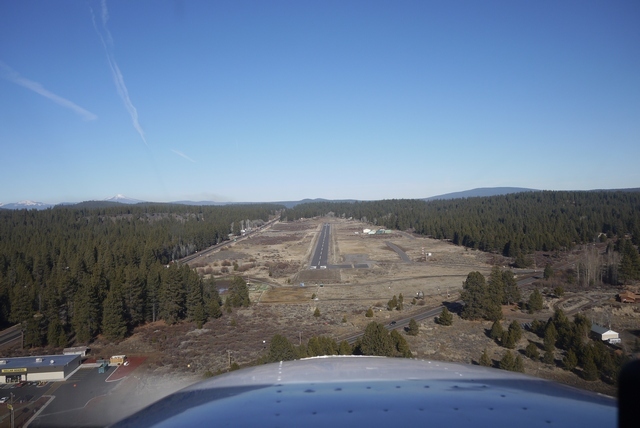
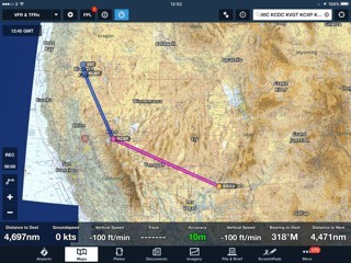
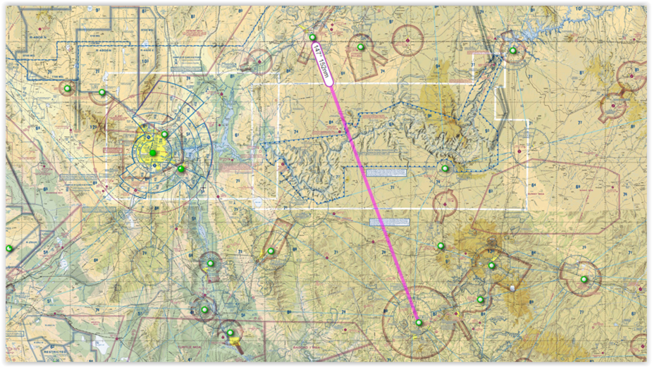
Late morning, the cloud lifts and breaks up. Perfect timing! Here’s today’s route:
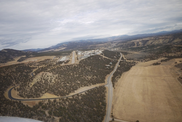
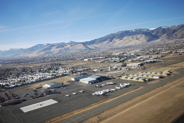
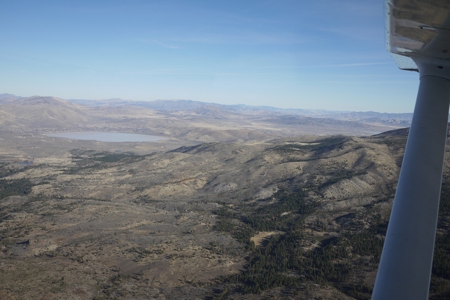
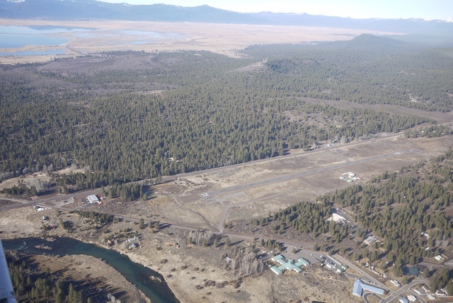
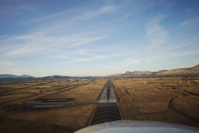
Here’s a last look at Animas air park’s 5000’ runway, elev. 6684’. In the winter, with one POB and full fuel, this altitude offers no surprises for the Cessna SP. In the summer, with 100 deg F, it might be a little different… Altitude is always a concern out here. To get through the mountains between here and Grand Junction, Colorado involves climbing to 14,000’ for a few minutes, which is quite OK if a little asthmatic for the Cessna, but for the pilot and passengers it might be another matter. And just around the corner from here is Telluride, elev. 9070’, where the trees get smaller only very slowly and I would not go in summer, period.
I’ve been blessed with good altitude tolerance and perhaps being based at 5000’ helps with acclimatisation, but a recent trip with a friend through the Rockies at Monarch pass led to some discomfort on his part and a smart descent over the ridge, a reminder that we can never take this country, or ourselves, for granted. Always monitor those vital signs and in my case, work out the time in England. If I can’t do that, it’s time to get more oxygen!
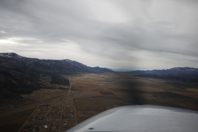
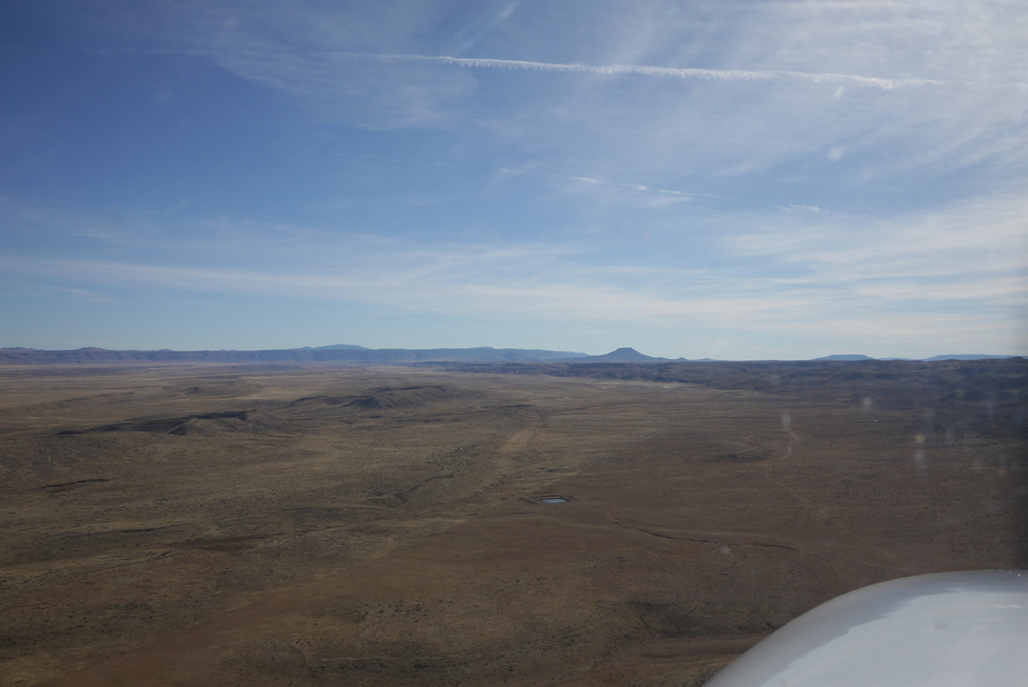
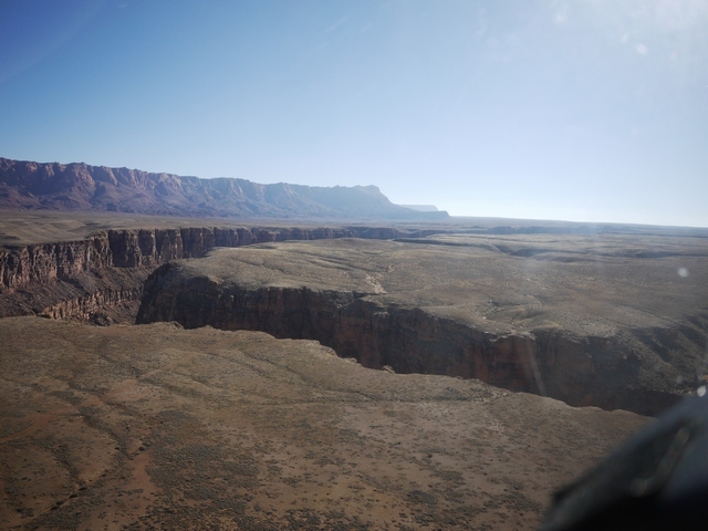
Looking back at the Rockies, we can see the remnants of the morning’s cloud burning off. Ahead, it’s beautiful VFR, despite flight service warning of possible IFR conditions ahead in Utah. Not long after departure, I can see the steam rising from the power plant at Page, Arizona 150 miles to the SW and I know as long as I can see that, (as I will for the next 250 miles), I have an escape route to good VMC. This is the thing about flying in Arizona – you don’t really need a map, because the landmarks, like the 10,000’ Navajo Mountain just south of my track, are visible from one side of the state to the other!
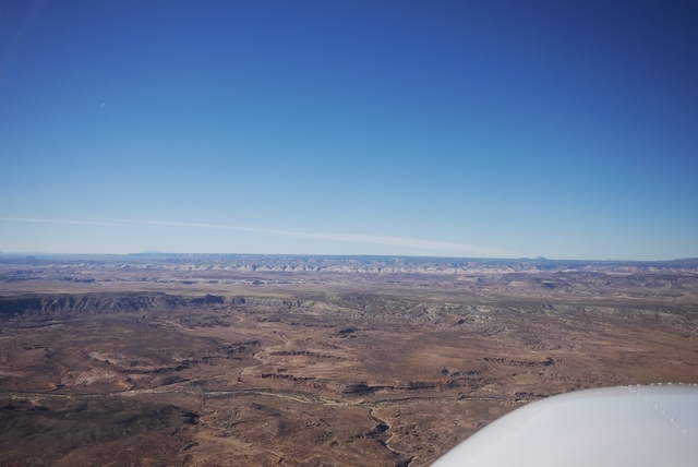
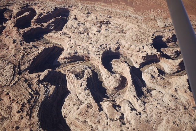
Now something different creeps across my line of flight. The outcrops of Comb Ridge run N-S from one horizon to the other, a razor toothed fault line capped by pearly white limestone. In this country, the mechanism of the Earth is laid bare for geologists to understand and aviators to play with. What a magic carpet the 172 truly is!
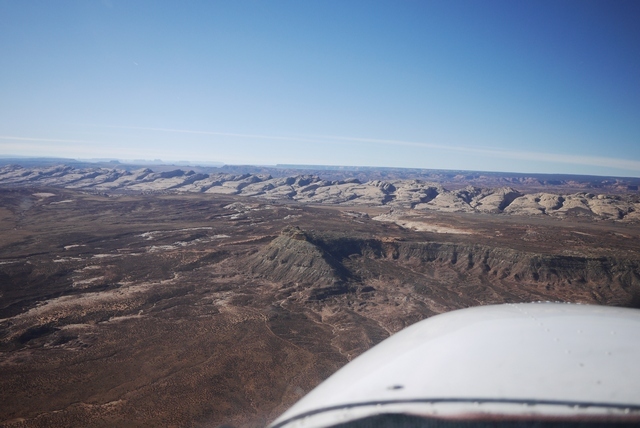
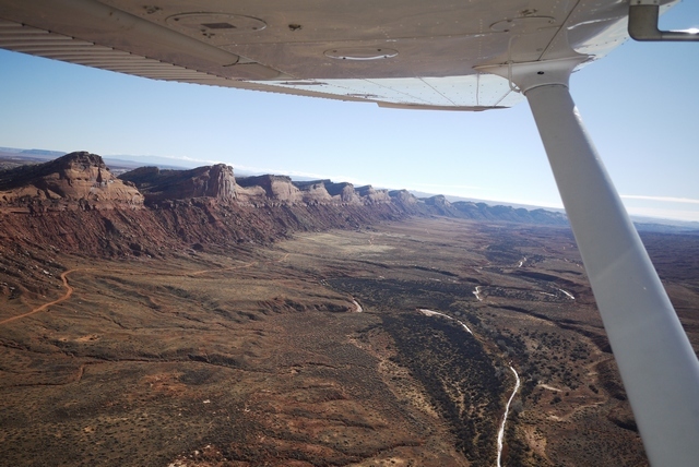
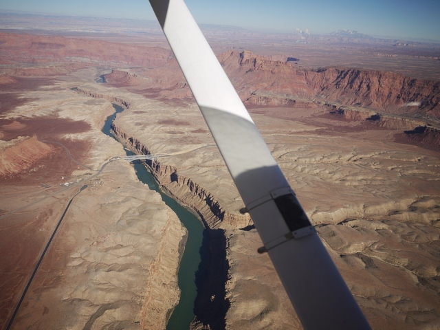
Beyond Comb Ridge, the limestone plateau has been carved into incredible loops and meanders by desert streams, all running down to the mighty Colorado river and the far away Pacific Ocean. Every one of these intricate canyons is a haven for life, the streams lined with green vegetation. What an extraordinary world this is!
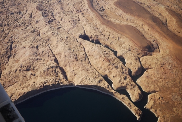
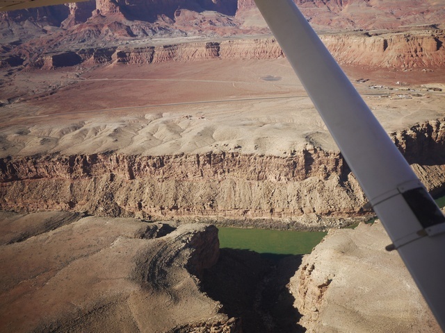
Before long, the Colorado itself creeps into view. Swelled now by the Glen Canyon dam down at Page into the vast outline of Lake Powell, it’s said the shoreline stretches for thousand of miles. Before the dam opened in 1966, the canyons here were in many ways as spectacular as the Grand Canyon itself. Now, they are the playground of thousands on houseboat owners, the tiny white dots on the water far below. (This land is a ‘National Recreation Area’ and pilots are ‘requested’ to fly at least 2000’ above and away from the surface. As a visitor here, I take these rules seriously. Some of the areas’ like the ‘National Sea Shore’ that lines much of the Pacific coast, have the force of law and Rangers have binoculars!)
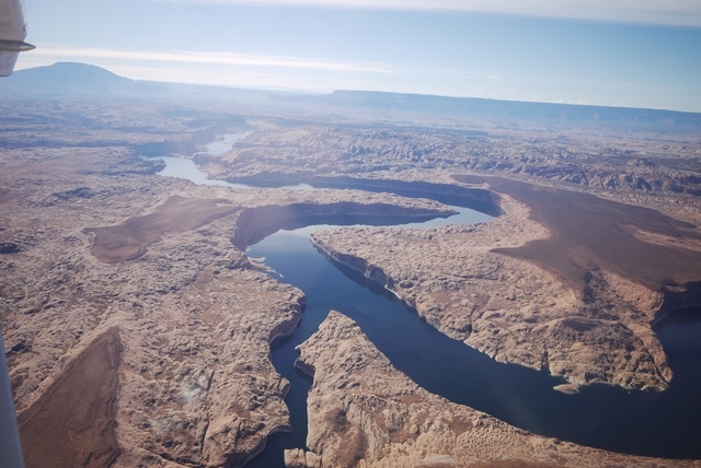
Countless inlets provide spectacular mooring sites. Note the white line along the water – this shows the high water mark, and has been getting ever taller as the SW suffers a prolonged drought lasting many years now. Not to mention the ever increasing water use from the new housing that encroaches ever further into these vast desert lands. When I first flew here, the deserts at night were an unending sea of inky black darkness. Now, everywhere that you look are the twinkling fireflies of habitation, even in the remotest corners.
.
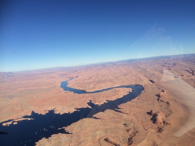
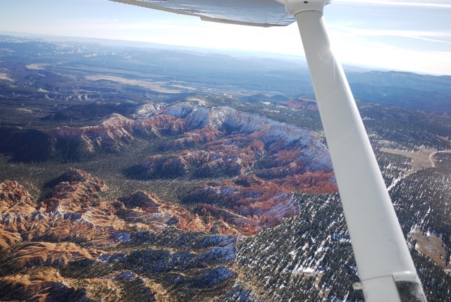
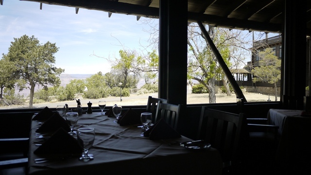
Leaving the Colorado behind, the surface begins a steady climb from 4000’ at the lake, and so do we. Ahead are the spectacular pinnacles of Bryce Canyon and it’s very convenient airport KBCE, one of the most conveniently located in a National Park, at almost 8000’ elev. (Most parks, like Zion mentioned above, involve a fair bit of ground transportation after landing. Grand Canyon is amongst the least convenient, but the doesn’t stop me from visiting the El Tovar hotel at the rim if for lunch if I have the requisite 3-4 Hrs! At Bryce, you can land and hop on a tour bus).
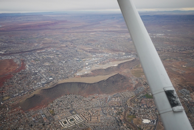
Now at last the final obstacle today, the bottom end of the Warsatch Range, begins to fill the Cessna’s wonderful panoramic wrap-around windscreen. (This one difference between the R, S and SP models and earlier 172’s means everything to me). Beyond, and 6000’ below, is my destination for today – cosy downtown Cedar City KCDC, Utah.
Crossing the ridge line at 11,500’ I begin a lazy descent into the valley beyond and hear another aircraft – the first I’ve heard all day – also going to Cedar City from close to my position, though much lower. We exchange distances on the radio and he’s much faster than me so never a factor, but it’s good to know he’s there. The system of CTAF (Common Traffic Advisory Frequency) works so very very well at these non-towered airports, so much better than our own over-prescriptive arrangements often do.
The forecast IFR conditions are not completely obvious, but actually 100 mi to the N of here, at Salt Lake, it’s well and truly socked in with the combination of atmospheric aerosols and cold temps forming a blanket dense enough to put off CAT, let alone little 172’s! But here, it’s gorgeous – for now. That Pacific storm is still coming on like an express train, and one reason for landing Cedar City is that it’s on the I-15 freeway, just 3 Hrs from Vegas KLAS. So my meeting tomorrow is in the bag, especially since the FBO has their own rental car. But I’m hoping I won’t need it.
Next time: What happens in Vegas…
What happens in Vegas … Gets published on here!
Next morning starts overcast and clear, but not so in Vegas, just 150 mi away to the SW. That Pacific storm is on onshore now, and reaching out beyond the Sierra Nevada mountains into the ‘basin and range’ province that makes up much of Nevada. The TAF for my destination this morning, my old stomping ground of KVGT, North Las Vegas (known locally as ‘Northtown’) is quite OK with 4000’ cloudbase and moderate vis. affecting the last part of my route. And I have plenty of bolt-holes along the way should things not be to my taste. Another great thing about VFR in the US is that virtually any airport is diversion material, without any hang-ups with PPR, landing fees, customs, etc., and so the temptation to press on regardless is greatly reduced.
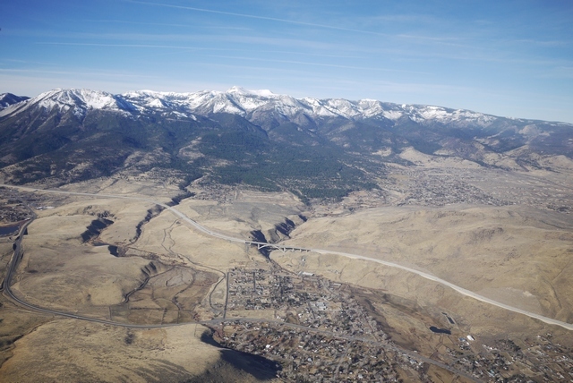
Here’s the ramp at Cedar City, with the lovely little town nestling up against the mountains. Cedar City = Utah = no slot machines! Bliss.
Note how not busy this ramp is. OK, it’s January, and there was a bit of a discussion about moving my plane from outside the FBO to the parking area “in case it got busy” but that wasn’t necessary in the event. A note about brakes here: FBO’s like to move aircraft around the ramp, so never, ever leave the parking brake on. Partly because you don’t want to come back to a puddle of hydraulic fluid on the carpet, and partly because Cessna brakes are so puny the they might not notice when towing, but still twist up the caliper assembly.
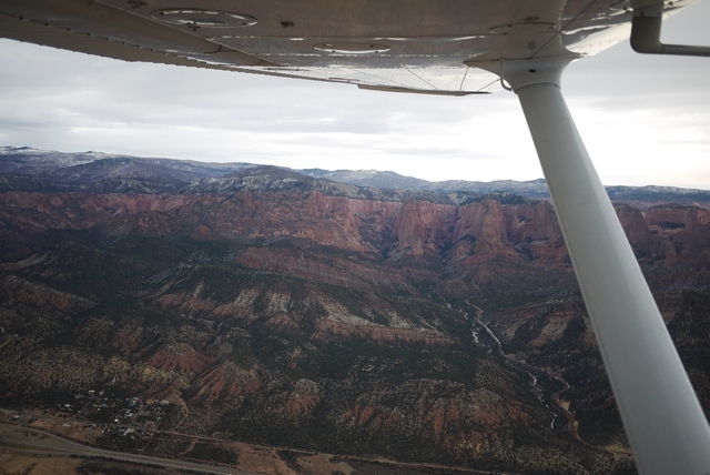
Here’s the way ahead, looking perfectly clear and just visible through the mountains the red rocks of Saint George KSGU, Utah, one of my favourite stop over locations in all America. On the left is Zion, one of the most fabulously scenic National Parks on the whole continent, abd below the I-15 freeway which I’ll be following all the way to Vegas. (IFR!)
And a peek into Zion’s NW corner:
By now I’m in touch with LA Center for flight following, since there will be traffic approaching Vegas and the vis is already declining. It’s perfectly possible to creep into Northtown underneath the Vegas class ‘B’, but on this approach from the N the airspace is controlled by the ever helpful Nellis AFB who never fail to clear a route a) into class B and b) more or less direct Northtown. This is not always the case in the S end of the valley, where things are much busier and clearance into the Bravo may be slow coming. I always pick up flight following when going to a populated area because it simplifies handovers and ensures that you get passed to the correct approach and tower frequencies on arrival.
There is a drawback to flight following though: it can be difficult to cancel a VFR flight plan on arrival. Departing Cedar City, I’ve opened my flight plan with Cedar City Radio, an outlet of the FSS (Flight Service Station) who administer the plans and asked for an onward frequency for flight following in this area, which they look up for me. But once on flight following, it can be difficult to leave, or even switch to box 2, to cancel the plan on arrival for fear of missing something. So you have to be very disciplined about closing on the ground after landing, because it’s so, so easy to get distracted while taxying, parking and shutting down.
As a note, I always give my cellphone number in the FPL, not my home base or worse, number in England. I carry a $20 Walmart PAYG phone for this purpose, because nobody in America will call you back if you give them an international number – they don’t know how. The number is there in case I forget to cancel, because the first thing FSS do if you go (30 mins) overdue is to call the number. Then they call the airport, or if unattended, the Sheriff to go have a look. Only after that do they start talking helicopters. A bit different to NZ, where VFR FPLs are mandatory and fines are automatic for failing to cancel. Ouch!
Here’s the chart:
And Saint George. Note the ‘oldR#8217; airport at centre and the ‘new’ airport just behind the strut at top. The old airport, another ‘aircraft carrier’, was right in the town and great fun. One morning I filed to go there, only to be told by the briefer “Oh no you’re not”. It turned out that was the very morning of opening for the new airport, and I was the third arrival, possibly the first light aircraft, and certainly the first Brit to land there! Initially the location was a pain, so far from town, but the hotels geared up and offer free shuttle services, a half-hour drive, to the Hilton or the Wyndham. The Wyndham is very nice and the lady who drives the bus is a retiree from California who once owned a B-25, used in many movies!
One night long ago in the hotel at the bottom of the mesa at the old airport, I turned up an article in the local paper about a Dinosaur trackway that had just been discovered close to town. “Take the so- and -so ranch road, and turn left at the water tank” it said. Next morning I found the place and found myself walking a dry gulch, in the floor of which were dozens of quite sizeable footprints. There was something quite eerie about following these tracks in this silent and remote place, following a modern stream bed that had been a stream then as well, countless millions of years ago. The closest that you can ever get to this lost world, IMHO. The trackway is long gone, but much of this material can be found in the city’s brand new Dinosaur Museum – well worth a visit.
The northern extremity of Lake Mead, formed by the damming of the Colorado River by the Hoover Dam, comes into view through the worsening vis.
Nellis have cleared me “own navigation” into the Class B direct to Northtown and the Vegas valley creeps into view beyond the ridgeline. There’s quite a bit of rain now and Foreflight’s radar mapping shows I’m headed straight into it. But it also shows the Metar for VGT is still VFR with an adequate cloudbase. Obviously this relies on a 3G/4G connection, but my experience is that iPad will get data much of the time when in range (10-20 mi) of habitations. During a long cross country, even in remote country, it’s always possible to get updates at intervals and it really makes a big difference to VFR flying because you can avoid or work around weather, or simply land and wait it out.
A note: for this to work, you really need a bona fide AT&T sim card in the iPad. Other brands, even if working on AT&T, suffer from all kinds of throttling. This includes 3’s otherwise excellent ‘feel at home’ feature, which I use for all UK calls with perfect results, but not for data. So my first port of call on arriving in the US is an AT&T store, where you can buy a sim for cash, avoiding the ‘foreign credit card’ issue which is still prevalent. In my experience no sim bought from ebay etc. offers the same connectivity as a genuine AT&T sim.
On my left, passing Nellis, is Frenchman Mountain looming in the murk (actually 10 mi). You have to watch this one, because it moves! Specifically, it’s moved 70 mi in 50 million years and if you’d been stuck in the hold at McCarran for that long you’d have seen it creeping up on you. I’m not making this up! (Well, the hold at McCarran bit perhaps.)
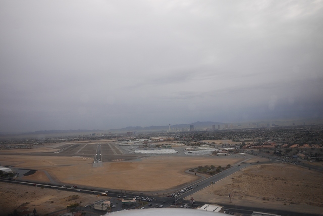
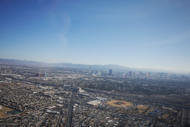
Soon the valley opens out and Northtown (centre) comes into view, with the Las Vegas strip behind. This approach from the North is very leisurely, but some of the published VFR routes can involve very rapid descents after being handed over by Las Vegas (in the class B) to VGT tower at the last possible moment. The published route from Lake Mead involves local landmarks like the ‘Showboat’ (now the ‘El Cortez’) and the Spaghetti Bowl freeway intersection. In the days before Foreflight, some of this could be challenging, being dumped out at 4500’ 3mi from an airport at 2000’ and expected to join base or something. How VFR flying has changed thanks to iPad.
Finally, final for 12R, having crossed the 12L approach which is also being flown by a faster twin who lands ahead of me. Northtown has a bit of a reputation as a runway incursion hot spot (I nearly wrote ‘capital of the world’, but those days are gone. Apparently). Note the crossing 30 runway, just beyond the threshold, which is also simultaneously in use. My landing is uneventful (and familiar – I’ve been flying here for quite a few years) but quite recently on final I was asked “are you LAHSO equipped?” which I didn’t know the answer to – some sort of automatic braking? so I replied “affirm I can land short” which seemed to be good enough. LAHSO – Land and Hold Short – was basically invented at Northtown after some fairly shocking roll-out collisions involving intersecting runways.
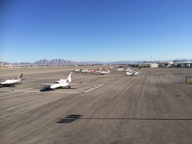
Taxying in, I’m aware of the empty transient ramp, traditionally occupied by lines of parked aircraft on this pre-show day of the Consumer Electronics Show (CES), supposedly the biggest consumer electronics trade show in the world and reason for my annual pilgrimage to Las Vegas. I’m so surprised at being able to park in the front row that I have to mentally note that essential chore – close the flight plan – before closing down. (Controllers in the US won’t close flight plans for you automatically, or even on request, and while you can sometimes reach FSS frequencies on the ground that doesn’t work at VGT, so you have to make to call on your cellphone). In the days before cellphones (that worked) it really was a nightmare and several times I got close to the wire.
Nowadays, landing at a quiet or unattended field, I always call up FSS in the air to close ‘field in sight’. I tried that in UK once, only to get bawled out by some agressive ATC, back in the days when VFR FPL’s even mattered. Here’s the ramp, actually some days later, showing hardly anyone else parked in the meantime.
Well that’s it for a few days, all flying done, as I hunker down for the 15 miles of aisles in this vast show, jostling with 200,000 other delegates from all over the world. Even, rarely, other Brits. Just as well, as the storm arrives. No more aviation for me – or so I think.
That evening about 7,000 of us trudge over to the new Aria auditorium to hear the opening keynote, presented by Intel CEO Brian Krzanich. Brian spends the first 10 minutes of his presentation apologising for the latest security flaws, the cure for which is only going to affect the performance of every computer everywhere “only a little”. Apparently.
And then Brian gets into the business of the evening – drones. Amongst a medley of stage acts (That have something to do with consumer electronics, or not), he introduces an indoor drone show. These drones, 110 of them, are Intel branded and feature proprietary indoor non-gps location sensing, flying a 5 min routine that comes out into the audience. It’s quite surprising and impressive. The nearest thing I’ve seen to the daily sunset departure of a million bats from Carlsbad Natural Caverns in New Mexico, where the cave mouth has been made into an auditorium and the bats spiral up through the audience.
Come to think about it, Brian does have a bit of ways to go. However he plunges on, and reaches his piece de resistance – the Volocopter. Now Intel branded, this multicopter human capable drone is going to revolutionise inner city travel, and presumably Intel’s fortunes in a chip market that seems to drifting away from computers toward cellphones. The Volocopter (I established later) has a duration of 30 mins, running about 100Kw, with a typical mission time of 10 mins and a 2 Hr recharge time. It’s main cost advantage over conventional aircraft is, apparently, the absence of any need for routine maintenance or ‘tear down annual’ according to one of the staffers. Indeed the only maintenance would be occasional replacement of the 18 model airplane propellers that drive it and annual battery swap outs.
To prove the point, Brian unveiled the full size Volocopter on stage in what he said was the first ever indoor demonstration of one of the devices. In the picture you can see it’s heavily roped down, and the audience is protected from any shrapnel that might arise by heavy transparent curtains. Nevertheless, he did fly it, if not in it. Apparently he has done that as well. So the future of consumer electronics is in: aviation! Hmmm…
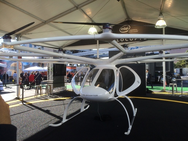
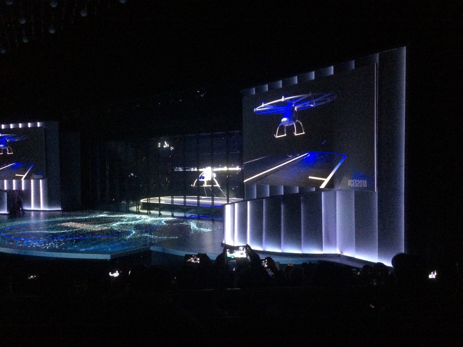
(This is an actual picture. The real Volocopter is stage centre. The image top right is a projection screen. Note the strong ropes and heavy curtains).
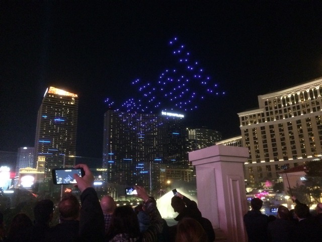
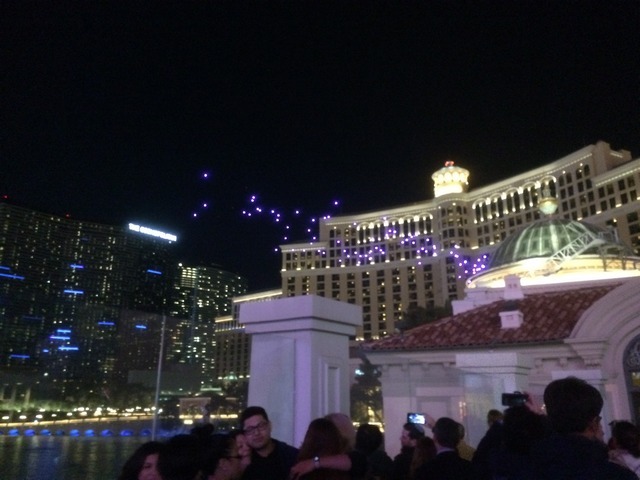
Later in the week, Intel ran an outdoor drone show, this time with 300 drones. The repertoire is pre-programmed, but the recovery is interesting featuring batches of drones forming a loose gaggle back to the stage and behaving more spontaneously, or so it appeared. (2nd pic)
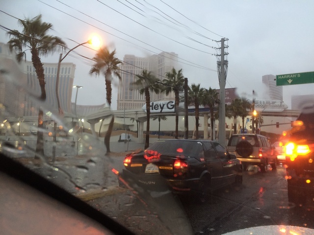
But tonight, the weather really closes in. In the next 24 Hrs, it rains continuously. My timing, with the aircraft safely parked, could not be more fortuitous. The drone shows are called off – drones are not (yet) waterproof. And Las Vegas drowns, in rain and also in traffic – the worst I’ve ever seen. Roll on Friday, when the skies are brighter and horizons clear. For now, it’s a 15 mile slog around the show.
Next time: TGIF!
Chapter 4 – Friday at last!
First a correction – what I said about being stuck in the hold at McCarran for 50 million years was absolute drivel, obviously. In practice, you’d only have to have been there for 10 million years to see Frenchman Mountain come marching up from the East, forming the basin that is now Lake Mead behind it. The geology in this part of Nevada is really quite young. Here’s another view of Frenchman mountain, Nellis AFB just off to the L and downtown Vegas away to the R.
CES this year will be memorable as the ‘year of AI’. I already mentioned in the ‘flying without GPS’ thread that the type of AI coming soon to a cellphone near you will make mincemeat out of visual navigation, and all without access to the (computer) cloud. Unlike human pilots, who frequently have trouble telling one mountain range from the next, tomorrow’s cellphone will take one peek and nail your position 100%. So long as it’s not raining, or cloudy, or dark etc..
I actually believe this because of what’s happened with VFR navigation out here in the West. In the beginning, there were printed sectionals covering about 500 mi E-W, which involved some complex joggling when your route crossed the border between one sectional and the next. To get over that, you had a ‘Jet Chart’, covering the entire country, and used that to transfer track lines to the sectional. (And you had to pack an 18" ruler). Then came Runway Finder, an iPad mash-up that allowed route plotting without having to find a hotel with a 10’ chart table in the room. By the time poor, wonderful Runway Finder was closed down by evil patent trolls, there was Foreflight, ready to go. The transformation in pre-flight planning that these tools have allowed is nothing less than astonishing.
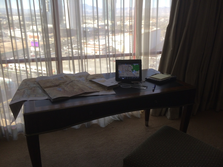
Yes, I do still mark up paper charts! Here’s that elusive hotel plotting table, used to draw track lines from Foreflight. It’s a nice day in the morning this Friday.
CES winds up on Friday and by luchtime even the Chinese are packing their displays away. Anyway, I’m really not able to walk further. I make for Northtown. This CES has been phenomenal, truly memorable, and a year that I think we will come to look back on as a turning point from dumb accessories to AI.
(Just to mention that there are other airports in Vegas: Henderson KHND to the South, a nice place a little further out than Northtown but with a good approach clear of the Bravo if you are coming from LA. And of course McCarran itself. Unfortunately, the FBO’s there are inconveniently placed on the wrong side of the field and are always busy ferrying real high rollers. Very pleasant though, if you don’t mind paying $8.00 for gas. Yup, that’s £1.50 / Litre – almost Euro money!
It’s 2.00 pm before I start up and my flight up to Carson City KCXP, Nevada will take the best part of 4 Hr with a modest headwind. It’ll be getting dark…
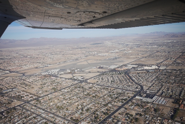
Taking off to the SE, the Stratosphere (with it’s roller coaster on top) is at centre, downtown Las Vegas to the L, and the strip to the right. Here, we are right under the Class ‘B’ and any further ahead would require a clearance. Northtown (and many other towered airports) has a separate frequency for clearance delivery and will give you an onward frequency for departure (depending on direction) along with a squawk. So it’s perfectly feasible to take off and keep straight ahead, knowing that tower will tell you to “call approach” in time to get a clearance into the Bravo before you actually get there. Or even tell you “Cleared into class ‘B’” before take off. Don’t try that at home!
A normal routing will take you down the strip, over McCarran and out of the Bravo near Henderson following the freeway toward LA. But it’s perfectly normal to ask for, or even be offered, a ‘Strip tour’, down to the airport boundary and back again. Not today, though. I swing away to the NW, never entering the Bravo, and set course toward the distant Sierra Nevada mountains. Here’s a last glance at wonderful Northtown, where the terminal building cafe is now open again after a long sojourn. (The lack of a cafe was a major reason for wholesale desertion down to Henderson). Gone with new decoration are the hundred’s of pilot’s signatures that once adorned the walls (including mine) but I suspect it won’t be long before someone starts that up again…
Left of track is 10’000’ Mt Charleston, and at the top a superb ski lodge with a colossal open hearth fire in the middle of the lounge, all within sight out of the windows of Las Vegas, but a million miles away in every other sense. On the Right, just beyond the highway, is the restricted airspace of the Nevada Test Site and way out there, Groom Lake, aka Area 51.
I suppose most pilots have their own UFO stories, and mine concerns late one night, driving down off Mt Charleston, on the long straight highway the faces due E toward the test site. High up I notice a fast moving brilliant green light apparently falling vertically toward the ground. I’ve never seen, or heard of, a green meteor and this maintained a constant brightness as it fell from the high overhead toward the horizon, where it vanished behind the nearest mountain range. This put a minimum range on it of 10 miles and in the unrestricted visiblity it easily could have been 100 miles away. So what’s bright green and falls vertically from the sky in 5-10 seconds in a secret test range? Answers on a postcard, please.
After half an hour or so, I round the Northern tip of the Charleston Mountains and, clear of the restricted airspace, finally set a direct course. 20 miles back, Vegas departure said I was going out of range and cancel my flight following, which I used to keep me clear of traffic leaving Northtown and up through their practice area. I change to the FSS frequency, and request activate my VFR FPL “off of Northtown at (time)”. And that’s it – no more radio contact for 300 miles. Far away on the Left is Death Valley, a nice little day trip from Northtown, with it’s unattended runway and phone kiosk, where you have a choice of “The Ranch” or “The Inn”, both of which will pick up from the airport. Before the phone box (and cell phones) it was a long and ill-advised walk. Amazingly, the maximum distance that a person can walk out here (in daytime, no water) is seven miles.
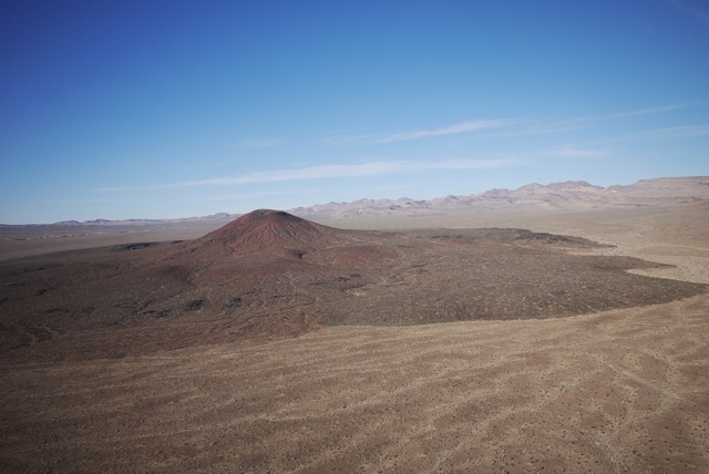
This terrain is a geologic wonderland (did I mention that?). Here, a cinder cone breaks through the surface, looking for all the world like it formed yesterday. And in geologic terms, it did. The San Francisco mountains near Flagstaff were active only 10,000 years ago, and one cinder cone, Sunset Crater, was actually inhabited by Indian peoples at the time. Now, the volcanoes are silent – or are they?
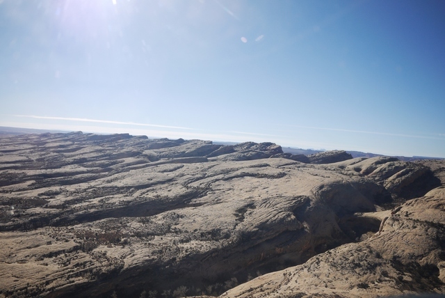
Each ridge line is a gateway to another vista, a gateway to another world. In my dreams, I can say that I’ve been to Mars, because some of this terrain is indistinguishable from the rover Opportunity’s images.
I’m keeping low because of the headwind (and I like the scenery) but the transponder light never goes silent like it does in Scandinavia. But if the engine stopped now? Much of this terrain is land-able and I keep cruise speed on so that, if anything faltered, I have a bit of kinetic energy to choose a spot. In the sidewall pocket is my PLB, and of course the Cessna has a panel mount ELT. In the back is a survival kit and two gallons of water, plus numerous free bottles handed out by FBO’s along the route. If I survive the landing, I might last long enough to be rescued, so long as I keep to the cardinal rule: stay with the plane.
Of course the engine could stop, but the primary reason for that – fuel exhaustion – is much less likely because a) The Cessna is on ‘both’ and crossfeeds and b) because at every stop, the FBO rushes out to fill her up before someone else gets there. And in this simple observation is the key to operating a Cessna in the US: you don’t need your own stepladder, or far less need to balance precariously on the flimsy feeling step, one hand supporting the heavy fuel hose and the other hanging on to – err something – like grim death. This single reason, IMHO, explains Cessna’s success in the US market while in Europe the PA-28 is your only defence against the baleful expressions of ‘refuellers’ who sit in their tiny heated huts watching you fuel the plane yourself.
It’s this fuelling enthusiasm that lies behind my ‘always top it off, every flight’ philosophy. On my own, I only have to worry about DA, and the Cessna POH makes that very simple. A few higher airports have a DA display at the hold and all mention it in the ATIS, but will it fly? I once had mushy takeoff at 7000’ elevation, requiring me to fly in ground effect for almost the length of the runway to get climb speed, and that taught me that technique matters as much as the book. Rotate too early and it can be hard to build speed at high altitudes and temps. Wait for the speed to reach 60 on the ground and she’ll fly, regardless of the runway you’re using up. After all, runways are long out here (Grand Canyon’s is 9000’ at 6600’ elevation) and they don’t charge by the length of ground roll!
Now the shadows are forming and the horizon forms a most beautiful apparition.
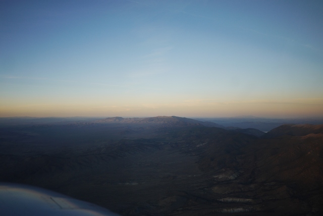
Still 70 miles to go and my “always a diversionary field” philosophy starts to break down. There are runways out here sure enough, but none with hotels, restaurants, etc.. Anyway, I’m night current, I’ve checked the lights, iPad is illuminated with Foreflight, so what can possibly go wrong? It takes a long time to get dark, perhaps because the air is so clear, as the sun sinks remorselessly behind the Sierra Nevada mountains not so far to the West now.
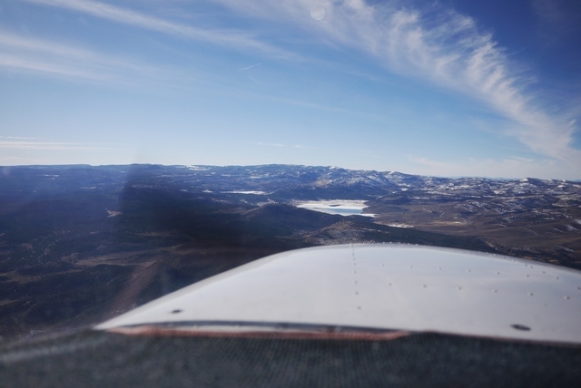
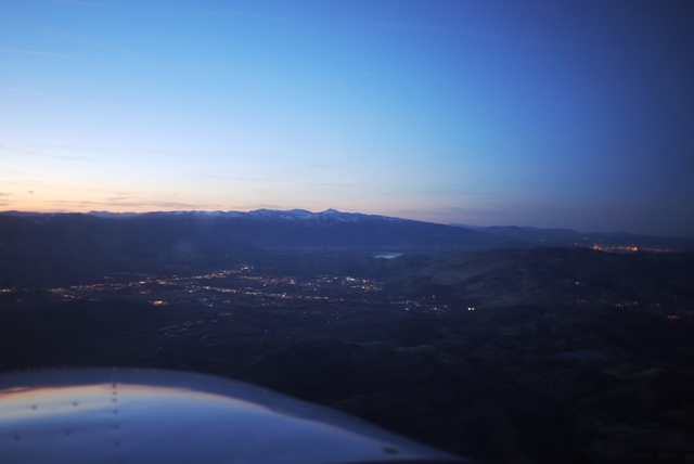
My only concern is the tall ridge that stands between me and Carson City, so I stay high (11,000’) and in the evening twilight, I can still see the terrain clearly enough. The valley beyond is an inky black bowl, and right where it should be, Carson City. Just then, a voice comes on the radio “Lake Amphibian, landing Carson City” and in response, not even the ‘click click click’, the lights come up and there’s the runway!
As I descend into the bowl of darkness, keeping the Lake Amphibian in sight, the fallacy of my pre-flight comes to, er, light – the light in the ASI doesn’t work! Well, no problem, I can fly without an ASI. And I can angle one of the map reading lights to cast a glow over it. Now, I’m spiralling down into the valley, 11,500’ down to 4,000’ bringing the power back in stages to avoid shock cooling (which is reputedly impossible with an IO-360 anyway, but I don’t want to be the one to find out). The view out of the window is truly glorious, and the outline of the jagged mountain ridges still discernable, but a comfort is Foreflight, so I’m not guessing what I’m descending over. At this point, the camera runs out of exposure (It’s a fixed focus wide angle setup) so I can only offer one more, a view of Lake Tahoe peeking through a gap in the Sierras, and it’s time to land.
Next time: The Oregon trail.
Chapter 5 – to Oregon!
A beautiful morning and an early departure. The local casino picks up from the airport, using a regular cab and refunding the driver. I tend to choose airports on the basis of having hotels nearby that pick up, because anything else can involve unpredictable cab rides or even car rental to get to someplace suitable for the night. And hotels that pick up always seem to have some special rate with the FBO intended for aircrew, which I sort of am.
The crucial tool in hotel finding is Airnav which lists both FBO’s and hotels. Once upon a time it used to list ‘Hotels that pick up’ but sadly that fell foul of some problem or other, and so nowadays they just give distance from the airport. Still pretty helpful, but you end up calling the FBO and asking them. But often they ask “can I make a reservation for you” which I always resist, because one of the worst things in flying out here is press-on-itis, driven by a paid for hotel reservation.
Behind the airport, the Sierra Nevadas tower majestically. The mountains present a bigger obstacle to small airplanes than the Rockies because although the are lower (12000’ vs 14000’) they are much deeper at around 30 mi for a crossing, meaning up to half an hour at 14000’ in the 172, right on the FAA and my personal limit. And in the winter, all the valleys up there are full of snow, and the roads closed. A forced landing might be problematic.
As it happens, if I turn left just now, I could fly through one of the few low level routes in the Sierras at Donner Lake, leading through to Sacramento at just over 7000’. This is the place where, in 1846, the the now eponymous Donner Party had the same idea and in 1867 the Central Pacific drove the first transcontinental railroad from ‘sea to shining sea’. But not for me the joys of California on this brilliant winter morning. My course is North to Oregon!
Today, the same pass carries the I-80, a superhighway that runs almost 3000 mi from San Fransisco to New York – nearly. Actually, having beaten the Sierra Nevadas and the Rockies, it kind of disappears in the suburbs of new York where planning objections became too virulent, a familiar story on this side of the Atlantic!
Ahead is Reno and it’s Class C airspace. The difference between class D and class C? Both require 2-way radio contact, neither require a clearance, but only class C has a transponder requirement. Yeah, I didn’t know that until recently either. Reno’s a busy airport that in UK would involve all kinds of airspace shenanigans, but here just a polite request from approach for me to “route along the west side of the valley” which is my intention anyway. Just try entering Solent Class D just with 2-way radio contact and see what happens!
I have to say that I’ve never actually landed at KRNO Reno. The idea of a mini Las Vegas, having just escaped from the real thing, jut doesn’t appeal. But I expect they have plenty of hotel choice and the experience of Atlantic (the only FBO) might not be too punishing. But it’s interesting that under FBO’s on Reno’s Airnav page,Mountain West have a big ad saying “come to Carson City instead, only 20 miles!” Hmm. This question of exclusive FBO’s is a real hot potato at the moment, with one of them (KJAC Jackson Hole, Wyo) being shown the door recently courtesy of AOPA agitation.
(When I landed at Jackson Hole a few years back, I made some remark about it “feeling just like home” to which they were silly enough to ask in reply “in what way?” so I told them in the way of their $20 landing fee. A very polite discussion ensued, during which I explained the corrosive effect of landing fees on UK GA which genuinely surprised them. And they are right in Yellowstone National Park, so they have some little justification in terms of limiting demand at what is seen as a ‘challenging’ airport).
Just to NW of Reno is Reno Stead, home of the famous air races. Not quite my cup of tea, but one of the few places where you can see a bona fide engine failure / forced landing on demand! In my case, a P51 whose deadstick landing ended perfectly on the main runway. The amazing thing (to European eyes) about Stead is that, from the stand, you can see the entire 8 mile course, right out to the furthest turning point. For me, the best part about the air races was flying there in a 172 from Boundary Bay, Canada, but that’s a whole other story).
Reno Stead right centre.
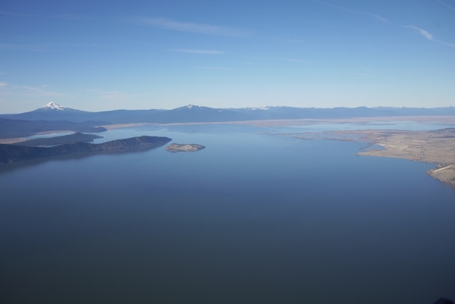
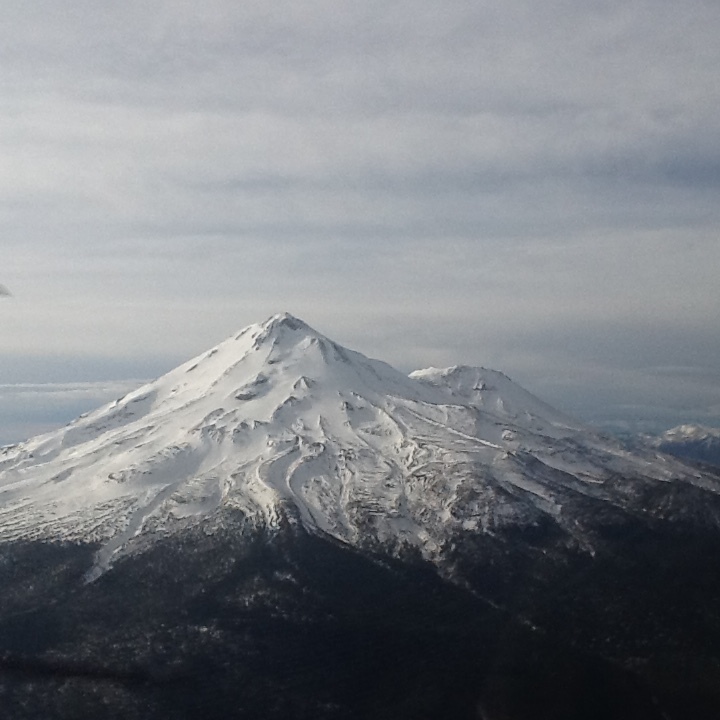
Ahead now, the volcanic cone of Mount Shasta peeks above the horizon. Shasta, at 14000’, is the first of the Pacific Cascade volcanoes which march in a straight line Northwards toward Canada. These mountains form the final barrier to the sea and contain the best known American Volcano, Mount St. Helens. At least these volcanoes make navigation up here easy (on a good day) and no sooner has Shasta drifted astern than the next one, Mount McLoughlin, comes into view.
Incidentally, the volcanoes are here because this marks the spot where the Pacific plate has dived down far beneath the North American plate and reached a depth (about 50 mi) and temperature high enough to form Magma plumes. It’s these plumes, rising back to the surface, that emerge as volcanoes and explains why they form a regular line about 100 mi inland from the coast. It’s believed that the entrapment of seawater and organically formed sediments in the subsiding seabed allows these fluid plumes to form, which suggests that surface geology has a lot to do with ancient life entrained far beneath our feet!
In the foreground is KLMT Klamath Falls, a place once only known to me as the name of a sectional chart. (The other one was ‘McMinneville Radio’, the callsign of the FSS radio station up here. “Where the devil is McMinnville” we would say, but now it is the new home of the Spruce Goose at the Evergreen Air Museum near Portland and justly famous).
Klamath Falls is a very nice hometown airport in a beautiful setting, but it is not my destination today. That lies further north along the shores of Klamath Lake at the tiny town of Ciloquin.
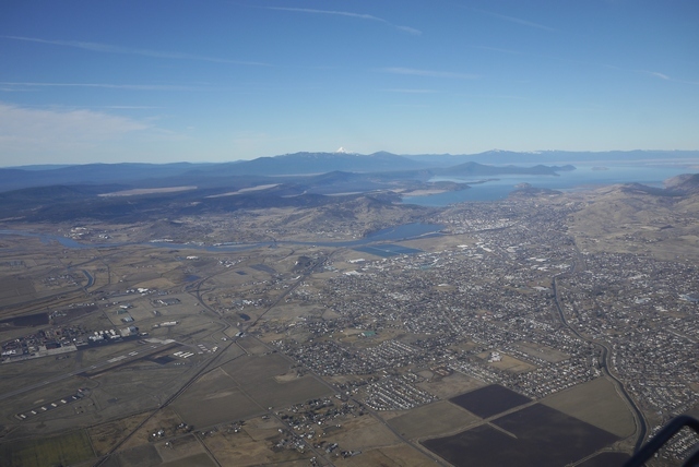
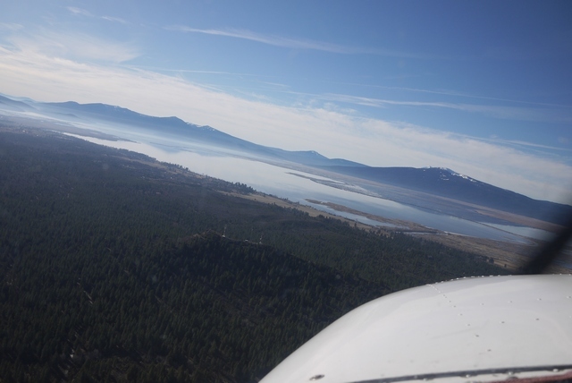
Klamath Lake opens up before me and I stick to the shoreline, following the highway which would be about the only place to land out here. On the horizon, jagged peaks of the Cascades line the skyline, and amongst them dead ahead, Crater Lake. More of that later.
And now, my destination for today, K2S7 Chiloquin State, slides into view. (We should be a little careful about these airfield designators. ‘K2S7’ is not a real ICAO designator because presumably there are too many secondary airports like this for them all to be listed. Type ‘K2S7’ into the KLN-94 and it won’t know it. In real life, it’s just ‘2S7’). It’ll catch you out once or twice until you get used to it.
Chiloquin State is an unattended field, 3,700’ at an elevation of 4,221’ MSL. It has no facilities and certainly no snow clearing. Every other time I’ve been past here it’s been snow bound and so this winter is exceptional, not only for the lack of snow but also the 60 deg F temperature on the ground. I don’t expect any traffic but nonetheless keep a good look out and make all the usual calls on the CTAF. There’s no reply.
The wind is light and the slight upslope on the 35 runway makes for an easy decision. On the passenger seat I have the ‘AFD’ (Airport Facility Directory) for the NW, page folded back for 2S7. This is the bible for airport info, and at $7 a throw, I buy new editions covering my trip every time. OK, the same info is in Foreflight and Airnav, but what if the battery dies? Etc.. Anyway, one crucial bit of info is the pattern (circuit) direction and if it says ‘RH’, I draw curved arrows on the page to remind me in case I’m getting punchy at the end of a long flight. No such stipulation for Chiloquin however.
Normally, you would approach a field like this with a ‘45 deg’ join. In this case, that would mean flying out NW of the field and making a RH teardrop back toward the runway and joining from 2 mi out at 45 deg to the downwind. That’s right, right hand turns for a L pattern. We’re not in UK now! In this case, I’m happy that there’s no conflicting traffic and I want to fly the runway centreline to have a good look anyway, so I continue directly to the airport.
Turning downwind, the view is stunning.
Turning base, I notice a train wending it’s way along the forest edge just R of centre. Bit of a clue here! Notice the base turn is fairly close in. The pattern is flown fairly close in here, none of the ‘bomber circuits’ we are so familiar with in UK. A mile from the airport is considered about right. Doubtless this has a lot to do with complainers in UK and the proximity of villages to many of our WW2 airfields.
And now on to final.
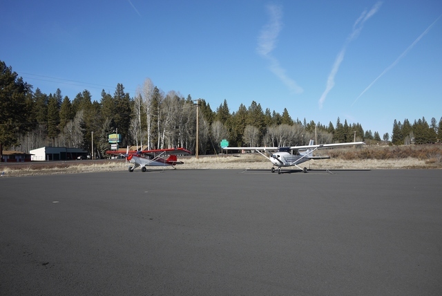
And to parking, right outside Melita’s restaurant. Surprisingly, there’s another plane here! And, as at even the smallest fields, adequate and robust tie down points. In this country, you don’t walk away from your plane without tying it down first!
Next Time: Train Mountain!
Train Mountain
A long time ago, I stopped over in Klamath Falls KLMT. On departure, the very helpful FBO guy said “Say, did you get to Train Mountain?”. Since my Son and I run a miniature steam locomotive in UK, this certainly got my attention. “Sure, he said, they’ve got a whole mountain covered in railroad tracks up there”. Well, no I did not know about train Mountain, and my schedule would not permit the 60 mile drive to see it – that time. It was with a heavy heart that I departed back to Arizona, wondering if I’d ever pass that way again.
Well, needless to say I have arranged that contrivance of ‘passing by’ quite a few times since, but 2018 was the first year that the runway at Ciloquin State 2S7 has been clear of snow during my trips along the West Coast. And Chiloquin State is across the road from Train Mountain!
Well, I know this isn’t a train site and that not all of you will share my love for the muckier, or steamier, side of life. So I hope this picture says it all:
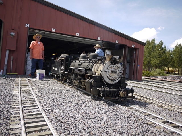
This loco is a 1/4 scale model of an engine running on the Silverton & Durango line in Colorado (Where I was last weekend!) and weighs almost 2000 lbs. You might wonder where there would be a miniature railway big enough for such a model, and Train Mountain is just the place. Because they have 37 miles of 7.5" gauge track! Yes, that’s 37 miles.
Well that’s enough train stuff. My route today goes back to Klamath, and then onward to Saint George, Utah KSGU. But before departing, here’s a view to the North. (In other years, I’ve continued along the coast as far as Seattle and Bellingham, Washington. I’ll write up that part of the route separately if Peter doesn’t tell me “No more, Please!” in the meantime).
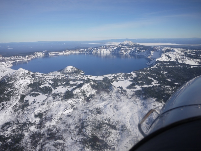
Crater Lake is just 25 miles NW of Train Mountain and this picture, taken in 2017, shows the fairly harsh terrain to advantage. The mountains in the rim stand 2000’ above the lake, which is 7 miles in diameter and itself is at 6000’ elev. Crater lake is itself a National Park and so the “not below 2000’” request applies. But in winter, even the Ranger station is often deserted…
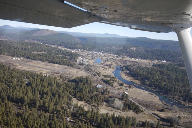
Back in 2018’s much milder winter, Klamath Falls lies just around the headland.
Soon, Klamath’s long runway opens up. This is a towered airport and the controller deftly sequences my straight in with other traffic in the pattern.
That evening, I step across the street to the local multiplex where “Darkest Hour” is playing. I don’t know what to expect from the movie, or the local audience who seem to be a broad cross section of the community. So it’s intriguing to hear them reacting to some of the more moving scenes in the film. Even the one where Roosevelt tells Churchill over a scrambler phone (not invented until 1942) that he can tow the P40’s he’s ordered across the Canadian border with horses. At the end, many stay behind as I do to watch the credits and file out of the theater deep in contemplation.
(I once had a remarkably similar experience, back when the movie ‘Memphis Belle’ came out. That time, in a local Las Vegas cinema far from the strip down on Eastern Avenue, the audience consisted mainly of boisterous teenagers. So it remained for the first 15 mins or so, but as it became apparent that the crew were of a similar age in the film to the modern audience, they became quieter, and then silent. When in it that seminal scene the landing gear goes ‘clunk’ just as the tyre scrubs the tarmac, they let out a collective sigh of relief. I fancy that those youngsters learnt something that night. For me, watching the green fields of England slide by beneath the aeroplane (even if they are criss-crossed by modern tramlines) was surreal, sitting in that cinema so far from home).
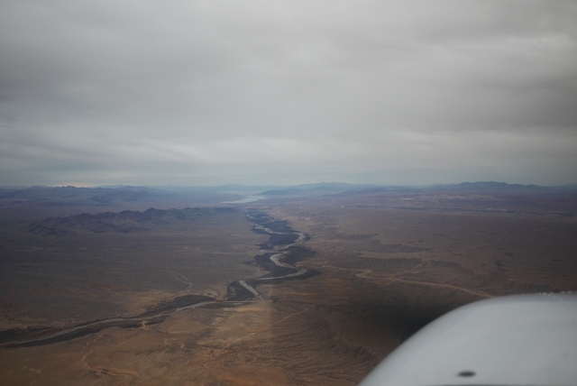
On Monday, the next Pacific storm system is pressing from the North West and I need to move on – otherwise, I could be here for some time. My route will take me across the desolate heart of northern Nevada and down into Utah.
But the weather is not so pressing as to preclude a little excursion across to Mt Shasta.
This 14000’ peak towers above the landscape and reminds me of the time when the children were young that i brought my family here. We drove to Mt St Helens, just a year after the eruption, and toured the devastated mountainside with it’s countless square miles of flattened forests. They still describe it as “one of the memorable moments of their childhood”, or to put it another way, what kind of lunatic would take small children to a place like that? Now, looking at the tranquil slopes of Shasta, I’m aware that “it merely sleeps, perchance to dream”.
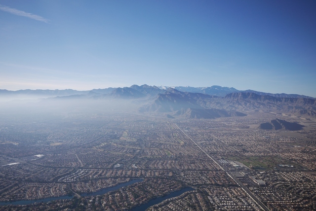
A last look back at the Sierras. It’s one of those “Mountain obscuration, VFR flight not recommended” type of days. The Pacific weather is already spilling over the ramparts of the mountains, only 50 miles away.
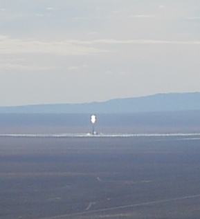
But ahead, all is bright! Especially at centre of this pic, where a science fiction solar tower stands out like a vast lighthouse in the desert near Tonopah, Nevada. This rather run-down desert community could certainly benefit from the boost that unlimited free electricity could provide, but I’ve not been there recently to find out if it has had any positive effect. And I don’t plan to fly any closer to this extraordinary power station either!.
Ahead, the desert valleys roll on relentlessly. I know some people find this terrain monotonous, but to me it’s always fascinating, with some new vista or geological wonder just around the next corner.
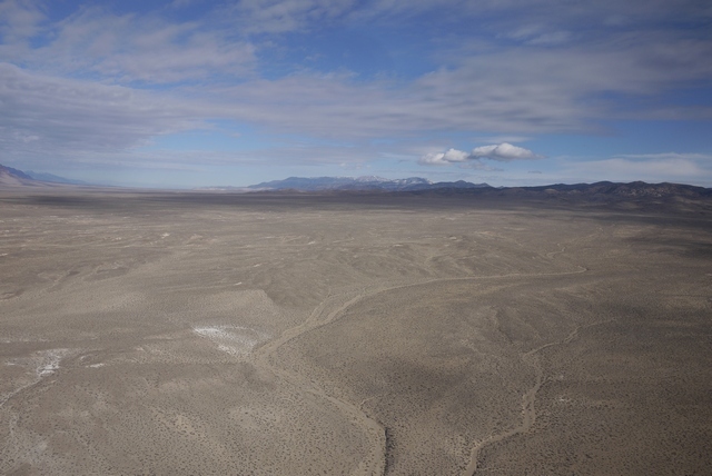
Geologists refer to this landscape as a ‘Basin and Range Province’. The ‘basins’ of course are formed from countless centuries of erosion, the mountains washing down into the valleys in layers of sediments miles thick. Indeed, this area is known as the ‘Great Basin’ because moisture running off the mountains here has no outlet to the sea. This land was virtually impassable until the railway came through just north of here in 1869 and there are landscapes here that were first seen by western eyes just over 100 years ago. And now I’m sweeping through this vast unforgiving landscape in armchair comfort in my magic carpet Cessna, the sum total of my childhood dreams made real.
Of course, you have to consider the outcome of forced landing out here. There are intermittent pieces of flat terrain that might be landable, and there are occasional roads. But I’m not in contact with any FSS in this remote corner of Nevada. If a forced landing was successful, I have my ELT and trusty UK PLB that might help. And, in 2018, the cellphone might work. And if the landing didn’t work out? Well, Mr Fossett’s crash site is not far from here. So I have that VFR FPL activated leaving Carson City and my transponder light never stops blinking, even low down in these remote valleys. Although I’m not flying a squawk, I’d guess that there are not too many returns out here for my time and route of flight.
Now I’m entering a MOA (Military Operations Area), a bit like one of our AIAA’s, where on the chart it says “contact Nellis approach” or some such, none of which frequencies are available out here at VFR levels. I’ve queried the MOA status with flight service prior to departure and established no activity outside of published times, but it’s a weekday now… A great feature of Foreflight is that you can tap in the MOA and it will show the times and frequencies, which can only be got from the margin of the paper sectional. MOAs do not require clearance, and the blinking transponder light shows me that military ATC must be aware of my presence even if I can’t contact them, so I proceed with a very good lookout. Unsurprisingly, in these thousands of square miles of empty landscape, I see nothing. One time, when I did have radio contact, ATC said “look out for a CH-53 helicopter refuelling a C-130 passing down your right side 1 mile same level” and there they were, perhaps the most extraordinary aerial combination I’ve ever seen. My camera remained firmly on the passenger seat!
Once, flying from Tonopah to Saint George, I thought I’d push my luck and ask for a clearance through the restricted airspace that forms a vast block from here down to Las Vegas. This restricted airspace contains the famous Area 51 and I was quite surprised when I thought I heard the response “Cleared to Enter”. I read back the ‘clearance’, only to receive the anxious reply “negative negative. remain clear” which is obviously what I’d heard over the scratchy radio the first time. So sorry, no photos of Area 51 in this blog.
Three hours have passed, seeming like only a fraction of the time, and the rugged red cliffs surrounding Saint George line the horizon.
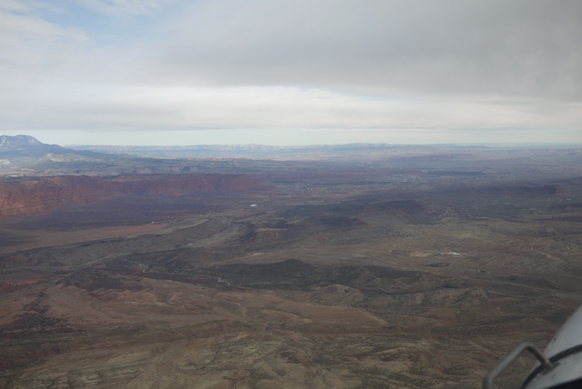
Behind the city, the Hurricane Cliffs stand out in the landscape and above them, the little English village of Hurricane. The layout, the architecture, the place and family names all resonate of England and the residents can trace their family lines directly back to the old country less than 200 years ago when they came here. On arrival, they were faced with the prodigious task of creating with their own hands a 20 mile aqueduct in order to make the land fertile and upon which they still rely. An extraordinary community, still intact after almost two centuries and most welcoming to a stray Brit who happens upon them. Hurricane even has it’s own airport, nestling right up against the base of the cliff, a truly scenic spot to land.
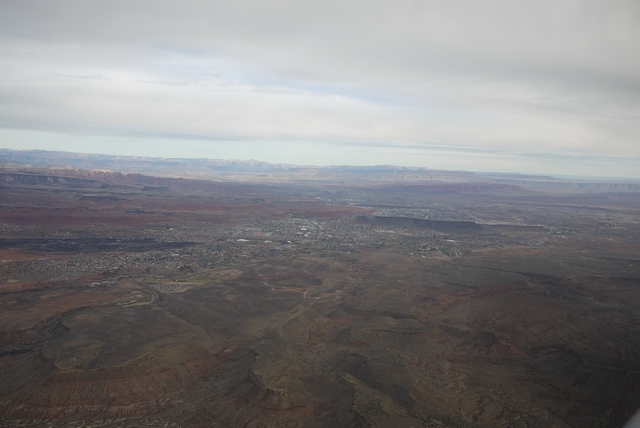
Soon, I’m overflying the ‘New’ Saint George KSGU to make a left 45 join for the 19 runway and while I’m doing so, several pieces of faster traffic sweep in and land ahead of me. Despite being uncontrolled, this airport has frequent commercial traffic from Salt Lake and Las Vegas along with tour flights and private GA. I make a close pattern and base following traffic while the other traffic fits in around me, one item being a private L-29 doing touch n’ go’s. It’s wonderful how well an airport works when pilots talk to each other, rather than some invisible third party.
As the wheels touch the tarmac, I’m conscious that this is the last overnight stop of my trip. That Pacific weather is close behind, and while tomorrow’s forecast is OK, the winds will be getting up and I still have a rather large feature to cross before getting this excellent little Cessna safely home again.
Next time: The Canyon!
The Canyon!
It’s still extraordinary to me that the Canyon itself was only explored, by John Wesley Powell, in 1869 – just 149 years ago. Especially as I reflect that I first flew there in 1970, my first flight in any small aircraft, in the right seat of a tour Islander, only 100 years after Powell’s momentous expedition. Since then I’ve returned many times, never for a moment losing my fascination for the place.
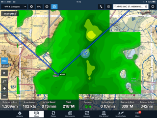
Today, my route from Saint George, Utah, KSGU, takes me South East to the Canyon Rim and then bounding across the vast chasm into Northern Arizona and onward to Williams, Az and thus home to Prescott KPRC. This flight takes me a little less than 2 hours, but crosses half of Earth’s geological history along the way. And I’ll make a small diversion en route so that I can illustrate some other parts of the Canyon.
Before continuing, a word about recent tragic events. No matter how cocooned we are in our comfy cockpits, the Canyon landscape is a wild and untamed wilderness. One of the things pointed out to me by the Islander pilot was the never recovered wreckage of the United / TWA crash in 1956, the one that led more or less directly to the modern ATC system. I’ve personally witnessed two fatal accidents at the Canyon, and locals tell me that they average around 70 per year, rather than the dozen or so admitted to within the confines of the National Park. In one case, a young boy climbed out on a ledge marked by warning signs, fell, and lay a pathetic crumpled form for most of the day until a helicopter could winch his body away. The personal grief and tragedy involved in this episode, and the recent helicopter accident can scarcely be imagined by the rest of us. The Canyon has to be treated with utmost respect. And the only way that you can respect the Canyon is by going there, and seeing it for yourself.
South of Saint George, broad low valleys sweep away toward the unseen Canyon Rim. I love flying low along these valleys, navigating by the bulk of Mount Trumbull, anticipating the scenic wonders that lie ahead.
All too soon, we have to start climbing. Climbing to get over one of the deepest trenches on Earth? Well yes.
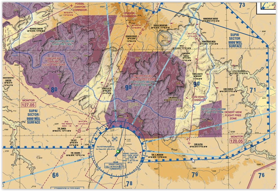
Most of the canyon airspace is covered by special flight rules, and divided into a number of ‘No fly’ and minimum altitude sectors. All this is described in a special Grand Canyon sectional which has remained current for many years. Indeed, my own copy has survived many trips and is held together with liberal amounts of tape! If only other aeronautical charts had last so long! Even after the advent of Foreflight, it was still necessary to carry the paper chart and despite the fact that today Foreflight zooms directly into the special chart, the paper copy still flies with me.
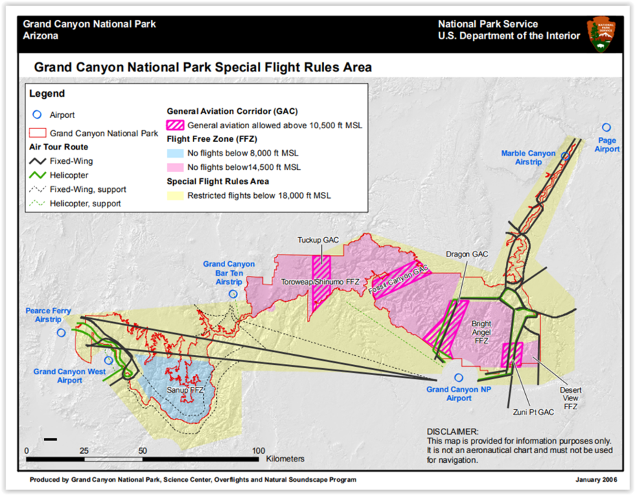
Ahead is the Diamond Creek sector with a minimum altitude (for airplanes) of 9000’ msl. But only just to my left behind Mt Trumbull is the Toroweep ‘Flight Free Zone’, where the minimum alt is 14’500’. (How often I’ve heard this designation mis-spoken as a ‘Free Flight Zone’. Not it isn’t – and unlike the polite request to remain 2000’ above in most National Parks, here it’s the law, and vigourously enforced. Apparently.)
As I climb through 9000’, far below is the airstrip at Bar Ten Ranch, a place I’ve never visited. I’ve called them a few times, but they’ve never sounded very keen. Maybe the British accent puts them off, and it’s not a place you’d want to get a flat, or a ding in the prop.
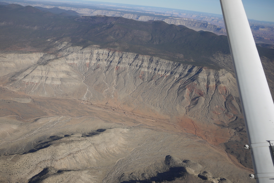
Anyway, there are other places you can get into the Canyon without breaching insurance conditions. More of that later. For now, the astonishing grandeur of the Canyon opens up.
This might be a point to note the weather conditions up here. Even fine days can produce strong winds, and this means turbulence, The winter is lovely time for flying because high pressure days mean clear, stable air and superb flying conditions, unlike the mist and fog that so often accompany winter highs in our maritime climate. So much of my flying in the SW involves timing my route to co-incide with high pressures predicted by the Prog charts. As highs drift away, wind gradients get up and throughout the mountains and particularly the Canyon you have to be very careful about any wind above about 20kts, where turbulence can be the limiting factor long before even considering rotors, lenticular clouds and drown drafts.
In the summer, daytime heating invariably stirs up strong turbulence even on calm wind days, usually starting before midday. While you may be able to withstand hours of prolonged bumping, your passengers (even other pilots) may not be so keen! And then there’s the afternoon thunderstorms. The closest I’ve ever been to a lightning bolt was at the Canyon, flying under an overhanging shelf when wallop! a shaft of lightning leapt 5000’ of clear air about a mile ahead.
To get the big weather picture, nothing beats the Weather Channel on TV, but only in the mornings – in the evening it’s nothing but reality TV shows. I look at where the Jetstream is and where the storms are coming from. The winter storms are not flyable in the 172 VFR, or IFR either because of strong winds and icing. But they pass, and you just have to have the time to wait them out.
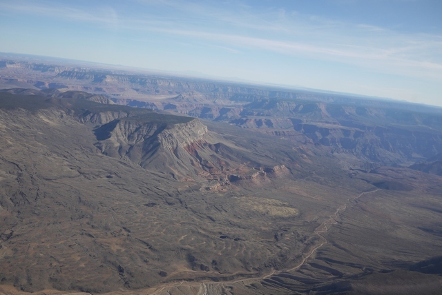
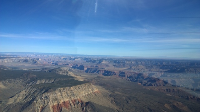
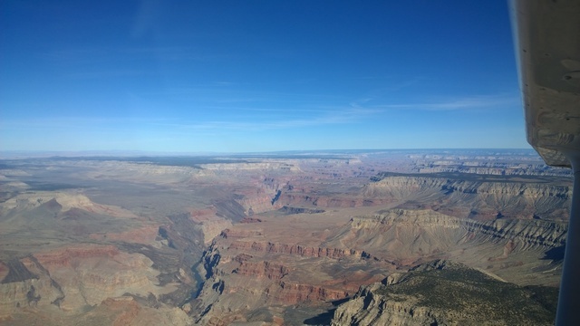
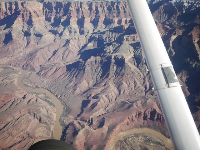
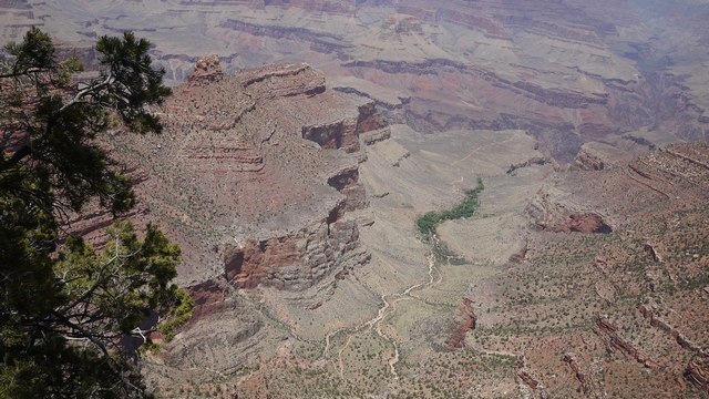
Down there, somewhere, is the river at 2000’ cutting through the hardest rocks in the Canyon, laid down almost 2 billion years ago. And above these oldest rocks has accumulated layers of sediment 9 miles thick. But hold on – we are in clear air only a mile and a half above the river! The answer is of course that 8 of those 9 miles have washed away since, mostly down to the Gulf of California, where along the way they have made up the land mass of Southern Arizona. So here comes the River:
The vast Colorado, completely contained now by the Glen Canyon dam at Page, Arizona, is still a raging torrent. But perhaps not quite the raging torrent it was when John Wesley Powell came through here in wooden boats. Indeed, right at this spot, two of his crew deserted and tried to reach safety along a side canyon. They were never heard of again.
This landscape is young. By young, I mean geologically young – only 10 million years or so. During that time, the collision of the Pacific and North American plates has pushed the land up into a vast dome and the river, which was already here, has simply cut down to retain it’s path. But long before that, the land was eroded away, and relaid in the form of alternating layers of white and red sandstone. You can see these layers in the photograph:
(The thin, alternating layers in the cliffs on the left). Each of these layers marks an epoch of perhaps 50,000 years, where the land became parched desert and shallow sea time and time again through Earth’s long and unwitnessed history. Maybe these layers are related to the our present epoch of glaciation, and tell us something about when the Glaciers will return?
A curiosity about the Canyon is that there are no dinosaurs here. Surely, with such a vast span of time, the dinosaur layers must be in those cliffs? Well actually no – the erosion has washed them all away. All the rocks in the Grand Canyon are far older than the earliest dinosaurs. But even then, the rocks we see in the Canyon walls now are much younger than those at the very bottom, because many miles of ancient sediment above them have vanished, and further accumulations of sediment have taken their place. The point, above which great mountain ranges once rose and then washed away again, is called “the Great Unconformity” and can be seen in Scotland, and somewhere close to the river in this picture. It’s also rather more accessible at the foot of Frenchman Mountain in Las Vegas where a geological field stroll makes a much nicer alternative to the jingling casinos. When first noticed by James Hutton in the sea cliffs north of Berwick on Tweed in 1788, the Great Unconformity gave the first true picture of the age of the Earth and the vastness of Geologic time.
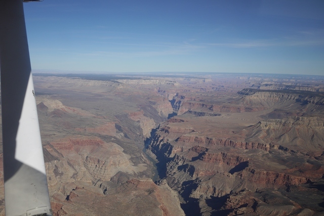
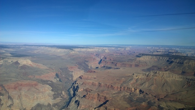
Looking away to the East, we can clearly see the domed formation through which the river cuts.
A little detour around the Canyon
Now, we’ll take a little detour 100 miles or so East, to make a landing inside the Canyon itself! Pictures in this section are from earlier years.
50 miles away on the Right, or Southern side, is the Grand Canyon Village and it’s airport, KGCN. And on the Left, the much less visited North Rim. There are no airports on the North Rim, with Saint George being about the closest place where you can rent a car for the drive to the summer only North Rim Lodge. It’s 70 miles off the highway on a narrow winding Park Service road to the North Rim lodge and made the trip very early one November morning, arriving at the deserted North Rim Lodge just in time to catch the sun coming up over the Canyon.
Photos in the bag (on film in those days before cellphones) I set off back to civilisation and breakfast, the only human being in that extraordinary and silent place for many, many miles. The North rim is higher than the South at around 8000’ and the road consists of dense forest alternating with beautiful, expansive alpine meadows. And as the road emerged from the trees into one of those meadows, I saw a figure standing in middle of the highway. But not a human figure – I was alone out here – but that of a huge wolf, maybe 4’ at the shoulder. I slowed to a crawl, fumbling with the clunky old SLR film camera, trying to get a shot. All the time, the wolf just looked at me, curious and master of all that he purveyed. I fancy we made eye contact and (No hunting here at the time anyway) he knew he had nothing to fear from me. Still fumbling with the camera, the majestic animal became bored, shrugged his shoulders (quite literally), and trotted off. By the time I’d got the recalcitrant camera to work, he’d reached the treeline, and vanished in an instant.
So once again, I’ve no photo to prove this episode ever happened. Sometimes now, flying the Arizona strip country out of Page which runs parallel to the North Rim, I go down low outside the special rules airspace along the road hoping to see a black spec or maybe a family of black specs, trotting along. But I never have.
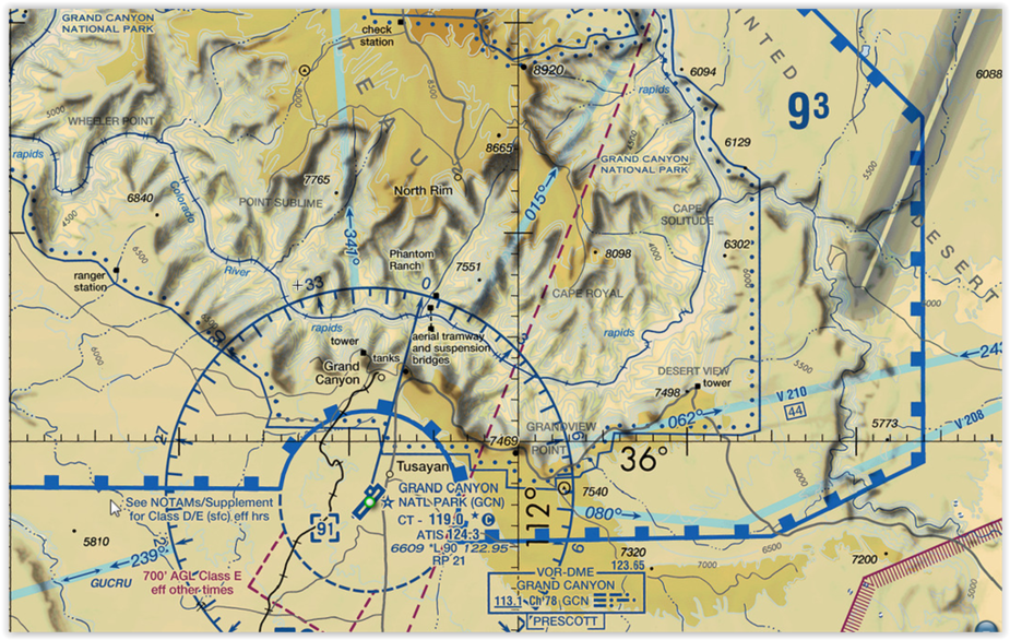
Further East the airspace steps up, so that to cross near the airport in one of the VFR corridors requires a minimum altitude of 10,500’. The corridors are a doddle in these days of iPad and Foreflight, but before GPS it was a challenge because VOR cross cuts rarely made sense out there. The saviour was an FAA publication about the routes which included full page B&W photos taken from each entry point looking across to landmarks on the other side. I still carry it now, although the pictures have faded to light grey on white. Once, crossing northbound in a 152 at 11,500’, a voice came over the radio: “How’d you get up there?”. Good question!
But there are places in the canyon where you can go down low. After the Canyon village, the Canyon turns North-East toward Page. And here, right in the canyon itself, is the Marble Canyon airstrip L41.
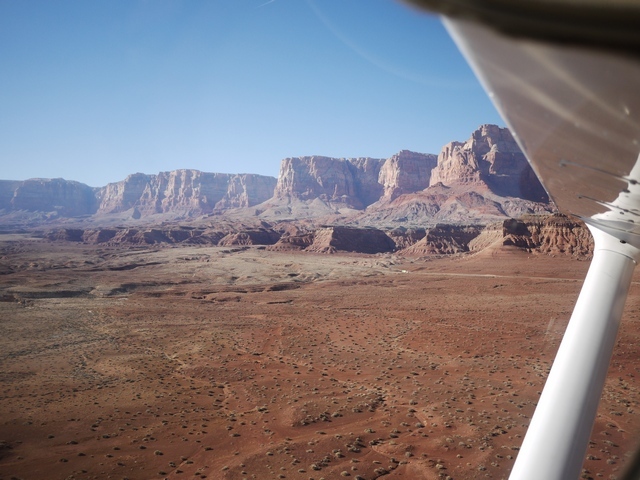
Here flight is permitted below the rim within 3 miles from the airport.
(Photos taken in 2017. Runway at Left.)
The power plant at Page, Az is at top right and Navajo Mountain 100mi to the NE. The runway at Marble Canyon is narrow but long. This didn’t help one twin driver who managed to stick his nose in the side of an RV in the parking lot at the far end! You can see how it might be tempting to land into this runway, with it’s kink, hump back, narrow width and scruffy condition at the approach end. In a 172, no problem at all: but in a faster twin, the lovely airport at Page is only 20 miles away.
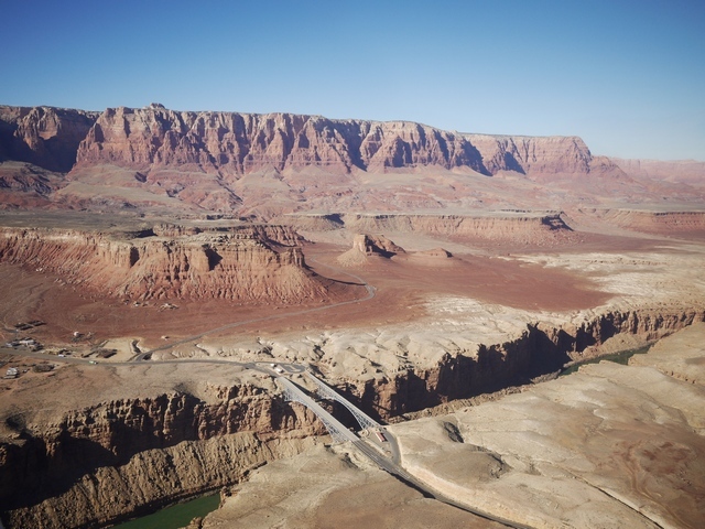
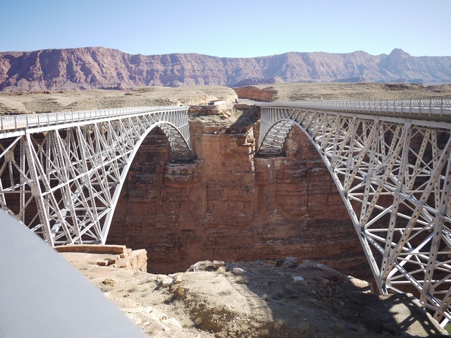
On the ground at Marble Canyon there’s a pleasant enough cafe and fairly basic motel. It’s just a short walk down to the bridges, which feature in many movies. The left hand bridge is retired from motor traffic and pedestrianised, while the seemingly identical but much more modern twin carries the highway. Just to the North is Harper’s Ferry, the spot where John Wesley Powell entered the river on his 3 month trip down to Las Vegas.
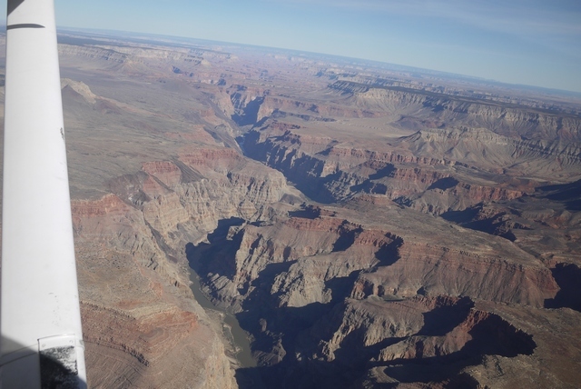
Turning South now from Page down toward the Grand Canyon airport KGCN we find the entry point to the Dragon corridor southbound at 11,500’. The corridor is 5mi wide. Note the San Fransisco Mountains at Flagstaff in the distance.
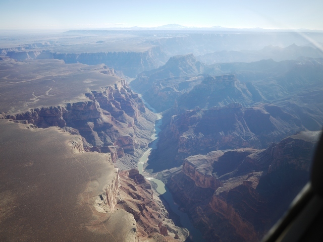
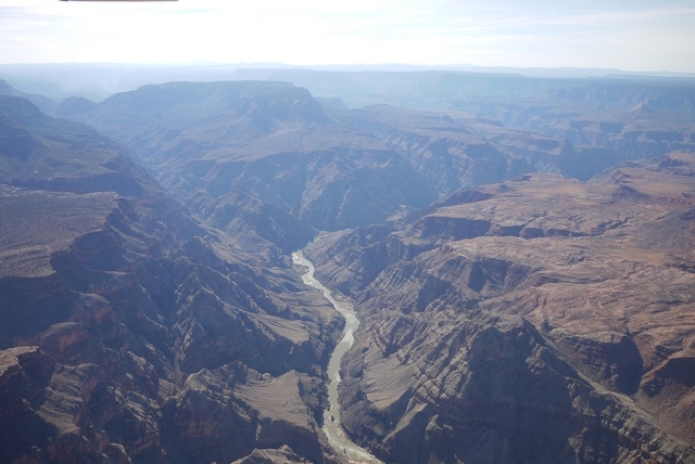
Out across the Canyon now at it’s widest point, unbelievably the river is 2 miles below!
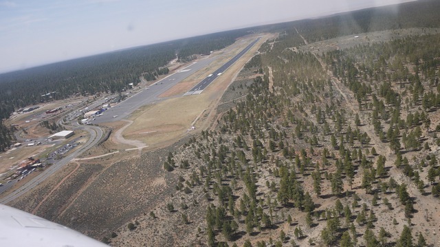
The Canyon airport is in class D airspace and the controllers are helpful as ever in the US system. (But not so helpful as to permit a downwind departure out over the rim!) It’s a good idea to make early contact for a landing here, because you are mixing with seriously intensive tour traffic. But the approach and landing is simple enough. Ground will direct you to parking and if you’re not familiar, to the hole in the fence where you can exit the ramp. From there, you are on your own, because while there are taxis at the Canyon, reliability is not their by-word. The best plan is to stroll up the approach road and through the woods to the village at Tusayan, where you can buy a park entrance pass and combined bus ticket, about a mile.
From there it’s a 30-45 min frequent shuttle bus ride to the Canyon village and the El Tovar Hotel, which is the place for lunch in a Fred Harvey dining room overlooking the South Rim. (You might need to book this stuff – my visits are always out of season, but other times might not be so easy). You can see that a lunch stop at the Canyon is a 3-4 Hr exercise! The walkway outside the El Tovar has a special place in my heart, because it was here that my baby Daughter, then 8 months, said her first word. We were walking her in a McClaren stroller (pushchair or buggy in English) and American parents having never seen such a contrivance before would lean over to look at it and say “Hi” to the tiny occupant. So her first word was of course “Hi”, with a perfect American accent!
The El Tovar is at the head of the Bright Angel Trail, which leads right down to the river a mile below. You might think a quick stroll down there would be a good appetiser, but my experience is not so casual. After many short trips down the trail, and noticing that most people pretty quickly turn back, I resolved to do better and leaving the plane at GCN one November set out to see how far I could get. It’s essential to have water, because there’s none down there. The trail is very narrow and heavily loaded with hikers and, unbelievably, Donkey trains. The Donkeys, like their cousins everywhere, have very forceful personalities and know that they want to walk on the inside. You as a mere human don’t get a choice in the matter.
As you go down, you walk past the bands in the rock, which are maybe 50’ apart vertically, 50,000 years or 10 centuries to the foot. It’s quite stunning to see how constant and orderly the Earth was for countless millions of years with nothing break up this regular cycle.
So how far did I get? I know young people who’ve done the whole trip, down and back up, in a single day. Not for me. There’s a plateau and a shelter building halfway down that’s visible from the El Tovar, standing out on a promontory into the Canyon. I’m proud to say that I got there, but when I did I knew beyond any doubt that was my limit! The trip back up was tiring, and at the end I was stopping every 50 yds or so to rest. So much so that several passers by asked if I was “all right?”. Hmmm. So that’s my record on the trail, a personal record that I’ll never break. And the view down there? Stunning, breathtaking, worth every step.
There’s fuel at the Canyon airport and hotels at Tusayan as well as at the rim. But nothing at the Canyon airport happens very quickly and any stop there should be for at least a day, though I have several times made a long lunch there. And one more train story: There’s a train station at the rim, built by the Santa Fe at the turn of the century to bring tourists to the Fred Harvey establishment. The line closed after the war and re-opened about 30 years ago. In the early days they ran steam locomotives and on one occasion I was able to blag my way onto the footplate. It’s a 64 mile trip down to Williams, Arizona and during the run (on a massive Alco 2-8-0, for those who know) it got dark. To my surprise, the fireman opened a little door in the front of the cab, climbed through it and right along the handrail to the front of engine, where he lit the headlamp!
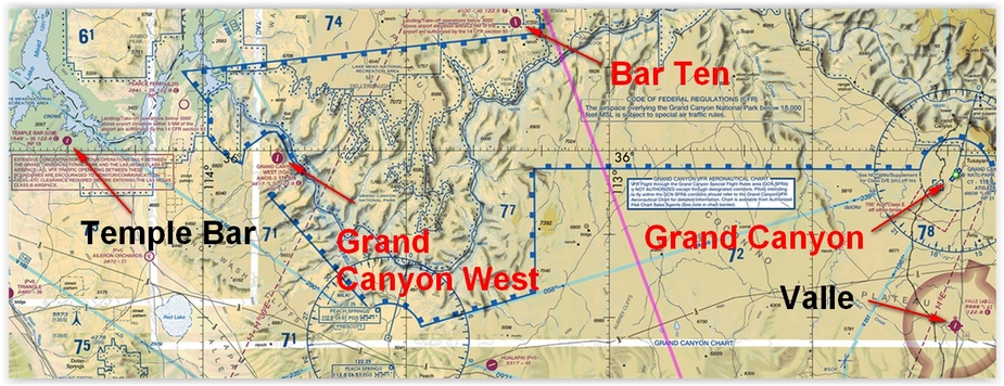
There are other Canyon airports. The Grand Canyon West airport 1G4, destination of many tour flights, is on tribal land and permanently rammed with traffic and tourists. The heavily scratched transparent walkway out over the Canyon rim is scarcely worth the $100 landing fee and this is not even in Europe! Much nicer is Valle 40G, about halfway to Williams, which has a superb auto and aviation museum run by really nice people. Far to the West on Lake Mead, the Lake formed by the Hoover Dam, is my personal favourite in Canyon land, Temple Bar U30. Parking is right outside the Marina restaurant with superb views across the Lake. But I’ve not been for a while, because nowadays I like to think I fly a better class of Aeroplane and the owners are likely to notice little dings and chips caused by loose gravel! And all the time there’s wonderful Page KPGA, a delightful little town built on a Mesa overlooking the Glen Canyon dam and Lake Powell with really helpful FBO’s and hotel transport. I use the Holiday, where you can get a room overlooking the river and the set of the film ‘Evolution’, filmed entirely in and around Page.
Well, the day’s drawing on and it’s time to return to my route to Prescott. I make a lazy orbit, taking a long view of the Canyon receding behind me, and set course to the South with, every time, very mixed feelings. I’m looking forward to being back in Prescott, and then home to England. But I’m sad to be leaving this excellent little Cessna, which hasn’t missed a beat in 2500 miles of arid desert, snow capped mountains and geological wonders.Oh well, there will be another time – I hope.
I resolve to make a respectable landing, remember to cancel my flight plan, park the aeroplane neatly and remove the accumulation of junk from the interior (Including several gallons of free FBO water bottles). And that’s it – until next time.
If you have been, thanks for reading!
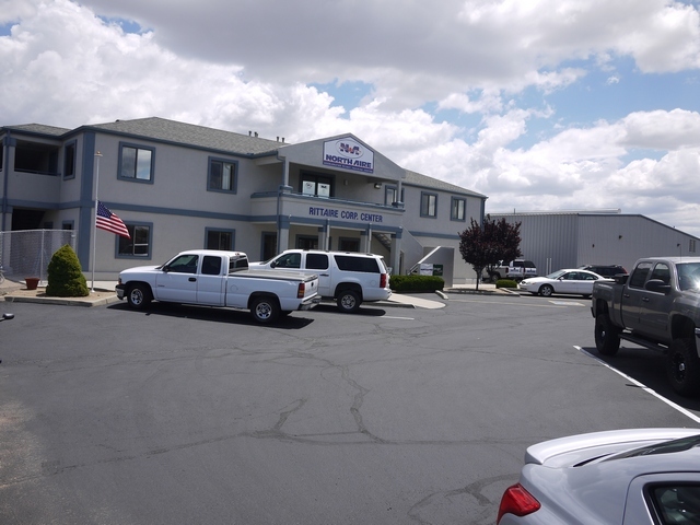
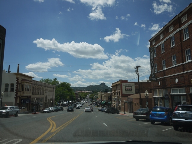
Below: Northaire (shameless plug!) and downtown Prescott, outside the Hassayampa Hotel.