Do all the various cloud and weather systems really follow the (often wildly varying) 3D airflow, or is there something happening which affects the 3D airflow picture if there is IMC about?
For example I often wonder how one can have a CB, base say 1000ft, tops say 30000ft, and it remains basically vertical. The wind variation could easily be 100kt over that altitude delta.
A great question. Just checked a TSRA on windy. Surface wind 6kts, FL300 12kts.
Vertical energy much higher than lateral? The CB „swallows“ lateral and moves it upwards/downwards maybe?
Lighting shown on Blitzertung was moving in opposite direction to the wind shown on Earth.nullschool.net at the weekend.
A big CB will creates it’s own weather system that could be unrelated to the surrounding winds, I recall flaring with lot tailwind once due to presence of one miles away, I failed to notice the sudden change of wind between overhead final…
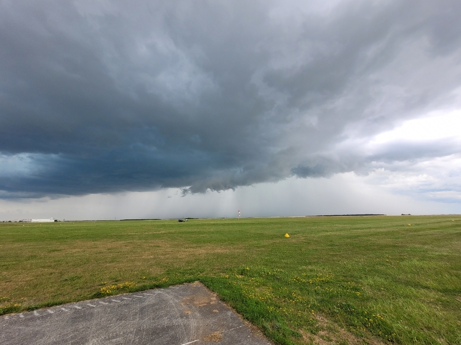
Another day, I was not flying just watching: as you see, windsock did change from +20kts to 0kts to -30kts…even if the 2000ft winds were 20kts in Windy that huge thing barely moved an inch, I think it was “too heavy to carry” 


As a little boy I learned that wind always blow towards a thunderstorm. This is correct in the vicinity of a thunderstorm, most of the time at least. Clouds are formed by condensation or freezing of vapor, This process releases huge amounts of energy (heat) that creates it’s own winds. Evaporation absorbs energy. That’s what basically creates 90% of “large scale” weather and winds in the first place also, evaporation and condensation of water.
Peter wrote:
or is there something happening which affects the 3D airflow picture if there is IMC about?
Clouds vastly affect airflow. I’ve seen rotor clouds and lenticularis made by airflow flowing around bigger cumulus clouds. I’ve climbed in a glider in front of a big cumulus over the cloud base, where that updraft was generated by the cloud itself being the obstacle. and a TS can create it’s own weather zone where depending on the state (growing or dissipating) the winds are oriented with regards to the TS cell. And so on.
I’ve seen the top part of a CB getting sheared off but that’s about it.
I wonder if anyone knows more.
Doesn’t the top part of a CB normally become anvil shaped due to the winds aloft being stronger than the up and down currents?