
I just got a 24 hr GRAMET for nearby Stockholm/Arlanda.
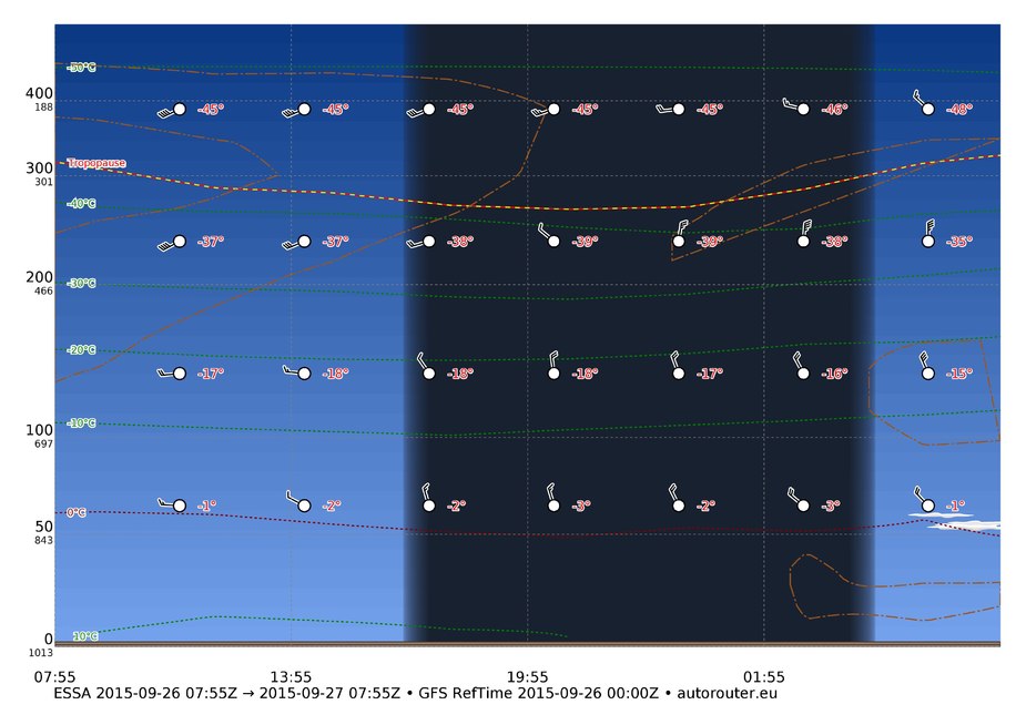
The METAR and TAF tell a different story:
ESSA 260750Z 28007KT 9999 BKN013 10/09 Q1016 NOSIG
TAF ESSA 260530Z 2606/2706 25009KT 9999 BKN006 PROB40 2606/2608 BKN010 BECMG 2608/2610 BKN015 TEMPO 2614/2617 SHRA BKN040CB
So we have both low cloud right now and expected convective cloud with rain later today. The clouds are not thin either – the Swedish GA forecast until 13 UTC gives the cloud tops at 3000 ft or higher.
I’m surprised the GFS model is so completely off for a short-time forecast. I saw something similar a few days ago.
I’ve seen similar forecasts for ESMS this summer. The least correct forecast happened when the TAF for both ESMS and EKCH had +TSRA and GRAMET didn’t show anything in particular, it was a quite clean picture IIRC and showed a lifted index with unlikely TS. It turned out that the TAF was correct, lots of strikes and heavy rain hit DK and southern SE.
Perhaps the model hasn’t learned our Scandinavian weather systems yet? ;)
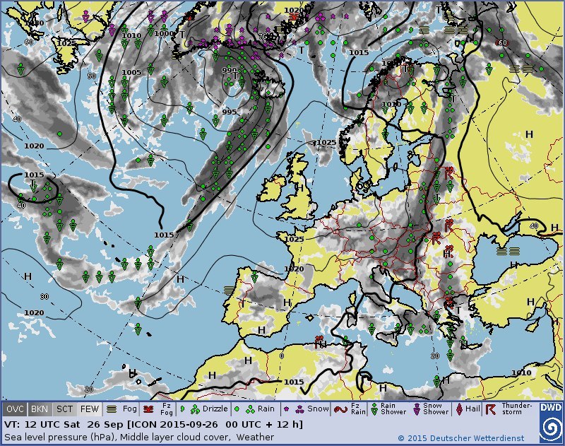
The DWD model doesn’t show any clouds either. Question is always where they come from. If it’s from a moving front, then it very much depends on how accurate the wind speed and direction forecast is. A front could not arrive at the forecast time or go elsewhere. If it’s local, orographic etc, the resolution of the global models is not good enough. Especially in fall you get low stratus that is extremely hard to predict and impossible for a low resolution model like GFS.
Use GFS (= GRAMET) to judge the route weather and TAFs to get local airport weather. Even the TAFs can be completely wrong. I remember the last Tannkosh event where the combined elite of meteorologists urged the crowd to rush home to escape a front that didn’t come. Their forecast timeframe was 2 hours and they got it completely wrong.
That’s why i find it so funny when some internet weather providers offer subscriptions for a 14 days weather preview.
I chechk the weather for the route Munich-Prague every Sunday afternoon (because 35 minutes of flying are more fun than 3.5 h of driving) but in more than 50 % of all cases the forceast for that short route is wrong. I cannot count the days on which the forwecast was CAVOK and when I arrived there there were low clouds.
3 days before a flight is the maximum for me, one day is better.
achimha wrote:
The DWD model doesn’t show any clouds either. Question is always where they come from. If it’s from a moving front, then it very much depends on how accurate the wind speed and direction forecast is. A front could not arrive at the forecast time or go elsewhere. If it’s local, orographic etc, the resolution of the global models is not good enough. Especially in fall you get low stratus that is extremely hard to predict and impossible for a low resolution model like GFS.
The situation is similar for much of southern Sweden so it’s not local.
Also, CBs are certainly enroute weather.
I don’t think GFS forecasts are any good for any “low energy” cloud i.e. anything below about 5000ft.
However, in the context of any reasonably performing aircraft (say a PA28-181) this is good enough. And there are adequate alternatives (tafs, metars, radar) which reveal these.
Flyer59 wrote:
That’s why i find it so funny when some internet weather providers offer subscriptions for a 14 days weather preview.
You know, I am at the receiving end of the crowd who believe this kind of stuff. And it’s scary how apps like Weather Pro and so on have chanced public perception.
People are used to their smartphones and their apps to an extent that they will take most information for granted no matter what. If the Smartphone sais it is so, they expect it to happen that way. But with weather, this is one very wrong perception.
Mind, apps like Weatherpro are quite good these days, mainly because they use different models and also ensemble forecasts. Meteogroup is getting larger and larger, they have tons of money to buy all the products they want. When I am abroad or have no access to a computer, it is quite sufficient as a forecasting tool for me.
BUT:
Like all model forecasts it has limits. And those who take ANY model data as the unblemished truth fall into a trap.
GFS is a relatively low resolution world wide model. it is quite good for general predictions, it can be very accurate short and mid term if the weather cooperates and follows known patterns. It is near unusable for local phenomena, for non-standard weather situations and the likes. Sometimes it is BETTER than the high resolution European models as it has the “big picture”, but that is what it will give you, the big picture. Yet, it is mostly quite adequate for flightplanning (Winds) particularly on long haul.
If you look at local models like Cosmo, which in variants have mindboggling resolutions, they will be much better for local phenomena as they are programmed to tackle those. Yet, with all their sophistication, they screw up badly too if the situation goes not to plan.
That goes for ALL models. They are fantastic tools if you know their strenghts and weaknesses. And to know those, you nee years of work in the field and you still can get it VERY wrong at times.
What I am trying to say is: Automated products give a hugely false sense of accuracy and security as well as incertainty and nuissance warnings.
When I started to fly in 1983, nobody had such stuff, because it did not exist. We went flying day by day and we made it back most of the time pretty much without too much problems. Sometimes we’d be a day or two late back on longer trips. We found this normal and lived with it.
Today, we are glued to our 14 day forecasts when we plan a trip and often enough get discouraged by a horrible prediction, even two to three days before so we cancel trips only to find that they would have been perfectly flyable. We listen to the “false prophets” like they are always right, knowing that they are not!
To know the accuracy, weakness and interpretation of a model, any model, is a science based not so much on academic achievement but on watching them time and time again and knowing where they are good and where they are not. Automated products don’t do that. That is very important to remember.
Airborne_Again wrote:
I’m surprised the GFS model is so completely off for a short-time forecast.
Looking at the METAR history I would say that the TAF was completely off :) Sometimes weather can be hard to predict…
One of the more useful things to learn about weather is which sorts of situations are easy or hard to forecast.
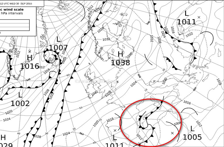
If you take say the UK here then the situation there is stable and forecasts should work for a few days
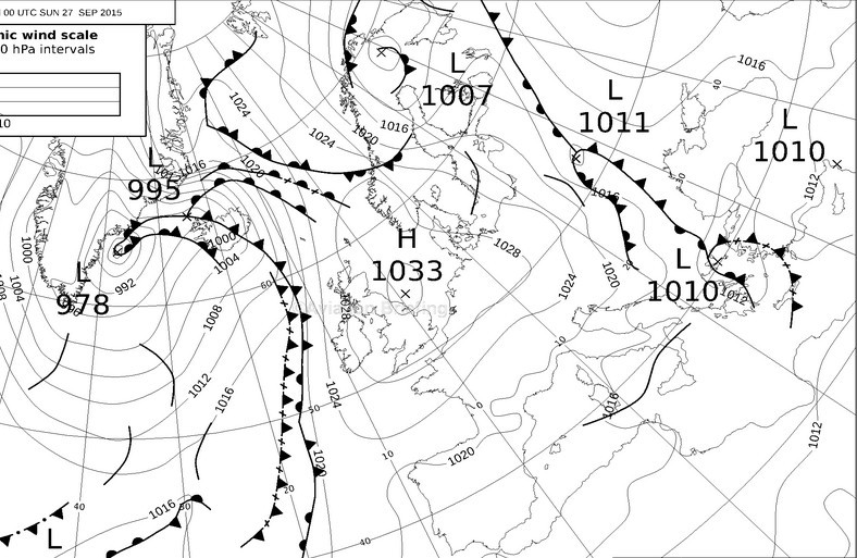
and the only big question is how it will be before that high pressure fizzles out.
If you take say Majorca (Mallorca for the more classy  ) here, nobody can tell which way that bit of crap is going to go in the next 12-24hrs
Fog is almost impossible to forecast usefully, and if say doing a 1-2hr flight to an airport which is fogged in but forecast to clear by time XX, only a fool will depart on the assumption the TAF will come right. Well, you might do it if you are equally happy to end up somewhere else. But the TAF will be nearly always wrong (way too optimistic).
Mooney_Driver wrote:
Today, we are glued to our 14 day forecasts when we plan a trip and often enough get discouraged by a horrible prediction, even two to three days before so we cancel trips only to find that they would have been perfectly flyable.
Fully agreed.
BUT
you seem to be the first to cancel a trip days before because of some uncertainty in the forecast. Why?
Peter wrote:
One of the more useful things to learn about weather is which sorts of situations are easy or hard to forecast
Indeed, and that seems to be the recent innovation in presenting weather forecast, namely to add some forecast reliability indicator. Meteoblue at least does it.


