
It would be interesting to look at Western France LFBH LFRI on Saturday evening/sunday morning
At LFFK at 5pm the temperature read 40°C at 6pm the car temperature guage was 47°C
There was very little temperature drop during the evening. At 11pm the lightning followed by the thunder crashed all around and continued until 4am in the morning. Some wind but not a gale and not a drop of rain.
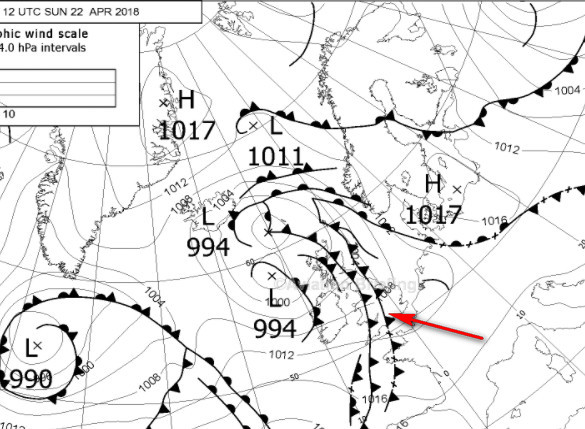
Yes a real wet frontal line was west of the dry front, it was going from Cherbourg to Glocs
I have not saved Windy screenshots but it’s interesting to see rain in one side and dry temperature line east of it
Looks like a pre-frontal dry line of wind. Rare but not unheard of. There was a massive system of cells west of that position, probably that is what triggered that massive line of gusts. And yea, those can be really dangerous and far away from the actual system. I recall a case where a small airplane was downed by the pre-frontal gust line while the cell was over 30 km away.
From yesterday, I was planning to fly at night as it’s calm and more friendly, it was 37C deg at 5pm with barbecue and swimming pool, so decided to cancel and drink like everybody, no TS/TSRA or DS/SS on TAF at Deauville (it’s AUTO anyway), then at 8pm wind picked to 40kts with dust storm
The clue: there was a slice of 10C temperature gradient in Windy over barely 5km width, no single cloud until temperatures cooled down at 11pm
It reminded me of dry fronts and dirt storms you get in Doha or Dubai…
At Northampton there was a cloud band early afternoon, overcast but no rain, cleared by 16:00.
Something similar again…
METAR EGKK 221350Z 21010KT 190V250 CAVOK 22/11 Q1009
TAF EGKK 221149Z 2212/2318 22010KT 9999 FEW030 BECMG 2220/2223 28010KT
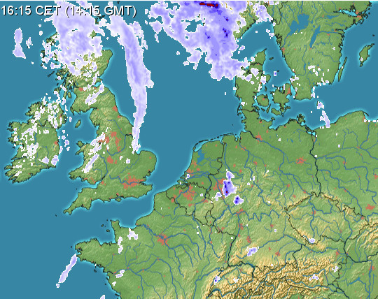
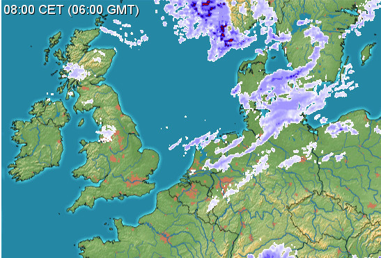
Similar thing today. Southern UK would normally be unflyable
but the IR image shows nothing
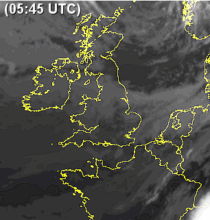
and the radar shows nothing much “wet” in there at any level
A front is an air mass boundary. Usually a front comes with cloud and most of the time other effects, but it doesn’t have to. If two dry air masses meet, it is still a front but nothing spectacular happens at that time.
Peter wrote:
I believe the removal of fronts from the SigWx was done by ICAO specifically for jet pilots, who don’t care much about fronts and anyway have to fly all the time the data is above ops manual minima otherwise they get fired. They have radar to do the tactical stuff.
No. They were taken off the usual SigWx charts because those charts usually cover FL100 to 600. Fronts are analyzed by their ground position and therefore the position of the fronts on a chart starting at FL100 upwards would be wrong.
Low level SWC’s as the EUROC e.t.c. still have all the fronts because they cover GND-FL600.
I think the answer to the original Q is the definition of a front, which AFAIK is a boundary between two air masses of different characteristics.
So you could have a boundary between two air masses both of which have a > 5C spread between the temp and the dewpoint, and hey presto – no cloud anywhere!
But the UK Met Office will draw a front there.
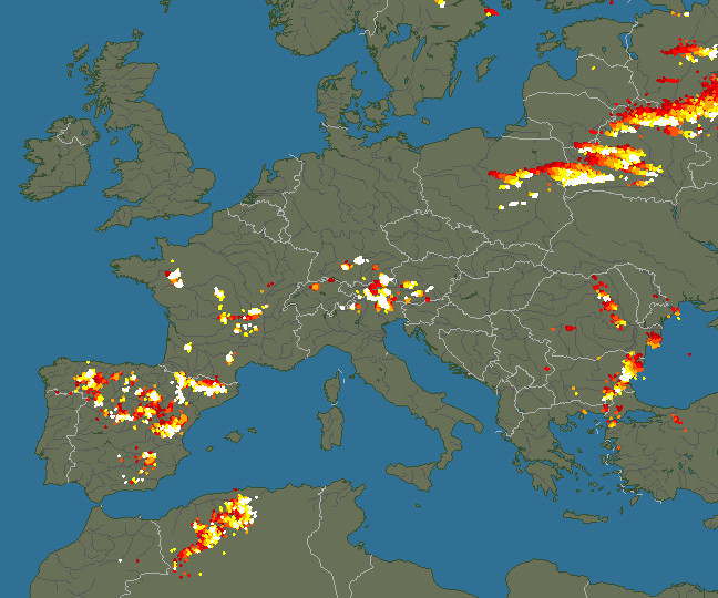
In this kind of wx (+33C at the surface) I would expect to see some troughs i.e. a PROB 30 TEMPO TSRA but even that is not happening; further south we are getting what I think are called air mass TS
BTW I believe the removal of fronts from the SigWx was done by ICAO specifically for jet pilots, who don’t care much about fronts and anyway have to fly all the time the data is above ops manual minima otherwise they get fired. They have radar to do the tactical stuff.
Why why such fronts even be shown if they don’t produce any weather?
On the significant weather charts we get for flight briefing the fronts are not shown at all any more. Initially I thought this was a disadvantage. But they show areas of clouds and icing instead (including their vertical extension) which proves much more useful than the fronts.
BTW: I flew to Cork and back today and saw no signs of any fronts over Ireland. Just some cloud covered parts and clear skies otherwise.


