Hello,
I’m replacing my Avydine sat weather with a Golze ADL for reasons of coverage and running costs. Playing with the internet download while I wait for the install to finish, I see the IR is coded for estimated cloud tops. In the practical experience of users, how accurate are these?
I also need to get used to the radar colour coding, it seems yellow and green on ADL are both equivalent to green on Avydine , so doable with no pax and keeping speed low. It would be great to have some feedback on that as well. Thanks!
Since only light grey is what I can top-up, I can say it has never been higher than FL180 i.e. flying at FL180 was sufficient to fly above light grey color coded clouds. Sometimes it was sufficient to fly above dark-grey tops. However, since it’s IR image, the image of clouds you want to top up can be sometimes distracted by layer of high clouds and you actually fly between the layers in clear skies. So to understand what you can really expect, you have to combine radar image with IR image (turn on and of each and compare) and then put it in the context of full forecast you saw before flight and make strategic decision.
Regarding radar image, I generally avoid yellow areas if I can’t top them up while green is acceptable to some extent. However, this also depends on other things like temperature, possible icing, general forecast and visual clues on development intensity. But I don’t pretend that I have onboard radar for tactical avoiding.
In the practical experience of users, how accurate are these?
For a number of reasons there is some error on the altitudes. The infrared product alone is not really suitable to determine if you can fly on top especially in normally aspirated planes where a few thousand feet count. When I introduced the infrared the main goal was to provide thunderstorm detection in areas without radar coverage and to provide another cross check for areas where radar data can be masked by mountains etc.
I also need to get used to the radar colour coding
I always suggest to look less at the actual colour but more at the context. A green only patch will usually be harmless and very often in the PA46 you will even fly in sunshine above it. But if that green area is just the border of an area which also contains yellow, orange, red already the green can be quite a different experience and I would try to also avoid such areas.
Also keep in mind that the radar intensities can vary a bit across different countries. I try to adjust as much as I can but still for example the Norwegian data seem to over read a bit and in Slovenia east of Portoroz there seems to be an area which under reads a bit.
Also try to cross check. I had one customer who saw lightning strikes, high infrared returns and medium radar echoes and thought that should work and he did encounter quite some hail. So if it is clearly a CB avoid it even if the radar is not all red.
Last September I was flying through a “green” and collecting about 1cm per minute of ice, at FL160 and -5C, on unprotected parts. So one needs to treat it with caution. Even with full TKS I am wary of enroute IMC below 0C.
We had a cloud tops thread the other day, among others, but I don’t think there is a site which corrects IR images for the forecast or actual temperature profile, to yield reasonably accurate cloud tops. Accordingly, in the summer, the tops are higher than an IR image would suggest – anything up to a few thousand feet.
Last September I was flying through a “green” and collecting about 1cm per minute of ice, at FL160 and -5C, on unprotected parts. So one needs to treat it with caution.
Don‘t know why you mention that. You know that there can be loads of ice where there isn‘t any precipitation. Radar returns can‘t be used to avoid ice directly.
Thanks for your feedback. Sebastian, it’s clear that green as part of heavier stuff can be very nasty… I learned that first hand once.
Just to illustrate the original idea behind the infrared data on the ADL system. This is a picture taken right now. You can see that radar coverage stops on the eastern border of Poland but infarred and strikes go well beyond that. The infrared combined with the strikes shows very well the intense thunderstrorms in Belarus, Russia and Ukraine.
The infrared combined with the strikes shows very well the intense thunderstrorms in Belarus, Russia and Ukraine.
Especially if you look at the wider picture including near by radar images in Poland.
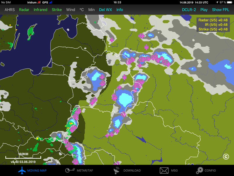
Few days ago when flying to EGBB I made few interesting screenshots at ADL. Looking only these pictures, if I hadn’t been there, I would have assumed pretty bed weather, maybe even some kind of storm. However, the situation was completely benign with no precipitation at my flight level.
The first picture shows combined radar and IR images. It looks like a pretty big cell.
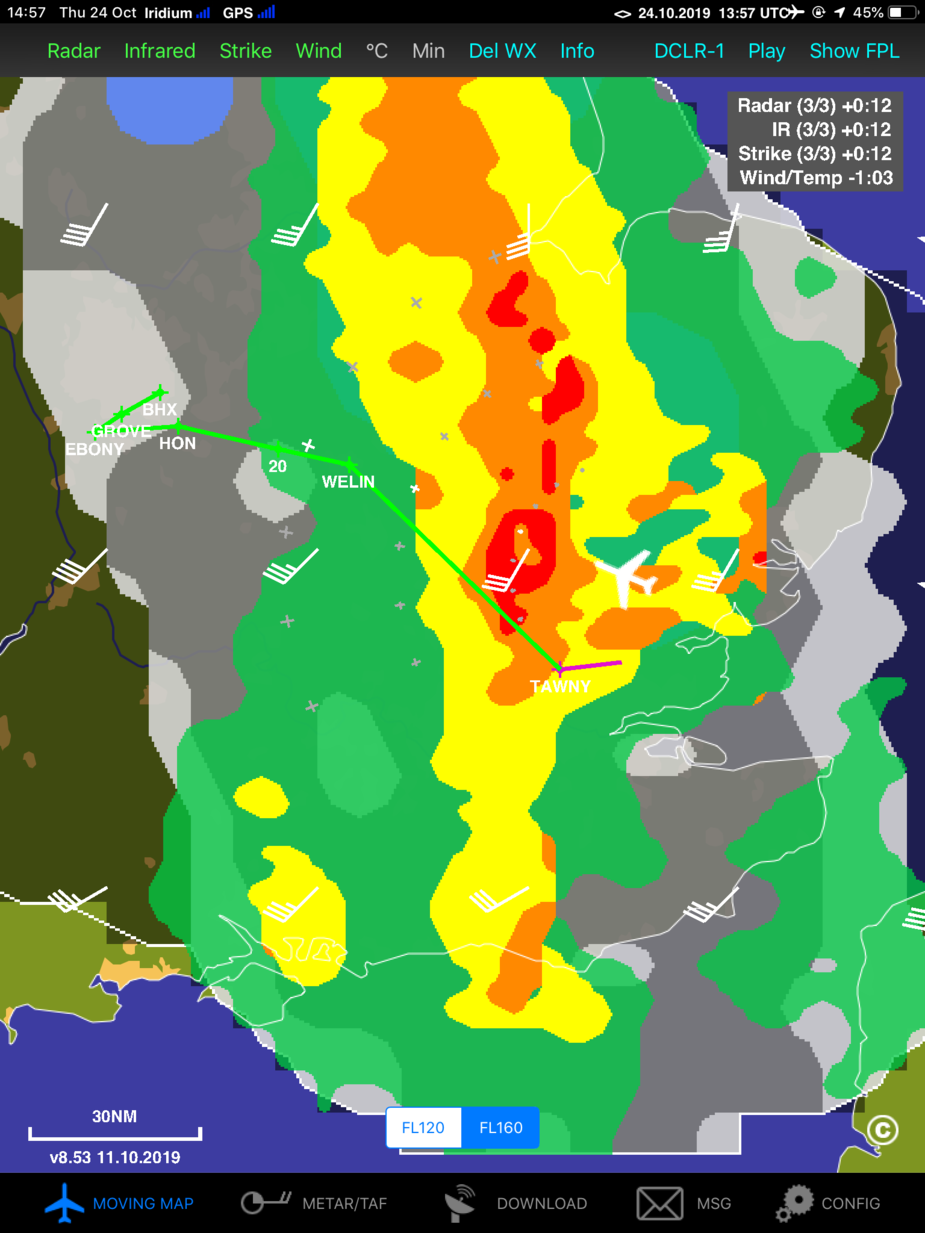
The second picture is only IR. And usually it would support previous one representing very high tops of developing cell.

In reality I flied practically in VMC in still air below layers of high clouds and above some low clouds (base at 1800 ft and ceilings at 4500 ft) and mid clouds with a lot of water in them. Total lack of any electrical activity was noticeable both at ADL and stormscope. However, descending through this wet layer caused some light icing.
This email from Sebastian is relevant: