
GND-FL100 seems sensible to me, it enhances accuracy and rebase expectations
Moreover, the lower the layer the harder to accurately calculate its altitude from IR image.
If one sees dark grey that means topping up without oxygen or pressurized aircraft will practically not be possible. Preferably turbo or turbine. Previously even light grey was ambiguous in that sense.
Ibra wrote:
How about keeping it straight to the point one layer that estimate clouds in (+5deg,-20deg) temperature band and plot fronts on it
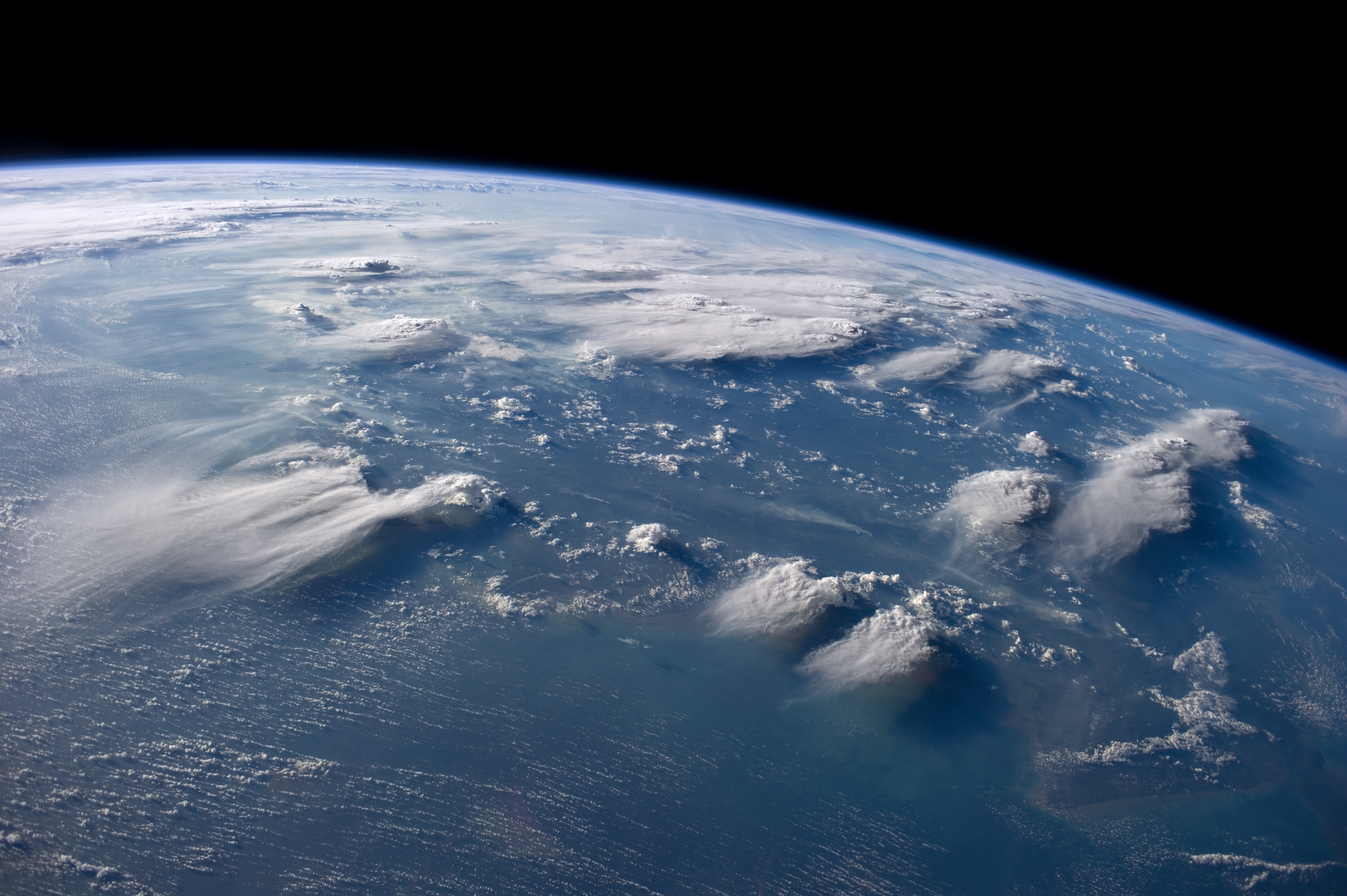
The idea of the satellite/infrared image is to also give a general idea of the weather especially in areas without radar coverage.. So even if the plane can not do for example FL300 knowing a cloud is that high and maybe see a few strikes nearby can help a lot to understand the structure of the weather. This is a picture from space:
https://upload.wikimedia.org/wikipedia/commons/1/1d/ISS-40_Thunderheads_near_Borneo.jpg
One can see how the thunderstroms act like little fires and then the wind blows the “smoke” downwind. Such structures will be very visible in the satellite image.
But I see pilots are also looking for more precise “can I get over this” information.
UdoR wrote:
This would allow another layer indication without introducing another color.
This is more about the transmission than the actual display of the data. But it could be possible to add some labeled points to the map for example close to the flight path.
